HVDC Inter-Island facts for kids
Quick facts for kids HVDC Inter-Island |
|
|---|---|
| Location | |
| Country | New Zealand |
| General direction | South-North |
| From | Benmore Hydroelectric Power Station, near Otematata, Canterbury |
| To | Haywards transmission substation, Lower Hutt |
| Ownership information | |
| Owner | Transpower New Zealand Limited |
| Operator | Transpower New Zealand Limited |
| Construction information | |
| Manufacturer of substations | ABB Group / Siemens |
| Construction started | 1961 |
| Commissioned | April 1965 |
| Technical information | |
| Type | Bipole HVDC powerline with overhead transmission line and submarine power cables underneath the Cook Strait |
| Type of current | HVDC |
| Total length | 610 km (380 mi) |
| Power rating | 1200 MW |
| AC voltage | 220 kV |
| DC voltage | ±350 kV |
| No. of poles | Two |
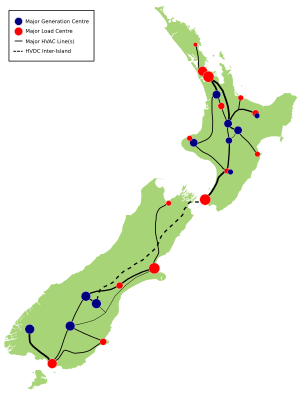
The HVDC Inter-Island link is a very long power system in New Zealand. It is about 610 kilometers (379 miles) long and can carry 1200 MW (megawatts) of electricity. This special power line connects the electricity grids of New Zealand's North Island and South Island.
Many people call it the Cook Strait cable. However, the link is much longer than just the part that goes under the Cook Strait. The underwater part actually has three separate cables running side-by-side. Transpower New Zealand, a company owned by the government, owns and runs this important power link.
The HVDC link begins at the Benmore Hydroelectric Power Station in Canterbury, on the South Island. From there, it travels 534 kilometers (332 miles) as an overhead power line across the land. It goes through Canterbury and Marlborough. Then, it dives underwater for 40 kilometers (25 miles) using submarine cables beneath Cook Strait. These cables reach Oteranga Bay near Wellington. The last 37 kilometers (23 miles) are overhead lines again, ending at the Haywards substation in Lower Hutt.
This power link first started working in April 1965. Its main job was to send electricity from the South Island, which had lots of power stations, to the North Island, where more people lived.
When it first opened, it was a 600 MW link using old-style mercury arc valves. In 1992, new technology called thyristors was added. This increased the link's power to 1040 MW. The older mercury arc system was finally turned off in 2012. A new thyristor system, called Pole 3, was switched on in May 2013. This brought the total power capacity back up to 1200 MW.
Contents
Why the Link is Important
The HVDC link is a very important part of New Zealand's electricity system. It connects the power grids of the two islands. This helps to balance how much electricity is available with how much is needed on each island.
The two islands are different in size and population. The South Island is bigger in land area, but the North Island has more than three times as many people. This means the North Island needs a lot more electricity. However, the South Island uses more electricity per person. This is because it has a colder climate and a large aluminum smelter (Tiwai Point) that uses a huge amount of power. In 2011, about 37% of New Zealand's electricity was used in the South Island, while 63% was used in the North Island. The South Island produced about 41% of the country's electricity, mostly from hydroelectricity (power from water). The North Island produced the rest, using a mix of hydro, natural gas, and geothermal power.
Even though both islands can usually produce enough electricity on their own, the HVDC link offers many benefits:
- It helps South Island users get power from the North Island's power stations when there isn't enough water for hydro power in the South Island.
- It helps North Island users get power from the South Island's large hydro power stations when the North Island needs more electricity.
The link also plays a big role in the New Zealand electricity market. It lets power companies on both islands compete, which can help lower electricity prices.
The inter-island system was designed as an HVDC system. This was chosen even though it costs money to change electricity from AC to DC and back again. HVDC is better for sending power over long distances, especially when cables go under the sea. It usually costs less to run and loses less energy.
How Power Flow is Limited
The link can send electricity in both directions, northwards and southwards. However, sending electricity southwards is sometimes limited by the power lines in the lower North Island. Most of the North Island's power stations are in the middle of the island. The two main cities that use a lot of power, Auckland and Wellington, are north and south of these power stations. The HVDC link connects to the North Island's power system at Haywards in Wellington.
Wellington needs a lot of electricity, but it doesn't have many local power stations. So, it has to bring in most of its power. When the HVDC link sends power northwards from the South Island, this power is mostly used in Wellington. Any extra power then travels north to other parts of the North Island.
But when the HVDC link sends power southwards (from North to South Island), the power lines going into Wellington must carry electricity for both Wellington and the HVDC link. This can limit how much power can be sent southwards on the HVDC link. Large southwards transfers are usually only needed when there's not enough water for hydro power in the South Island. So, this limit isn't a big problem most of the time.
Sending power northwards is usually not limited. But it can be if one of the main power lines out of Wellington or through the central North Island is too busy or not working.
The Route of the Link
The HVDC Inter-Island link starts at two special stations next to the Benmore Hydroelectric Power Station. Here, the electricity from the power station is changed from AC to ±350 kV HVDC for long-distance travel.
The HVDC power line crosses the Benmore power station area and follows the eastern side of the dam. It continues north along Lake Benmore, then turns northeast and east. It crosses State Highway 8 south of Fairlie. The line then turns northeast, passing between Fairlie and Geraldine. North of Geraldine, it generally follows the Inland Scenic Route, passing near towns like Methven, Sheffield, and Oxford, before heading northeast towards Waipara.
The HVDC line goes through Weka Pass into the Amuri district. It travels north, west of Culverden, to Hanmer Springs. From there, it turns northeast and goes through Molesworth Station into Marlborough. It follows the Awatere River valley, then turns north to meet State Highway 1. The line travels east of Blenheim, reaching the coast at Cloudy Bay. It then goes up the coast into the Marlborough Sounds. The line turns east and southeast around Port Underwood, finally reaching Fighting Bay, where the South Island's underwater cable connection is.
At Fighting Bay, the power lines connect to three underwater cables that carry electricity beneath Cook Strait. As of 2012, two of these cables were in use, with the third ready for a new system (Pole 3). The cables first head south from Fighting Bay, then turn east towards the North Island. They then turn northeast towards the North Island cable connection at Oteranga Bay.
From Oteranga Bay, the land-based North Island power line travels northeast through Mākara, just west of Johnsonville. Near Ngaio, a smaller line from the North Island's earth electrode (a special connection to the ground) joins the main power line towers. The line then turns east around Churton Park, crosses to Horokiwi, and passes through Belmont Regional Park to Haywards in northern Lower Hutt. This is where the North Island's converter station is.
At Haywards, two converter stations receive the ±350 kV HVDC power. They change it back to 220 kV AC. From here, the power from the Inter-Island link goes to the main Haywards substation. It is then sent to the Wellington area or further north to the rest of the North Island's power grid.
How the Link Works
The New Zealand Inter-Island HVDC link is a "Classic" HVDC system. It uses overhead lines and submarine cables to connect the two islands. It has special equipment called thyristor-based converters at each end. These converters change electricity from AC to DC (and back again). The link also has ground electrode stations. These allow the system to use the earth to complete the electrical circuit, which means it can still work even if one part of the system is temporarily shut down.
Converter Stations
Each end of the link has converter stations for each "pole" (part of the system). These stations include:
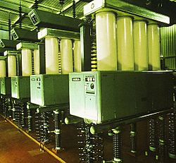
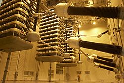
- A building with converter valves, a cooling system, and controls.
- Large transformers that change the voltage.
- Equipment for the 220 kV AC switchyard.
- Filters to clean up the electricity.
- Equipment for the 350 kV DC system.
The converter valves are designed to be strong against earthquakes, which is important in New Zealand. There are three large transformers for each converter valve.
Submarine Cables
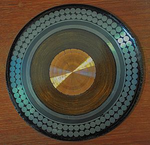
The three submarine power cables installed in 1991 can each carry 1430 A of current at 350 kV. They have a copper core, surrounded by insulation and a lead cover. Two layers of strong steel wire protect them. The cables are about 130 mm (5 inches) thick.
To protect these important underwater cables, there's a 7-kilometer (4.3-mile) wide "Cable Protection Zone" (CPZ) in Cook Strait. Boats are not allowed to anchor or fish in this area. The zone is regularly checked by sea and air. If someone anchors or fishes there, they can face large fines.
HVDC Transmission Line
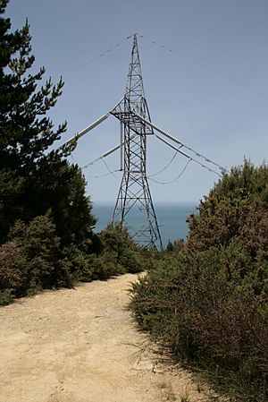
The overhead power line was finished in January 1965. It has 1623 steel towers. In some parts of the South Island, the line reaches an altitude of 1280 meters (4200 feet). The longest single span between towers is 1119 meters (3671 feet), near Port Underwood.
The line was first designed for ±250 kV. Later, it was updated to handle 350 kV. This was done by adding special insulators to the towers. These insulators are longer in coastal areas to protect against salt.
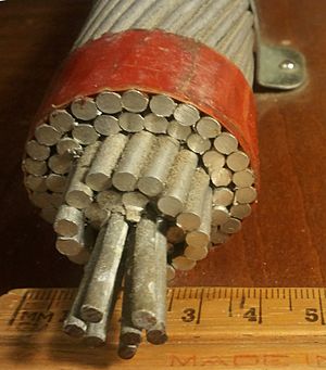
Each side of the towers holds two conductors (wires). These wires are 39.4 mm (1.55 inches) thick. The HVDC line also has a continuous overhead wire for lightning protection.
About 20 new towers were built in 1992 to move the HVDC line north of Johnsonville. This was done to make way for new houses. In 2010, about 92.5% of the original towers were still in use.
After the upgrades, the line could carry 2000 amperes of current on each pole at 350 kV.
Earth Electrode Stations
The North Island converter station connects to the earth through a shore electrode station at Te Hikowhenua. This station is about 25 kilometers (15.5 miles) from Haywards. It can carry 2400 A of current. Forty electrode cells are buried along 800 meters (0.5 miles) of a stony beach. These cells allow seawater in but keep silt out.
The South Island earth electrode station is at Bog Roy, 7.6 kilometers (4.7 miles) from Benmore. It has buried electrode arms spread out over about 1 square kilometer (0.4 square miles). These arms are steel rods buried in coke. A small power line connects the Benmore converter station to this South Island electrode. This allows one part of the system to work using the earth as a return path if the other part is out of service.
Problems and Outages
Like all power systems, the HVDC Inter-Island link can have problems. Because it's so important, an unexpected shutdown can cause big issues for New Zealand's electricity system. This could lead to power shortages and higher electricity prices. The worst situation would be if both parts of the system shut down at once during high power transfer. This could cause a widespread power outage across an entire island.
Sometimes, planned shutdowns are needed for maintenance. These are usually done in summer when less electricity is needed. Only one part of the system is shut down at a time, with the other part still working and providing half the power.
Here are some notable problems and shutdowns:
- 1973: An electrical fault happened in an underwater cable joint at Fighting Bay.
- August 1975: A strong wind storm caused seven power line towers to fall, damaging the line. It took five days to fix.
- 1976: A fault occurred in an underwater cable joint 15.5 kilometers (9.6 miles) from the South Island end. It was repaired in 1977.
- 2004: In January, three HVDC towers collapsed due to extreme winds. In August, the line voltage had to be lowered for long periods because of salt on the insulators near Oteranga Bay. In October, a fault in one of the Cook Strait cables reduced power capacity. Repairs took almost six months.
- June 19, 2006: The link unexpectedly shut down just before the evening rush hour on a very cold day. This caused power shortages in the North Island.
- August 28, 2008: A power line tower in the Marlborough Sounds was found bent after its foundations slipped. It was temporarily fixed until it could be replaced.
- November 12, 2013: During testing of new control systems, a software bug caused a sudden drop in power transfer. This led to automatic power cuts in the North Island, blacking out thousands of customers.
The Original Link
Planning the Link
The idea for sending electricity between the North and South Islands came from Bill Latta, a chief engineer. In 1950, he saw that the North Island would soon need more electricity than it could produce. He suggested building more hydro power stations in the South Island and sending that power north.
In 1951, a cable company said that an underwater cable across Cook Strait was possible, but difficult. In the 1950s, new mercury arc valve converters made it possible to build long-distance HVDC systems.
In 1956, the government asked the cable company to study the Cook Strait crossing. They reported it was "thoroughly practicable." In 1957, a committee recommended building a large hydro power station at Benmore and linking the two islands' power systems.
The project had many unique challenges:
- The Benmore power station needed to handle special electrical currents from the converters.
- The mercury arc valves would be the largest ever built.
- The overhead power line would be one of the longest and hardest to build in New Zealand.
- The Cook Strait submarine cables needed a special design for the seabed conditions.
In 1958, trial cables were laid in Cook Strait to test how they would hold up. The tests were successful. In March 1961, the government approved the project. Contracts were signed with companies to build the converter stations and make and lay the submarine cables.
Building the Link
The HVDC inter-island link was designed and built between 1961 and 1965. The original Cook Strait cables were installed in 1964 by a ship called Photinia.
When it was finished, the New Zealand HVDC link was the longest HVDC system in the world. It also had the highest power rating and the largest undersea power cables. The stations at each end used large mercury-arc rectifiers and inverters to change between AC and DC power. The South Island station was at Benmore, and the North Island station was at Haywards near Wellington.
The overhead power line connecting Benmore and Haywards is 610 kilometers (379 miles) long. It is supported by 1649 transmission towers. The underwater cables under Cook Strait are 40 kilometers (25 miles) long.
Until it was upgraded in 1993, the HVDC Inter-Island link usually operated at ±250 kV and could carry about 600 MW of power. It was first designed to send power northwards. In 1976, the control system was changed to allow power to be sent in the reverse direction, from Haywards to Benmore.
Engineering History
The original HVDC link was recognized as an important part of New Zealand's engineering history.
The Hybrid Upgrade Project
In 1987, the Electricity Corporation of New Zealand looked into upgrading the inter-island link. They chose a "hybrid" upgrade, which meant combining old and new technology. This was cheaper than replacing everything. The upgrade involved using the existing mercury arc valve equipment alongside new solid-state thyristor converter stations.
The work included:
- Adding three new HVDC submarine cables under Cook Strait. These cables were installed in 1991.
- Building new cable stations at Fighting Bay and Oteranga Bay.
- Changing the old mercury arc valve converters to work together as "Pole 1."
- Increasing the operating voltage of the mercury arc valve converters from 250 kV to 270 kV.
- Adding new HVDC thyristor converter stations, called "Pole 2," which operated at 350 kV.
- Upgrading the entire HVDC overhead transmission line to handle 350 kV.
The Pole 2 converter stations and new submarine cables started working in March 1991. This upgrade increased the total power capacity.
Turning Off Pole 1
On September 21, 2007, the original Pole 1 mercury-arc converter stations were shut down. However, Transpower later decided to bring back half of Pole 1's capacity for "warm standby" service. This was to help meet power demand in the North Island if needed.
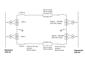
Transpower also increased the power transfer capacity of Pole 2 from 500 MW to 700 MW. This was done by moving one of the cables that used to be connected to Pole 1 over to Pole 2.
On August 1, 2012, Transpower officially turned off the remaining half of the Pole 1 mercury arc valve converter stations. They had been in service for 47 years. At that time, the Inter-Island link was the last HVDC system in the world still using mercury arc valve converters.
The Pole 3 Project
In May 2008, Transpower proposed replacing the old Pole 1 mercury arc valve stations with new thyristor converter stations. This project was approved.
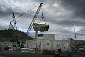
This project involved building new converter stations called Pole 3. They would operate at +350 kV and 700 MW, matching the existing Pole 2. Work on this $672 million project began on April 19, 2010. The new converter stations were planned to be ready by April 2012, but there were delays.
The work for Pole 3 included:
- New buildings next to the Pole 2 buildings at both Benmore and Haywards for the new thyristor converters.
- New transformers to connect the new converters to the power grid.
- Connecting the new Pole 3 converters to the existing Pole 1 lines and earth electrode lines.
- Switching the number 5 Cook Strait cable from Pole 2 back to the Pole 1/3 system.
- Adding new filters to clean up the electricity.
- Removing all the old Pole 1 mercury arc valve equipment.
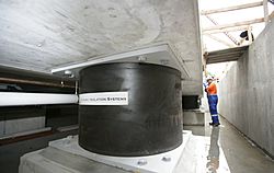
Pole 3 was able to operate at 700 MW from the start. However, the combined power transfer of Pole 2 and Pole 3 was limited to 1000 MW at first. After a new device called a STATCOM was installed at Haywards in January 2014, Pole 3 could operate at its full capacity with Pole 2, allowing a total transfer of 1200 MW.
Pole 2 Control System Upgrade
Pole 2 was built in 1992 with control systems from the late 1980s. After 20 years, these systems were getting old and were not compatible with the new Pole 3 systems.
In late 2013, Transpower took Pole 2 out of service for four weeks. They replaced its control systems with new ones, just like those used in Pole 3. They also installed a new system to control both poles together. Pole 3 continued to operate during this time.
Other Related Work
Line Maintenance
While Pole 1 was being replaced with Pole 3, some maintenance was done on the power line. This included:
- Replacing about 100 towers in the South Island to fix clearance issues.
- Replacing some sections of wire in the North Island that were nearing the end of their life.
- Strengthening some North Island towers.
Benmore Power Station Transformers
The original design of the Benmore power station was closely linked to the HVDC system. The power from Benmore's generators could flow directly to the HVDC link. However, after Pole 1 was removed, this direct connection was gone. The power station's transformers were not strong enough to send all the power to the rest of the South Island grid. So, the owner of Benmore, Meridian Energy, replaced these transformers. The six generators were reconnected to the 220 kV national grid through new transformers.
Future Plans
Fourth Cook Strait Cable
There are ideas to install a fourth cable under Cook Strait (called Cable 7). This would connect to Pole 2 and allow the HVDC link to carry even more power, up to 1400 MW. This would also involve new filters and a new STATCOM at Haywards. As of 2017, there is no set date for this fourth cable.
North Canterbury Connection
The northern part of the South Island, north of the Waitaki Valley, doesn't produce much electricity but has many large towns like Christchurch, Nelson, and Timaru. Most of their electricity comes from the Waitaki Valley through three main power lines. These lines are getting busy, and a major fault at the Islington substation in Christchurch could cut off power to the entire upper South Island.
One idea to help this is to add a connection point to the HVDC Inter-Island link near Waipara in North Canterbury. This would create another way for electricity to reach Christchurch and the upper South Island, making the power network more reliable. However, this project would be very expensive. It is unlikely to be built before 2027 because there are cheaper ways to secure electricity supply in the short term.
Site Locations
- Haywards HVDC Converter Station: 41°09′05″S 174°58′54″E / 41.151446°S 174.981691°E
- Te Hikowhenua deviation line take-off point: 41°14′03″S 174°45′31″E / 41.234167°S 174.758611°E
- Te Hikowhenua Shore Electrode Station: 41°12′28″S 174°43′11″E / 41.20778°S 174.71972°E
- Oteranga Bay Cable Terminal Station: 41°17′37″S 174°37′48″E / 41.29361°S 174.63000°E
- Fighting Bay Cable Terminal Station: 41°18′35″S 174°12′07″E / 41.3098°S 174.202°E
- Bog Roy Land Electrode Station: 44°34′26″S 170°05′56″E / 44.574°S 170.099°E
- Benmore HVDC Converter Station: 44°33′55″S 170°11′24″E / 44.56528°S 170.19000°E
 | Leon Lynch |
 | Milton P. Webster |
 | Ferdinand Smith |


