
Nelson, New Zealand facts for kids
Quick facts for kids
Nelson
Whakatū (Māori)
|
|||
|---|---|---|---|
|
City and unitary region
|
|||

View of Nelson from the "Centre of New Zealand" in November 2006
|
|||
|
|||
| Nickname(s):
Sunny Nelson
|
|||
| Motto(s):
Latin: Palmam qui meruit ferat
(Let him, who has earned it, bear the palm) |
|||
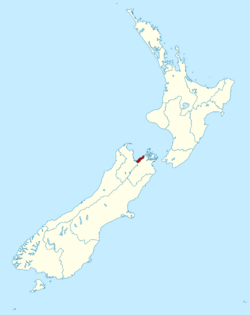 Nelson region within New Zealand
|
|||
| Country | New Zealand | ||
| Island | South Island | ||
| Unitary authority | Nelson City | ||
| Settled by Europeans | 1841 | ||
| Founded by | Arthur Wakefield | ||
| Named for | Horatio Nelson | ||
| Electorates | Nelson Te Tai Tonga |
||
| Suburbs | |||
| Government | |||
| • Body | Nelson City Council | ||
| Area | |||
| • Territorial | 422.19 km2 (163.01 sq mi) | ||
| • Urban | 54.69 km2 (21.12 sq mi) | ||
| Population
(June 2023)
|
|||
| • Territorial | 55,600 | ||
| • Density | 131.69/km2 (341.09/sq mi) | ||
| • Urban | 51,900 | ||
| • Urban density | 949.0/km2 (2,457.9/sq mi) | ||
| Time zone | UTC+12 (NZST) | ||
| • Summer (DST) | UTC+13 (NZDT) | ||
| Postcode |
7010, 7011, 7020
|
||
| Area code(s) | 03 | ||
| HDI (2022) | 0.933 very high · 7th |
||


Nelson (which is Whakatū in Māori) is a city located at the top of New Zealand's South Island. It sits on the eastern shores of Tasman Bay. Nelson is special because it's both a city and a region, making it the only one of its kind in New Zealand.
It is the oldest city in the South Island. It's also the second-oldest settled city in the whole country. Nelson was started in 1841 and officially became a city in 1858. The Nelson urban area is home to about 49,224 people.
Nelson is famous for its lively arts and crafts scene. Every year, the city hosts fun events like the Nelson Arts Festival. These events are popular with both locals and visitors.
Contents
What's in a Name?
Nelson was named after Admiral Horatio Nelson. He was a famous British naval hero who won a big battle called the Battle of Trafalgar in 1805. Many streets and public places in Nelson are named after people and ships from that battle. People who live in Nelson are often called Nelsonians. Trafalgar Street is the main shopping area.
The Māori name for Nelson is Whakatū. This name means 'to build', 'to raise', or 'to set up'.
Nelson is also known by some cool nicknames. People call it "Sunny Nelson" because it gets a lot of sunshine each year. It's also called the "Top of the South" because of where it is on the map.
Nelson's Past

Early Māori Life
Māori people first settled in the Nelson area about 700 years ago. Some of the very first settlements in New Zealand were found here. Early tribes like Ngāti Hāwea, Ngāti Wairangi, Waitaha, and Kāti Māmoe lived in the Nelson district. The Waitaha people were skilled at farming and quarrying a special stone called argillite.
Later, in the 1600s, the Ngāti Tūmatakōkiri tribe became very strong in the area. But in the 1820s, northern tribes, led by Te Rauparaha and his Ngāti Toa, attacked the area. This caused many local people to move away.
Today, there are eight main Māori tribes who are recognised in the northern region. These include Ngāti Kuia, Ngāti Apa ki te Rā Tō, and Ngāti Toa Rangatira.
Historic Places to Visit
Nelson has three main historic places you can explore. They help you learn about the city's past.
- Broadgreen Historic House: This house was built in 1855 for the Buxton family. Later, it became a museum. You can visit it to see how people lived long ago.
- Isel House: This old building was home to one of Nelson's first families, the Marsdens. Many rooms are now displays for the public. It's looked after by a special trust and the Nelson City Council.
- Founders Heritage Park: This is an interactive park that shows Nelson's history. It's set up like an old village with historic buildings and beautiful gardens. You can learn many stories about the town's past here.
How Nelson Was Planned
.png)
The New Zealand Company in London planned the settlement of Nelson. They wanted to buy a lot of land from the Māori people. Their plan was to divide this land into many smaller plots and sell them to settlers. They also planned to use some of the money to help workers and their families travel to New Zealand for free.
However, they didn't sell as much land as they hoped. Even so, the colony went ahead. Captain Arthur Wakefield led three ships from London to New Zealand. When they arrived, they found that the Governor, William Hobson, wouldn't let them just take huge areas of land. But he did let them look around the Tasman Bay area.
They chose the spot where Nelson City is now because it had the best harbour. The problem was, there wasn't much good farming land nearby. Nelson City is right next to mountains, and the flat land was much smaller than what the Company needed.
The Company bought land from the Māori for £800. This land included Nelson and other nearby areas. But the exact borders were not clear, which caused problems later. The first ships with settlers arrived in Nelson in November 1841. Three months later, more ships arrived. The town was already set up with streets and some houses. Many people came, but only a few had enough money to buy land.
Early Problems and Conflicts
After a good start, Nelson faced problems because there wasn't enough land and money. Workers' wages had to be cut. Many people started to leave Nelson.
The settlers really needed more farming land. They looked at the fertile Wairau Valley. The New Zealand Company claimed they had bought this land. But the Māori owners strongly disagreed. They said the Wairau Valley was not part of the sale.
This led to a sad event called the Wairau Affray. In this conflict, 22 settlers and 4 Māori people died. A government investigation found that the Nelson settlers had no right to the land outside Tasman Bay. This event made people in Nelson worried about Māori attacks, so they formed a local army in 1845.
Nelson Becomes a City

Nelson officially became a city on 27 September 1858. This was decided by Queen Victoria. At that time, Nelson only had about 5,000 residents. It was the second city in New Zealand to be given this special status.
Nelson's Coat of Arms
Nelson City has its own special symbol called a coat of arms. It was created in 1958 to celebrate Nelson being a city for 100 years. The coat of arms has a wavy blue and silver pattern, a black cross, and a bishop's hat. Above it, there's a lion holding a sun. On the sides, there are two native New Zealand birds: a Huia and a Kotuku.
The motto on the coat of arms is "Palmam qui meruit ferat". This means "Let him, who has earned it, bear the palm". This is the same motto used by Lord Nelson.
Nelson's Provincial History
.svg)
From 1853 to 1876, Nelson was the capital of the Nelson Province. This province was much bigger than today's Nelson City. It included areas like Buller, Kaikōura, Marlborough, and Tasman. In 1859, the Marlborough Province separated from Nelson.
Nelson Anniversary Day
Nelson Anniversary Day is a public holiday in the northern South Island. It celebrates the arrival of the first New Zealand Company ship, the Fifeshire, on 1 February 1842. This holiday is still celebrated even though the old provinces were ended in 1876.
In the past, celebrations included sailing races, horse races, and sports. In 1892, the Nelson Jubilee Celebration was a week-long event with church services, sports, concerts, and fireworks.
The Time Gun
In 1858, the Nelson Provincial Council put up a special "time gun" on Brittania Heights. This gun was fired every Saturday at noon to tell everyone the correct time. Today, the gun is a historical item. A large tree, the Songer Tree, marks the spot where the first flagpole stood.
Nelson's Location and Landscape
The Nelson-Tasman area includes two main local government areas: Nelson City and Tasman District. Nelson is surrounded by mountains on three sides and Tasman Bay on the fourth.
There has been talk about joining Nelson City and Tasman District. This would help them work together more smoothly and save money. For example, they already share Port Nelson and a tourism group called Nelson Tasman Tourism. However, a poll in 2012 showed that many people in Richmond were against this idea.
Nelson has lovely beaches and a safe harbour. The harbour entrance is protected by a long, natural bank of rocks called the Boulder Bank. This bank is about 13 km long. It creates a perfect natural harbour, which attracted the first settlers. However, the entrance was narrow. A ship called the Fifeshire crashed on Arrow Rock in 1842, showing how tricky the passage was. Later, in 1906, a cut was made in the bank to let bigger ships into the port.
The building of Rocks Road along the waterfront in 1892 changed the tides at Nelson's popular beach, Tāhunanui. This caused the beach and sand dunes to erode. To fix this, a project was started to add sand back to the beach. This has been successful, and the sand levels are rising again.
Rivers and Streams
Nelson City is a small area, but it has four main rivers: the Whangamoa, Wakapuaka, Maitai, and Roding Rivers. The Roding River flows into the Tasman District and joins the Waimea River. The Maitai River flows through Nelson's town centre and into Tasman Bay. The Wakapuaka River flows north to Cable Bay. The Whangamoa River is the longest river in Nelson.
There are also many smaller streams in the south of Nelson, like Saxton Creek and Poorman Valley Stream.
Nelson City Centre

The central part of Nelson, also called the CBD (Central Business District), is where many shops and businesses are. It's bordered by Halifax Street, Rutherford Street, Collingwood Street, and Selwyn Place. Other important streets in the centre include Trafalgar Street, Bridge Street, and Hardy Street.
Nelson's Suburbs
Nelson City has many suburbs, grouped into four main areas:
- Nelson North: Glenduan, Wakapuaka, Todds Valley, Marybank, Atawhai, Dodson Valley, Brooklands.
- City Centre: Nelson Central, Port Nelson, Beachville, The Wood, Hanby Park, Maitai, Nelson East, Nelson South, Toi Toi (Victory Village), Bishopdale, The Brook, Washington Valley, Stepneyville, Britannia Heights.
- Tāhunanui-Port Hills: Tāhunanui, Enner Glynn, Moana, Tasman Heights, Annesbrook, Wakatu.
- Stoke: Stoke, Greenmeadows Park, Nayland, Monaco, Maitlands, Saxton.
People who work in Nelson might live in nearby towns like Richmond, Brightwater, Hope, Māpua, and Wakefield, which are in the Tasman District.
National Parks Nearby
Nelson is a great place to start adventures in nature. It's close to three amazing national parks: Abel Tasman, Kahurangi, and Nelson Lakes National Park.
It's a popular spot for ecotourism (travel that helps nature) and adventure tourism. People who love caving enjoy the big cave systems around Takaka Hill.
Nelson is known for its beautiful lakes and walking tracks. Popular tracks include the Abel Tasman Coast Track and the Heaphy Track. You can find huts and camping spots along these tracks. These parks are also great for fishing, hunting, and watching wildlife.
Nelson's Weather
Nelson has a mild oceanic climate, which means it has cool winters and warm summers. Rain is spread out throughout the year. Nelson doesn't get many frosts because it's close to the sea. Winter is the stormiest time.
Nelson is one of the sunniest cities in New Zealand. It gets over 2400 hours of sunshine each year, which is why it's called 'Sunny Nelson'. The hottest temperature ever recorded was 36.3°C, and the coldest was -6.6°C.
| Climate data for Nelson (1991–2020 normals, 1862–present) | |||||||||||||
|---|---|---|---|---|---|---|---|---|---|---|---|---|---|
| Month | Jan | Feb | Mar | Apr | May | Jun | Jul | Aug | Sep | Oct | Nov | Dec | Year |
| Record high °C (°F) | 33.3 (91.9) |
36.3 (97.3) |
29.4 (84.9) |
26.9 (80.4) |
22.9 (73.2) |
20.0 (68.0) |
19.5 (67.1) |
21.1 (70.0) |
24.3 (75.7) |
26.9 (80.4) |
28.9 (84.0) |
31.1 (88.0) |
36.3 (97.3) |
| Mean maximum °C (°F) | 27.6 (81.7) |
27.6 (81.7) |
25.4 (77.7) |
22.3 (72.1) |
20.0 (68.0) |
17.1 (62.8) |
15.9 (60.6) |
17.4 (63.3) |
19.6 (67.3) |
21.9 (71.4) |
24.3 (75.7) |
25.7 (78.3) |
28.7 (83.7) |
| Mean daily maximum °C (°F) | 22.5 (72.5) |
22.7 (72.9) |
21.2 (70.2) |
18.4 (65.1) |
16.0 (60.8) |
13.4 (56.1) |
12.7 (54.9) |
13.6 (56.5) |
15.2 (59.4) |
17.2 (63.0) |
19.0 (66.2) |
20.9 (69.6) |
17.7 (63.9) |
| Daily mean °C (°F) | 18.1 (64.6) |
18.2 (64.8) |
16.4 (61.5) |
13.7 (56.7) |
11.2 (52.2) |
8.5 (47.3) |
7.6 (45.7) |
8.8 (47.8) |
10.7 (51.3) |
12.7 (54.9) |
14.5 (58.1) |
16.7 (62.1) |
13.1 (55.6) |
| Mean daily minimum °C (°F) | 13.7 (56.7) |
13.7 (56.7) |
11.7 (53.1) |
9.0 (48.2) |
6.3 (43.3) |
3.5 (38.3) |
2.6 (36.7) |
4.0 (39.2) |
6.1 (43.0) |
8.2 (46.8) |
9.9 (49.8) |
12.5 (54.5) |
8.4 (47.1) |
| Mean minimum °C (°F) | 8.2 (46.8) |
8.6 (47.5) |
6.1 (43.0) |
3.3 (37.9) |
0.5 (32.9) |
−1.8 (28.8) |
−2.2 (28.0) |
−1.2 (29.8) |
0.5 (32.9) |
2.3 (36.1) |
4.1 (39.4) |
6.7 (44.1) |
−2.6 (27.3) |
| Record low °C (°F) | 2.8 (37.0) |
2.8 (37.0) |
−0.2 (31.6) |
−2.8 (27.0) |
−3.9 (25.0) |
−6.6 (20.1) |
−6.1 (21.0) |
−5.8 (21.6) |
−3.7 (25.3) |
−1.7 (28.9) |
−1.0 (30.2) |
1.2 (34.2) |
−6.6 (20.1) |
| Average rainfall mm (inches) | 73.2 (2.88) |
62.8 (2.47) |
71.1 (2.80) |
84.9 (3.34) |
87.7 (3.45) |
99.5 (3.92) |
78.6 (3.09) |
83.8 (3.30) |
84.6 (3.33) |
89.0 (3.50) |
67.9 (2.67) |
93.0 (3.66) |
976.1 (38.41) |
| Average rainy days (≥ 1.0 mm) | 6.8 | 5.3 | 6.1 | 7.3 | 7.4 | 8.7 | 7.7 | 9.2 | 9.8 | 8.9 | 7.5 | 8.6 | 93.3 |
| Average relative humidity (%) | 73.6 | 77.4 | 81.1 | 83.2 | 87.9 | 89.8 | 90.0 | 86.9 | 78.7 | 76.2 | 71.3 | 72.5 | 80.7 |
| Mean monthly sunshine hours | 264.6 | 238.8 | 230.8 | 191.9 | 176.0 | 145.4 | 159.6 | 183.9 | 192.5 | 228.3 | 242.6 | 242.7 | 2,497.1 |
| Mean daily daylight hours | 14.8 | 13.7 | 12.3 | 11.0 | 9.8 | 9.2 | 9.5 | 10.5 | 11.8 | 13.2 | 14.4 | 15.1 | 12.1 |
| Percent possible sunshine | 58 | 62 | 61 | 58 | 58 | 53 | 54 | 56 | 54 | 56 | 56 | 52 | 57 |
| Source 1: NIWA Climate Data | |||||||||||||
| Source 2: Weather Spark | |||||||||||||
"Centre of New Zealand" Monument

In Nelson, there's a monument on Botanical Hill called the "Centre of New Zealand walk". It's a popular spot for visitors.
However, this monument doesn't actually mark the true middle of New Zealand. Instead, it was the starting point for the first land surveys of New Zealand back in the 1870s. From this spot, surveyors could measure distances to other places.
The actual geographic centre of New Zealand is about 60 km southwest of Nelson. It's in a forest area called the Big Bush Conservation Area.
Who Lives in Nelson?
Nelson City covers about 422 square kilometres. It has an estimated population of 52,584 people.
In the 2023 census, Nelson City's population grew by 3.3% since 2018. The median age was 44.0 years. About 16.6% of people were under 15 years old.

People in Nelson come from many different backgrounds.
- 84.7% identified as European (Pākehā).
- 11.9% identified as Māori.
- 2.8% identified as Pasifika.
- 8.6% identified as Asian.
- 1.4% identified as Middle Eastern, Latin American, and African.
- 2.7% identified as other ethnicities.
English is spoken by most people (96.9%). Māori language is spoken by 2.9%. About 26.4% of people were born outside New Zealand.
When it comes to beliefs, 28.2% of people identified as Christian. Many people (59.1%) said they had no religion.
Many adults in Nelson have good education. About 19.3% have a bachelor's degree or higher. The median income was $38,800. About 47.1% of people aged 15 and over work full-time.
Nelson's Economy
Nelson's economy, along with the nearby Tasman District, relies on five main industries:
- Seafood
- Horticulture (growing plants)
- Forestry (trees and wood)
- Farming
- Tourism
Port Nelson is the biggest fishing port in Australia and New Zealand.
Nelson also has growing industries like art and craft, aviation, and information technology. The region has shown good economic growth.
The total value of goods and services produced in Nelson and Tasman District was about $3.4 billion in 2010. This was 1.8% of New Zealand's total economy.
Nelson has groups that help businesses. Nelson Tasman Tourism (NTT) promotes the region to visitors. The Nelson Regional Economic Development Agency (EDA) helps with economic growth and creating jobs.
Some of the largest companies and employers in the region include:
- Former regional airline Air Nelson (now part of Air New Zealand).
- Helicopters (NZ).
- Japanese car company Honda has its New Zealand distribution centre here.
- Beverage company McCashins has a brewery.
- Sea Dragon Marine Oils refines fish oil.
- The Cawthron Institute is a research facility.
- Food manufacturer, the Talley's Group, has processing facilities at Port Nelson.
- The New Zealand King Salmon Company processes salmon.
- Pic's Peanut Butter is made in Stoke.
Culture and Arts in Nelson

Nelson is a great place for visitors. It has many places to stay, restaurants, and unique shops. For example, you can visit Jens Hansen Goldsmiths, where "The One Ring" from The Lord of the Rings movies was designed.
Nelson has a lively music and arts scene. It's known for its talented artists and craftspeople. These include potters, glass blowers, and wood carvers.
Nelson is a popular place for tourists all year round. The Nelson Saturday Market is a weekly market where you can buy art directly from local artists. The Theatre Royal, built in 1878, is the oldest wooden theatre still working in the Southern Hemisphere. It was restored in 2010.
Art places include the Suter Art Gallery and the Nelson Arts Festival. The Victory Village community even won the New Zealander of the Year award in 2010 for Community of the Year.
The very first rugby union match in New Zealand happened in Nelson on 14 May 1870. It was played at the Botanic Reserve.
Marae
Whakatū Marae, in the suburb of Atawhai, is an important meeting place for several Māori tribes. It includes the Kākāti wharenui (meeting house). In 2020, the government helped fund the restoration of the marae.
Events and Festivals
Nelson hosts many exciting events and festivals throughout the year:
- Nelson Jazz & Blues Festival – January
- Nelson Kite Festival – January
- Nelson Yacht Regatta – January
- Baydreams-Nelson – January
- Taste Tasman – January
- Evolve Festival – January
- Adam Chamber Music Festival – every two years – January / February
- International Kai Festival – February
- Weet-bix Kids TRYathlon – March
- Marchfest – March
- Taste Nelson festival – March
- Te Ramaroa Light Festival – every two years in June/July
- Winter Music Festival – July
- Nelson Arts Festival – October
- NZ Cider Festival – November
- Nelson A&P Show – November
World of Wearable Art Awards
The famous World of Wearable Art (WOW) Awards started in Nelson in 1987. It was created by Suzie Moncrieff. The first show was held in a small cottage. The show became so big that it moved to Wellington in 2005. Nelson used to have a museum that showed winning WOW designs alongside classic cars.
Architecture

The tallest building in Nelson is the Rutherford Hotel, which is 40 metres tall. It's near Trafalgar Square. Nelson has kept many beautiful Victorian buildings in its old town centre. The South Street area is especially known for its historic value.
Old Buildings You Can Still See

- Nelson Cathedral
- Amber House
- Broadgreen House
- Cabragh House
- Chez Eelco
- Fairfield House
- Founders Park Windmill
- Isel House
- Melrose House
- Nelson Central School Renwick House
- Theatre Royal
- Victorian Rose Pub
- Redwood College (Founders Park)
- Nelson Centre of Musical Arts (formerly Nelson School of Music)
Museums
Nelson has several museums where you can learn about history and art:
- The Founders Heritage Park has historical displays, including old transport.
- The Nelson Provincial Museum has a collection of local historical items.
- The Nelson Classic Car Museum displays a collection of old cars.
Parks and Zoo

Nelson has many public parks and reserves. These are looked after by the Nelson City Council. Important reserves include Grampians Reserve and the Botanical Reserve.
Natureland Zoological Park is a small zoo near Tāhunanui Beach. Kids love it because they can see animals like wallabies, monkeys, meerkats, llamas, and peacocks up close. There are also turtles, fish, and a walk-through bird area.
Sister Cities
Nelson has special "sister city" relationships with cities in other countries:
- Miyazu, Japan (since 1976)
- Huangshi, China (since 1996)
- Yangjiang, China (since 2014)
Sports in Nelson
Major Sports Teams
| Club | Sport | Founded | League | Venue |
|---|---|---|---|---|
| Nelson Cricket Association | Cricket | 1858 | Hawke Cup | Saxton Oval |
| Nelson Giants | Basketball | 1982 | National Basketball League | Trafalgar Centre |
| Nelson Suburbs FC | Football | 1962 | Mainland Premier League Chatham Cup |
Saxton Field |
| Tasman Mako | Rugby | 2006 | Mitre 10 Cup | Trafalgar Park |
| Tasman Titans | Rugby league | 1995 | Rugby League Cup | |
| Tasman United | Football | 2015 | ISPS Handa Premiership | Trafalgar Park |
Major Sports Venues
| Image | Venue |
|---|---|
 |
Saxton Oval |
| The Trafalgar Centre | |
 |
Trafalgar Park |
 |
Theatre Royal |
Services in Nelson
Healthcare
The main hospital in Nelson is the Nelson Hospital. It is managed by the Nelson Marlborough District Health Board. There is also a private hospital called Manuka Street Hospital.
Law Enforcement
The Nelson Central Police Station is the main police station for the Tasman Police District. This district has one of the lowest crime rates in New Zealand.
Electricity
Nelson started getting public electricity in 1923 from a power station. In 1944, it connected to a hydroelectric power station. Today, Nelson Electricity runs the power lines in the city centre. Network Tasman runs the lines in the outer suburbs and rural areas.
Getting Around Nelson
Air Travel
Nelson Airport is located southwest of the city. It has one terminal and a runway that is 1,347 metres long. In 2018, it was the fifth-busiest airport in New Zealand. Over a million passengers use the airport every year.
The airport is mainly for flights within New Zealand. You can fly to and from Auckland, Christchurch, Wellington, and other cities. Nelson Airport used to be the home of Air Nelson, a large domestic airline.
In 2006, the airport was allowed to handle small private international jets. In 2018, the airport road flooded during a storm. There are also concerns about how rising sea levels might affect the airport in the future.
Sea Travel
Port Nelson is a very important gateway for the Nelson, Tasman, and Marlborough regions. Many shipping companies use this port.
There was a proposal in the mid-1990s to build a much larger deep-water port called Port Kakariki. This port would have been 1 kilometre long and could handle very large ships. It was planned to ship coal and logs. However, this project did not happen.
In 2010, there was an idea for a ferry service between Nelson and New Plymouth. But the main ferry companies have not shown interest in this route.
Anchor Shipping Company
The 'Anchor Shipping and Foundry Company' was a shipping company formed in 1901. It aimed to provide services for people in Nelson and the West Coast of the South Island. At its busiest around 1930, it had 16 ships. The company ran ferry services between Nelson and Wellington, and freight services to other ports. In 1974, the Anchor Company was sold.
Public Transport

The first motor bus in Nelson started in 1906.
Ebus Services
Ebus provides public bus services in Nelson and nearby towns like Richmond, Motueka, and Wakefield. There are also local routes connecting Atawhai, Nelson Hospital, The Brook, and the Airport.
| Route numbers |
Start | via | End | Notes |
|---|---|---|---|---|
| 1 | Nelson | Hospital, Bishopdale, Stoke | Richmond | |
| 2 | Nelson | Tāhunanui, Annesbrook, Stoke | Richmond | |
| 3 | Atawhai | The Wood, Nelson, Toi Toi | Hospital | |
| 4 | Airport | Washington Valley, Nelson, NMIT | The Brook | |
| 5 | Nelson | Richmond, Māpua, Tasman Village | Motueka | |
| 6 | Nelson | Richmond, Hope, Brightwater | Wakefield |
The Late Late Bus is a weekend night service between Nelson and Richmond. Bus cards were updated to Bee Cards in 2020.
InterCity also provides daily bus services connecting Nelson to other towns and cities in the South Island.
Taxis and Shuttle Vans
You can find several taxi companies in Nelson, including Nelson Bays Cabs, Nelson City Taxis, and Sun City Taxis.
Rail Transport
Nelson is one of the few major cities in New Zealand that doesn't have a train connection. There used to be a train line called the Nelson Section that ran between Nelson and Glenhope from 1876 to 1955.
Today, the only train activity is a short heritage line run by the Nelson Railway Society at Founders Heritage Park. They use their own line for rides. There have been ideas to connect Nelson to the main South Island train network, but none have happened yet.
Road Transport
State Highway 6 runs through Nelson. It goes from north to southwest, through the city and nearby Richmond. There have been plans to build a motorway to improve traffic flow, but these have not been successful so far.
Other ideas for road projects have included building a tunnel through the city. The passenger and freight company Newmans Coach Lines was started in Nelson in 1879.
Education in Nelson
High Schools
Nelson has several high schools for students:
- Garin College
- Nayland College
- Nelson College (for boys)
- Nelson College for Girls
Colleges and Universities
Nelson has two main places for higher education:
- Nelson Marlborough Institute of Technology: This is the main college, with campuses in Nelson and Blenheim. It has been providing education for over 100 years.
- University of Canterbury College of Education: This campus offers training for primary school teachers.
Media in Nelson
Radio and TV
Nelson receives all major national radio and television stations. Local radio stations include The Hits, More FM, The Breeze, ZM, and Fresh FM. There is also a local television station called Mainland Television.
Newspapers and Magazines
The Nelson Examiner was the first newspaper in the South Island, started in 1842. Other early newspapers were The Colonist and the Nelson Evening Mail.
Today, the Nelson Mail is published four days a week. It also publishes weekly community papers called The Nelson Leader and The Tasman Leader. The largest local newspaper is the Nelson Weekly, published every Wednesday.
WildTomato was a monthly lifestyle magazine about the Nelson and Marlborough regions. It started in 2006 but closed in 2021.
Famous People from Nelson
- Sophia Anstice – a seamstress and businesswoman
- Harry Atmore – a politician
- Francis Bell – a politician
- George Bennett – a cyclist
- Chester Borrows – a politician
- Mark Bright – a rugby player
- Jeremy Brockie – a footballer
- Cory Brown – a footballer
- Paul Brydon – a footballer
- Mel Courtney – a politician
- Ryan Crotty – a rugby player
- Rod Dixon – an athlete
- Frederick Richard Edmund Emmett – a music dealer
- Dame Sister Pauline Engel – a nun and educator
- Finn Fisher-Black – a cyclist
- Rose Frank – a photographer
- John Guy – a cricket player
- Isaac Mason Hill – a social reformer
- Frederick Nelson Jones – an inventor
- Nina Jones – an artist
- Charles Littlejohn – a rower
- Liam Malone – an athlete
- Simon Mannering – a rugby league player
- Aldo Miccio – a politician
- Marjorie Naylor – an artist
- Edgar Neale – a politician
- Geoffrey Palmer – a former Prime Minister
- Nick Smith – a politician
- Frank Howard Nelson Stapp – a concert organiser
- Rhian Sheehan – a composer and musician
- Riki van Steeden – a footballer
- Mike Ward – a politician
- George William Wallace Webber – a postmaster and farmer
- Nate Wilbourne – an environmentalist
- Guy Williams – a comedian
- Paul Williams – a comedian
Panoramas


Images for kids
-
St Paul's Lutheran Church, Upper Moutere

See also
 In Spanish: Nelson (Nueva Zelanda) para niños
