Tasman Bay facts for kids
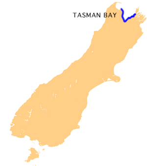
Tasman Bay is a large bay located at the top of New Zealand's South Island. It looks like a "V" shape and sits right in the middle of the island's northern coast. This bay is about 120 kilometers long and 70 kilometers wide. It's a part of the Tasman Sea coastline, found on the western side of the Cook Strait.
On the western side of Tasman Bay, you'll find land covered in thick plants and trees. This area also marks the spot where Tasman Bay separates from the next bay, Golden Bay. This western part is also a section of the beautiful Abel Tasman National Park. To the east, the bay is bordered by the valleys of the Marlborough Sounds.
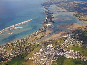
Several rivers flow into Tasman Bay. Some of these include the Waimea River, the Riwaka River, the Motueka River, and the Serpentine River. Tasman Bay is also home to a unique natural feature called the Boulder Bank, which is a rare rock formation.
The land around the center of the bay is used for farming. This area is famous for growing many different crops. You'll find lots of apples, kiwifruit, olives, grapes, and hops here. In the middle of the 1900s, Tasman Bay also produced Tobacco. Today, there's a Tobacco museum in Motueka where you can learn about this history. This part of the South Island's north coast is also the most populated. Several towns and the city of Nelson are located here. Other important towns include Motueka, Riwaka, and Richmond.
See also
 In Spanish: Bahía de Tasmania para niños
- Golden Bay
- Abel Tasman National Park
- Nelson, New Zealand
 | Delilah Pierce |
 | Gordon Parks |
 | Augusta Savage |
 | Charles Ethan Porter |


