Maizières-la-Grande-Paroisse facts for kids
Quick facts for kids
Maizières-la-Grande-Paroisse
|
||
|---|---|---|
 |
||
|
||
| Country | France | |
| Region | Grand Est | |
| Department | Aube | |
| Arrondissement | Nogent-sur-Seine | |
| Canton | Romilly-sur-Seine | |
| Intercommunality | Portes de Romilly-sur-Seine | |
| Area
1
|
20.46 km2 (7.90 sq mi) | |
| Population
(Jan. 2019)
|
1,498 | |
| • Density | 73.22/km2 (189.63/sq mi) | |
| Time zone | UTC+01:00 (CET) | |
| • Summer (DST) | UTC+02:00 (CEST) | |
| INSEE/Postal code |
10220 /10510
|
|
| 1 French Land Register data, which excludes lakes, ponds, glaciers > 1 km2 (0.386 sq mi or 247 acres) and river estuaries. | ||
Maizières-la-Grande-Paroisse is a small town in north-central France. It is known as a commune, which is like a local government area. This commune is located in the Aube département.
Contents
About Maizières-la-Grande-Paroisse
Maizières-la-Grande-Paroisse is a charming place in the French countryside. It has a rich history, like many towns in France. The name itself suggests its past.
Where is Maizières-la-Grande-Paroisse?
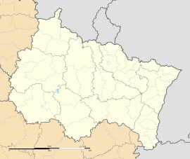
This commune is found in the Grand Est region of France. Specifically, it is in the Aube department. The Aube department is known for its beautiful landscapes. It is also close to the city of Troyes.
The town is located in the Nogent-sur-Seine arrondissement. It is also part of the Romilly-sur-Seine canton. These are ways France organizes its local areas.
What is a Commune?
In France, a commune is the smallest unit of local government. It is like a town or a village with its own local council. Every part of France belongs to a commune.
Communes have a mayor and a town council. They manage local services for the people living there. This includes things like schools, roads, and local events.
Life in Maizières
As of January 2019, about 1,498 people lived in Maizières-la-Grande-Paroisse. This makes it a small community. The area of the commune is about 20.46 square kilometers.
The mayor of Maizières-la-Grande-Paroisse is Michel Lamy. He was elected to lead the town. The town is also part of a group of communes called Portes de Romilly-sur-Seine. This group works together on bigger projects.
The elevation of the commune is about 78 meters above sea level. This means it is not very high up. The coordinates for the town are 48.5125 degrees north and 3.7911 degrees east. These numbers help you find it on a map.
See also
 In Spanish: Maizières-la-Grande-Paroisse para niños
 | James Van Der Zee |
 | Alma Thomas |
 | Ellis Wilson |
 | Margaret Taylor-Burroughs |


