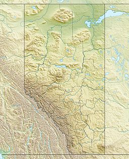
Mann Lakes (Alberta) facts for kids
Quick facts for kids Mann Lakes |
|
|---|---|
| Location | County of St. Paul No. 19, Alberta |
| Coordinates | 54°09′29″N 111°30′32″W / 54.158°N 111.509°W |
| Basin countries | Canada |
| Max. length | Upper 3.1 km (1.9 mi) Lower 3 km (1.9 mi) |
| Max. width | Upper 3.3 km (2.1 mi) Lower 3.5 km (2.2 mi) |
| Surface area | Upper 4.59 km2 (1.77 sq mi) Lower 5.10 km2 (1.97 sq mi) |
| Average depth | Upper 5.7 m (19 ft) Lower 4.0 m (13.1 ft) |
| Max. depth | Upper 9.1 m (30 ft) Lower 6.1 m (20 ft) |
| Surface elevation | Upper 618 m (2,028 ft) Lower 617 m (2,024 ft) |
The Mann Lakes are two special lakes located in Alberta, Canada. They are unique because they are "close basin" lakes. This means their water stays within the lake and doesn't flow out to the ocean. Long ago, these two lakes were actually one big lake called Mann Lake.
Contents
Discovering Mann Lakes: Two Lakes in One!
The Mann Lakes are found in the County of St. Paul No. 19 in Alberta. They are a cool example of how human activity can change nature. What was once a single body of water is now two distinct lakes.
The Highway That Split a Lake
In 1961, something big happened that changed Mann Lake forever. Workers built Alberta Highway 28 right through the middle of the lake. This construction project divided the single lake into two separate parts. Now, we have Upper Mann Lake and Lower Mann Lake.
Where Are They Located?
The two lakes are very close to each other. Upper Mann Lake is the one further south. You can find it at coordinates 54°08′37″N 111°30′57″W. Just a bit north of that is Lower Mann Lake, located at 54°10′N 111°30′W. They are like neighbors, separated by a road.
Why Are the Lakes Shrinking?
Since 1980, the water level in both Upper and Lower Mann Lakes has been slowly going down. This is a common issue for "close basin" lakes. Because their water doesn't flow out, they depend on rain and snow to keep their levels up. If there's less rain or more evaporation, the lakes can shrink over time.
What is a Close Basin Lake?
A close basin lake, also known as an endorheic basin, is like a giant bowl that collects water. Rivers and streams might flow into it, but no water flows out to other rivers or the ocean. The only way water leaves is by evaporating into the air or sinking into the ground. This makes their water levels very sensitive to changes in weather.
 | Janet Taylor Pickett |
 | Synthia Saint James |
 | Howardena Pindell |
 | Faith Ringgold |


