Mansfield, Kansas facts for kids
Quick facts for kids
Mansfield, Kansas
|
|
|---|---|

|
|
| Country | United States |
| State | Kansas |
| County | Finney |
| Elevation | 2,795 ft (852 m) |
| Time zone | UTC-6 (CST) |
| • Summer (DST) | UTC-5 (CDT) |
| Area code | 620 |
| FIPS code | 20-44350 |
| GNIS ID | 484576 |
Mansfield is a small, quiet place in Finney County, Kansas, United States. It is known as an unincorporated community. This means it is a settlement that does not have its own local government. Instead, it is managed by the county.
Contents
What is an Unincorporated Community?
An unincorporated community is a place where people live, but it's not officially a city or town. It doesn't have its own mayor or city council. The county government handles services like roads and law enforcement. Many small communities across the United States are unincorporated.
Where is Mansfield Located?
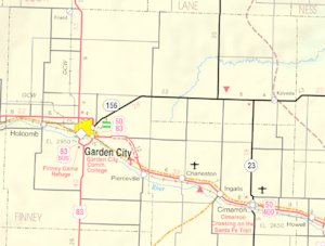
Mansfield is found in the southwestern part of Kansas. It is located in Finney County. This community is about 7 miles (11 km) southeast of a larger city called Garden City. Garden City is the county seat of Finney County.
Geography and Surroundings
Mansfield sits in a flat area of Kansas. The land around it is mostly used for farming. The elevation of Mansfield is about 2,795 feet (852 meters) above sea level. This makes it a bit higher than some other parts of Kansas.
Quick Facts About Mansfield
Even though Mansfield is a small place, it has some interesting details.
- Time Zone: Mansfield is in the Central Time Zone (CST). During daylight saving time, it switches to CDT.
- Area Code: The phone area code for Mansfield is 620.
- Official Codes: It has a FIPS code (20-44350) and a GNIS ID (484576). These are special numbers used to identify places in the United States.
 | Kyle Baker |
 | Joseph Yoakum |
 | Laura Wheeler Waring |
 | Henry Ossawa Tanner |


