Maple Lake (Ontario) facts for kids
Quick facts for kids Maple Lake |
|
|---|---|
| Location | Ontario |
| Coordinates | 45°05′45″N 78°40′20″W / 45.0958°N 78.6721°W |
| Basin countries | Canada |
| Surface area | 336 ha (830 acres) |
| Average depth | 38.6 ft (11.8 m) |
| Max. depth | 123 ft (37 m) |
| Water volume | 31,999 acre⋅ft (39.470 hm3) |
| Surface elevation | 1,033 ft (315 m) |
| Islands | none |
| Settlements | ̉ |
Maple Lake is a beautiful lake located in the southern part of Haliburton County, Ontario, Canada. It's a popular spot for outdoor activities, especially fishing! This lake is easy to find, as it's close to Highway 118. It's also part of a larger group of lakes in the area.
Contents
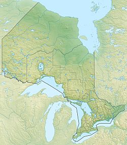
Exploring Maple Lake's Location
Maple Lake is found in the southern part of Haliburton County, Ontario. This area is famous for its many lakes and forests. The lake is situated northeast of a place called Carnarvon. It is also northwest of the town of Haliburton. You can easily reach Maple Lake by car. Highway 118 runs along its southern shores. For access to the northern side, you can use North Shore Road.
How Big is Maple Lake?
Maple Lake covers an area of about 336 hectares (which is about 830 acres). To give you an idea, that's like 628 football fields! The lake is also quite deep. Its average depth is about 38.6 feet (11.8 meters). At its deepest point, Maple Lake reaches an impressive 123 feet (37.5 meters). That's as tall as a 12-story building!
What Fish Live in Maple Lake?
Maple Lake is a great place for fishing! It's known for having several types of fish. Each year, the lake is stocked with Lake Trout. This means young Lake Trout are added to the lake to help keep the fish population healthy.
Other Fish You Can Catch
Besides Lake Trout, anglers (that's what we call people who fish!) often try to catch other fish. These include Whitefish, Largemouth Bass, and Smallmouth Bass. Bass are known for being fun to catch because they put up a good fight!
There are also Muskie in Maple Lake. Muskie are large, powerful fish. They can be quite tricky to catch, so fishing for them is usually slow. It takes a lot of patience and skill to land a Muskie!
Part of a Lake Chain
Maple Lake is not just a single lake. It is actually part of a chain of lakes. This means it's connected to other lakes in the area. These connections allow fish and water to move between the different lakes. This creates a larger ecosystem for wildlife to thrive.


