María Linda River facts for kids
Quick facts for kids María Linda River |
|
|---|---|
|
Location of mouth
|
|
| Native name | Río María Linda (Spanish) |
| Country | Guatemala |
| Physical characteristics | |
| Main source | Guatemala (Guatemala (department)) 1,600 m (5,200 ft) 14°20′06″N 90°30′41″W / 14.334912°N 90.511293°W |
| River mouth | Pacific Ocean 0 m (0 ft) 13°56′32″N 90°42′31″W / 13.942148°N 90.708489°W |
| Length | 70 km (43 mi) |
The Río María Linda is an important river located in the southwest part of Guatemala. It starts its journey high up in the mountains and flows all the way to the Pacific Ocean. Rivers like the María Linda are vital for the environment and the people living nearby. They provide water for drinking, farming, and support many kinds of plants and animals.
Contents
Where Does the María Linda River Start?
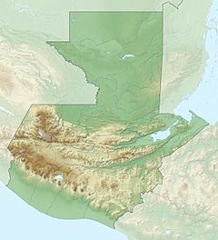
The María Linda River begins south of Lake Amatitlán. This area is in the Guatemala Department, which is one of the administrative regions of the country. The river's source is quite high up, about 1,600 meters (5,249 feet) above sea level. This high elevation gives the river a good start for its long journey downhill.
The River's Path Through Guatemala
After starting near Lake Amatitlán, the María Linda River flows south. It travels through the flat, low-lying areas near the coast. These areas are part of two other important departments: Escuintla and Santa Rosa. As it moves, the river collects water from many smaller streams and tributaries.
Journey to the Pacific Ocean
The river continues its journey until it finally reaches the Pacific Ocean. This is where the river's fresh water mixes with the salty ocean water. The total length of the María Linda River is about 70 kilometers (43 miles). It's a relatively short but very active river.
Understanding the María Linda River Basin
A river basin is like a giant funnel. It's all the land area where rainwater and snowmelt drain into a specific river or its tributaries. The María Linda river basin is quite large, covering an area of about 2,727 square kilometers (1,053 square miles). This means a lot of land contributes water to this river.
Why River Basins Are Important
The size of a river basin tells us how much land feeds water into the river. A larger basin usually means the river carries more water. The health of the river depends on the health of its entire basin. What happens on the land, like farming or building, can affect the river's water quality and flow.
Water Flow and Discharge
The María Linda River's average water flow, or discharge, is about 13.1 cubic meters per second (463 cubic feet per second) at a place called Guacamayas. This measurement tells us how much water passes a certain point in the river each second. It can change a lot depending on the season, especially during rainy periods.
Importance of the María Linda River
Rivers like the María Linda are incredibly important for many reasons. They are a primary source of fresh water for people living in the surrounding areas. This water is used for drinking, washing, and other daily needs.
Supporting Life and Agriculture
The river also supports a rich variety of plant and animal life. The areas around the river, especially the coastal lowlands, are often used for agriculture. Farmers rely on the river's water to irrigate their crops. This helps grow food for the local communities and for export.
Natural Habitats and Ecosystems
The María Linda River and its basin create important habitats for many species. Fish, birds, and other wildlife depend on the river for survival. The river's journey from the mountains to the ocean creates different environments, each supporting unique ecosystems. Protecting these river systems is key to keeping the natural world healthy.
See also
 In Spanish: Río María Linda para niños
 | Emma Amos |
 | Edward Mitchell Bannister |
 | Larry D. Alexander |
 | Ernie Barnes |


