Marble Range facts for kids
Quick facts for kids Marble Range |
|
|---|---|
 |
|
| Dimensions | |
| Area | 1,727 km2 (667 sq mi) |
| Geography | |
| Country | Canada |
| Province | British Columbia |
| Parent range | Fraser Plateau |
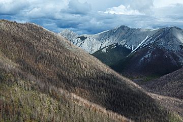
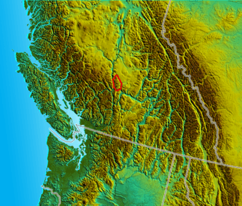
The Marble Range is a small group of mountains in British Columbia, Canada. It's located right next to the famous Fraser River, on the southwestern edge of a large area called the Interior Plateau.
This mountain range covers an area of about 1,250 square kilometres (480 square miles). It stretches for about 65 kilometres (40 miles) from north to south and is about 20 kilometres (12 miles) wide.
Its southern side forms the northern wall of the amazing Marble Canyon. This area also includes the valley where the communities of Pavilion are located. This community is home to both ranching families and First Nations people.
Where is the Marble Range?
The Marble Range is found in the Canadian province of British Columbia. It's part of the larger Interior Plateau region. This plateau is a vast, high area of land that covers much of central British Columbia. The range sits right where the plateau meets the Fraser River, one of British Columbia's longest rivers.
Key Features of the Area
The southern part of the Marble Range is very important because it forms one side of the Marble Canyon. This canyon is a deep, narrow valley carved by water over many years.
Nearby, you'll find the community of Pavilion. This small place is known for its ranching activities and is also home to members of the First Nations.
 | DeHart Hubbard |
 | Wilma Rudolph |
 | Jesse Owens |
 | Jackie Joyner-Kersee |
 | Major Taylor |


