Marysville, Pennsylvania facts for kids
Quick facts for kids
Marysville, Pennsylvania
|
|
|---|---|
|
Borough
|
|

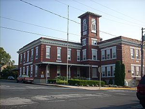
The former Public School for Marysville
|
|

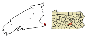
Location of Marysville in Perry County, Pennsylvania.
|
|
| Country | United States |
| State | Pennsylvania |
| County | Perry |
| Settled | 1755 |
| Incorporated | 1867 |
| Government | |
| • Type | Borough Council |
| Area | |
| • Total | 2.34 sq mi (6.06 km2) |
| • Land | 2.33 sq mi (6.05 km2) |
| • Water | 0.00 sq mi (0.01 km2) |
| Elevation
(Borough benchmark near center)
|
369 ft (112 m) |
| Highest elevation
(Cove Mountain)
|
1,200 ft (400 m) |
| Lowest elevation
(Susquehanna River)
|
328 ft (100 m) |
| Population
(2020)
|
|
| • Total | 2,652 |
| • Density | 1,135.76/sq mi (438.53/km2) |
| Time zone | UTC-5 (Eastern (EST)) |
| • Summer (DST) | UTC-4 (EDT) |
| Zip code |
17053
|
| Area code(s) | 717 |
| FIPS code | 42-47968 |
| Website | Marysville Borough |
Marysville is a small town, also known as a borough, located in Perry County, Pennsylvania, United States. In 2020, about 2,652 people lived here. It's part of the larger Harrisburg–Carlisle area, which is a big group of cities and towns.
Marysville was first settled in 1755. It officially became a borough in 1866 and was first called the Borough of Haley. A year later, in 1867, its name was changed to Marysville.
Contents
History of Marysville
Marysville has an interesting past. One of its most famous landmarks is the Rockville Bridge. This bridge is very old and important.
The Rockville Bridge
The Rockville Bridge was built a long time ago. It was added to the National Register of Historic Places in 1975. This means it's recognized as a special place that should be protected because of its history.
Geography of Marysville
Marysville is located at coordinates 40.342287 degrees North and -76.931463 degrees West. It's a small area, covering about 2.4 square miles (which is about 6.06 square kilometers) of land.
Natural Borders and Roads
The town has some natural boundaries. To the south, you'll find Blue Mountain. To the north, there's Cove Mountain. The Susquehanna River flows along the eastern side of Marysville.
Major roads also pass through the town. U.S. Route 11 and U.S. Route 15 go through Marysville from north to south. Pennsylvania Route 850 also ends here.
Population of Marysville
The number of people living in Marysville has changed over the years. Here's a look at how the population has grown and shrunk:
| Historical population | |||
|---|---|---|---|
| Census | Pop. | %± | |
| 1870 | 863 | — | |
| 1880 | 1,206 | 39.7% | |
| 1890 | 1,115 | −7.5% | |
| 1900 | 1,463 | 31.2% | |
| 1910 | 1,693 | 15.7% | |
| 1920 | 1,877 | 10.9% | |
| 1930 | 1,922 | 2.4% | |
| 1940 | 1,882 | −2.1% | |
| 1950 | 2,158 | 14.7% | |
| 1960 | 2,580 | 19.6% | |
| 1970 | 2,328 | −9.8% | |
| 1980 | 2,452 | 5.3% | |
| 1990 | 2,425 | −1.1% | |
| 2000 | 2,306 | −4.9% | |
| 2010 | 2,534 | 9.9% | |
| 2020 | 2,652 | 4.7% | |
| 2021 (est.) | 2,661 | 5.0% | |
| Sources: | |||
Who Lives in Marysville?
In 2000, there were 2,306 people living in Marysville. These people lived in 1,027 different homes. About 635 of these homes were families.
The average home had about 2.25 people. For families, the average size was about 2.80 people.
Age Groups in Marysville
The population of Marysville includes people of all ages.
- About 21.2% of the people were under 18 years old.
- About 7.4% were between 18 and 24 years old.
- The largest group, about 29.3%, was between 25 and 44 years old.
- About 24.9% were between 45 and 64 years old.
- And about 17.2% were 65 years old or older.
The median age in Marysville was 40 years. This means half the people were younger than 40 and half were older.
See also
 In Spanish: Marysville (Pensilvania) para niños


