
Perry County, Pennsylvania facts for kids
Quick facts for kids
Perry County
|
||
|---|---|---|

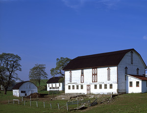
Saville Covered Bridge in Saville Township, October 2010
|
||
|
||

Location within the U.S. state of Pennsylvania
|
||
 Pennsylvania's location within the U.S. |
||
| Country | ||
| State | ||
| Founded | March 22, 1820 | |
| Named for | Oliver Hazard Perry | |
| Seat | New Bloomfield | |
| Largest Borough | Marysville | |
| Area | ||
| • Total | 556 sq mi (1,440 km2) | |
| • Land | 551 sq mi (1,430 km2) | |
| • Water | 4.1 sq mi (11 km2) 0.7%% | |
| Population
(2020)
|
||
| • Total | 45,842 | |
| • Density | 82.45/sq mi (31.834/km2) | |
| Time zone | UTC−5 (Eastern) | |
| • Summer (DST) | UTC−4 (EDT) | |
| Congressional district | 13th | |

Perry County is a county located in the state of Pennsylvania. In 2020, about 45,842 people lived there. The main town, or county seat, is New Bloomfield.
The county was created on March 22, 1820. It was named after Oliver Hazard Perry, a famous hero from the War of 1812. Perry County was originally part of Cumberland County. People wanted their own county because it was hard to travel over the mountains to Carlisle, which was the county seat of Cumberland County.
At first, Landisburg was the temporary county seat. Later, New Bloomfield was chosen as the permanent one. Perry County is part of the South Central Pennsylvania region. It is also part of the larger Harrisburg–York–Lebanon combined statistical area.
In 2010, the center of Pennsylvania's population was in eastern Perry County. Green Park is a small village that marks the middle point of the county. It's between the mountains in the west and the Susquehanna River in the east.
Contents
Geography of Perry County
Perry County's landscape is shaped by the Appalachian Mountain ridges. These ridges run from the southwest to the northeast. The highest point is on the Blue Mountain Ridge, which is the border with Cumberland County. This spot is about 2,269 feet (692 meters) above sea level.
The Susquehanna River flows south and forms most of the county's eastern border. The Juniata River enters from Juniata County and joins the Susquehanna River near Duncannon. Many smaller creeks and lakes are also found here. These waterways are great for fishing and boating, like canoeing and kayaking on Shermans Creek.
The county covers about 556 square miles (1,440 km²). Most of this area, 551 square miles (1,427 km²), is land. The rest is water.
The famous Appalachian Trail passes through Duncannon. Perry County is also known as the start of the Tuscarora Trail.
Climate and Nature
Perry County has a humid continental climate, meaning it has hot summers. Average temperatures in New Bloomfield range from about 28.5°F (-1.9°C) in January to 73.2°F (22.9°C) in July.
You can find many types of trees here, such as red maple, Virginia pine, oak, and eastern white pine. Other common trees include eastern hemlock, birch, and shagbark hickory. You might also see American sycamore, black walnut, and sassafras. Mosses and ferns are common, especially in shaded areas and along streams.
Neighboring Counties
- Juniata County - north
- Northumberland County - northeast
- Dauphin County - east
- Cumberland County - south
- Franklin County - southwest
Main Roads

 US 11 / US 15
 US 22 / US 322
 PA 17
PA 17 PA 34
PA 34 PA 74
PA 74 PA 104
 PA 233
 PA 235
 PA 274
 PA 849
 PA 850
Parks and Protected Areas
- Big Spring State Forest Picnic Area
- Fowlers Hollow State Park
- Little Buffalo State Park
- Colonel Denning State Park (part)
- Hoverter and Sholl Box Huckleberry Natural Area
- State Game Lands Number 88
- State Game Lands Number 170
- State Game Lands Number 256
- State Game Lands Number 281
- Tuscarora State Forest (part)
Population of Perry County
| Historical population | |||
|---|---|---|---|
| Census | Pop. | %± | |
| 1820 | 11,342 | — | |
| 1830 | 14,261 | 25.7% | |
| 1840 | 17,096 | 19.9% | |
| 1850 | 20,088 | 17.5% | |
| 1860 | 22,793 | 13.5% | |
| 1870 | 25,447 | 11.6% | |
| 1880 | 27,522 | 8.2% | |
| 1890 | 26,276 | −4.5% | |
| 1900 | 26,263 | 0.0% | |
| 1910 | 24,136 | −8.1% | |
| 1920 | 22,875 | −5.2% | |
| 1930 | 21,744 | −4.9% | |
| 1940 | 23,213 | 6.8% | |
| 1950 | 24,782 | 6.8% | |
| 1960 | 26,582 | 7.3% | |
| 1970 | 28,615 | 7.6% | |
| 1980 | 35,718 | 24.8% | |
| 1990 | 41,172 | 15.3% | |
| 2000 | 43,609 | 5.9% | |
| 2010 | 45,969 | 5.4% | |
| 2020 | 45,842 | −0.3% | |
| 2023 (est.) | 46,083 | 0.2% | |
| US Decennial Census 1790–1960 1900–1990 1990–2000 2010–2017 2010-2020 |
|||
What the 2020 Census Shows
In 2020, the census counted 45,842 people in Perry County. Most people, about 93.4%, identified as White. Smaller groups included Black or African American people (0.63%), Asian people (0.3%), and Native American people (0.11%). About 2% of the population identified as Hispanic or Latino.
| Race | Num. | Perc. |
|---|---|---|
| White (NH) | 42,838 | 93.4% |
| Black or African American (NH) | 289 | 0.63% |
| Native American (NH) | 50 | 0.11% |
| Asian (NH) | 139 | 0.3% |
| Pacific Islander (NH) | 3 | 0.01% |
| Other/Mixed (NH) | 1,611 | 3.51% |
| Hispanic or Latino | 912 | 2% |
Metropolitan Areas
Perry County is part of the Harrisburg-Carlisle, PA Metropolitan Statistical Area (MSA). An MSA is a region with a large population center and nearby areas that are closely linked. This MSA was the 6th largest in Pennsylvania in 2010.
Perry County is also part of an even larger area called the Harrisburg–York–Lebanon combined statistical area (CSA). A CSA includes several MSAs that are connected. This CSA includes Perry, Adams, Cumberland, Dauphin, Lebanon, and York Counties. It was the 5th largest in Pennsylvania in 2010.
Emergency Services
Perry County's emergency services are located in the basement of the Perry County Courthouse. The 911 center helps people in almost all of Perry County. It also covers parts of Juniata and Dauphin counties.
Education in Perry County
Public Schools
Perry County has several public school districts:
- Greenwood School District (also serves parts of Juniata County)
- Newport School District
- Susquenita School District (also serves parts of Dauphin County)
- West Perry School District
- Fannett-Metal School District (located in Franklin County, but covers parts of Perry County)
The Capital Area Intermediate Unit 15 helps these school districts. It provides services like K-12 curriculum, shared resources, and special education support.
Private Schools
Many private schools are also in Perry County:
- Blue Goose Children's Learning Center, Inc – Newport
- Carson Long Military Institute
- Clarks Run Parochial School – Blain
- Community Christian Academy – Newport
- Farm Lane School – Ickesburg
- Fowlers Hollow School – Blain
- Heritage Christian School – West Perry
- Honeysuckle Ridge School – Elliotsburg
- Kuddly Bear Child Care Center Inc. – Duncannon
- Loysville Youth Development Center – Loysville
- Manassa School – Blain
- Messiah Day Care Center – Elliottsburg
- Mountain View Parochial School – Ickesburg
- Perry View Parochial School – Landisburg
- Raccoon Valley Amish School – Millerstown
- Shermans View School – Loysville
- Stony Point School – Loysville
- Sunset Valley School – Millerstown
Trade Schools
- Central Pennsylvania Diesel Institute – Liverpool
Public Libraries
- New Bloomfield Public Library
- Community Library of Western Perry County
- Marysville-Rye Public Library
- Newport Public Library
Media and Books
Newspapers
Perry County has four weekly newspapers. Three are published by Advance Publications: the Duncannon Record, The News-Sun, and Perry County Times. The Perry County Weekly is published by The Sentinel in Carlisle.
Books about Perry County
Many historical books have been written about Perry County. You can find them at the Council of the Arts in Newport and other places. These books cover topics like the history of the Blain area and the lives of early settlers along Shermans Creek. Some books even describe a Civil War battle that happened at Sterrett's Gap. A local author, Roy F. Chandler, wrote many books about the county.
Communities in Perry County

In Pennsylvania, there are different types of towns and areas. These include cities, boroughs, and townships. Here are the main communities in Perry County:
Boroughs
Boroughs are like small towns with their own local government.
- Blain
- Duncannon
- Landisburg
- Liverpool
- Marysville
- Millerstown
- New Bloomfield (county seat)
- New Buffalo
- Newport
Unincorporated Communities
These are smaller places that are not officially part of a borough or city.
- Acker
- Andersonburg
- Alinda
- Amity Hall
- Aqueduct
- Bailey
- Bixler
- Bridgeport
- Centre
- Center Square
- Cisna Run
- Couchtown
- Cove
- Crums Corners
- Dellville
- Donnally Mills
- Dromgold
- Elliottsburg
- Erly
- Eshcol
- Everhartville
- Falling Spring
- Fort Robertson
- Glenvale
- Gramere
- Green Park
- Half Falls
- Ickesburg
- Juniata Furnace
- Keystone
- Kinkora Heights
- Kistler
- Little Germany
- Losh Run
- Loysville
- Mannsville
- Marklesville
- McKee
- Mecks Corner
- Milltown
- Montebello
- Montgomery Ferry
- Mount Patrick
- Mount Pleasant
- Nekoda
- New Germantown
- Oakgrove
- Old Ferry
- Perdix
- Pine Grove
- Pfoutz Valley
- Reward
- Rose Glen
- Roseburg
- Saville
- Seyoc
- Shermans Dale
- Stony Point
- Sundy Place
- Wahneta
- Walnut Grove
- Wardville
- Wila
Townships
Townships are larger areas that often include smaller villages or rural areas.
- Buffalo
- Carroll
- Centre
- Greenwood
- Howe
- Jackson
- Juniata
- Liverpool
- Miller
- Northeast Madison
- Oliver
- Penn
- Rye
- Saville
- Southwest Madison
- Spring
- Toboyne
- Tuscarora
- Tyrone
- Watts
- Wheatfield
Largest Communities by Population
Here are the largest communities in Perry County based on the 2010 census:
† county seat
| Rank | City/Town/etc. | Municipal type | Population (2010 Census) |
|---|---|---|---|
| 1 | Marysville | Borough | 2,534 |
| 2 | Newport | Borough | 1,574 |
| 3 | Duncannon | Borough | 1,522 |
| 4 | † New Bloomfield | Borough | 1,247 |
| 5 | Liverpool | Borough | 955 |
| 6 | Millerstown | Borough | 673 |
| 7 | Blain | Borough | 263 |
| 8 | Landisburg | Borough | 218 |
| 9 | New Buffalo | Borough | 129 |
Economy and History
Perry County's economy is mostly based on farming. You can find many farmers markets, roadside stands, and farm stores throughout the county. Two well-known farms are Spiral Path Farm and Yeehaw Farm. About 38% of the county's land is farmland.
In the past, mills were very important here. They used water power to grind grain or saw wood. There are still 21 old mills standing today. Early settlers weren't allowed in the area until 1755. Even then, it wasn't safe, and many pioneers had to leave because of Native American attacks. They could safely return in 1762. The first mill was taxed in 1763.
Almost every stream had a sawmill. These mills provided wood for the first buildings and boardwalks in the county.
Fun Things to Do
Perry County offers many places for recreation and outdoor activities.
State Parks and Natural Areas
- Fowlers Hollow State Park
- Little Buffalo State Park
- Big Spring State Forest Picnic Area
- Hoverter and Sholl Box Huckleberry Natural Area near New Bloomfield.
- Carroll Township Park has many sports facilities.
Pools
You can cool off at these pools:
- Liverpool Pool (Jann Deitzler Memorial Pool)
- Millerstown Pool
- New Bloomfield Pool
- Little Buffalo State Park Pool
Trails
Enjoy hiking on:
- Hawk Rock Trail
- Iron Horse Trail
State Game Lands
These areas are for hunting (with a license from the PA Game Commission) and other outdoor activities:
- State Game Lands #170 Dellville
- State Game Lands #254 New Buffalo
- #256-Mecks Corner
- State Game Lands #281 Miller Township
Images for kids
-
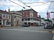
Duncannon, downtown view showing the Doyle.
-
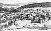
New Bloomfield in 1913.
-
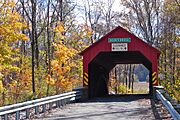
Books Covered Bridge.
-
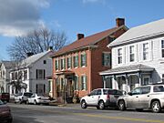
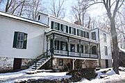
New Bloomfield.
-
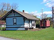
Blain Depot in Blain.
-
South High Street Bridge, Duncannon.
-
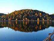
Little Buffalo State Park, near New Bloomfield.
-
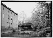
An old building in Dellville (formerly a store.)
-
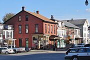
Downtown Newport.
-
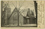
Presbyterian church in Duncannon.
-
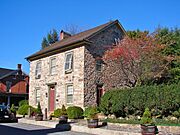
Landisburg.
-
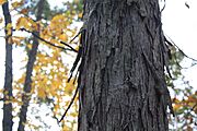
A shagbark hickory tree near Dellville.

.jpg)

.jpg)


See also
 In Spanish: Condado de Perry (Pensilvania) para niños
