Max V. Shaul State Park facts for kids
Quick facts for kids Max V. Shaul State Park |
|
|---|---|

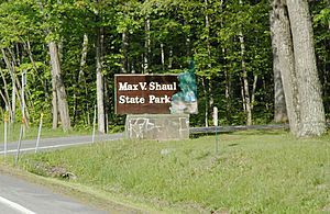
Max V. Shaul State Park's entrance.
|
|
| Lua error in Module:Location_map at line 420: attempt to index field 'wikibase' (a nil value). | |
| Type | State park |
| Location | Route 30 Fultonham, New York |
| Nearest city | Fultonham, New York |
| Area | 70 acres (0.28 km2) |
| Created | 1959 |
| Operated by | New York State Office of Parks, Recreation and Historic Preservation |
| Visitors | 25,885 (in 2014) |
| Open | All year |
| Camp sites | 30 |
| Website | Max V. Shaul State Park |
Max V. Shaul State Park is a fun place to visit in Schoharie County, New York. It's a state park that covers about 70 acres (28 hectares). You can find it in the beautiful Schoharie Valley. The park is located between the towns of Breakabeen and Fultonham. From the park, you can even see a cool landmark called Vroman's Nose.
Contents
What is Max V. Shaul State Park?
Max V. Shaul State Park is a great spot for outdoor adventures. It offers many activities for families and friends. The park is managed by the New York State Office of Parks, Recreation and Historic Preservation. This group helps keep the park safe and fun for everyone.
When Did the Park Open?
New York State bought the land for the park in 1958. It was first called the Toepath Mountain Picnic Area and Campsite. The park officially opened its doors to visitors on May 28, 1959.
Fun Things to Do at the Park
Max V. Shaul State Park has lots of things to keep you busy.
- You can play a game of softball on the field.
- Kids can have a blast on the playground.
- If you like fishing, you can try your luck in Panther Creek or Schoharie Creek.
- There are special areas for picnics, perfect for lunch outdoors.
- You can also find places to cook your food.
- For those who love spending the night outdoors, there are camping sites.
Camping at Max V. Shaul State Park
The park has 30 sites where you can set up your tent or park your trailer. If you are camping here, you get a special bonus! You can visit Mine Kill State Park for free during your stay. Mine Kill State Park is another great park nearby.
Where is the Park Located?
The park is easy to find right on Route 30. The southern entrance of Old Route 30 is also located at the park.
 | Emma Amos |
 | Edward Mitchell Bannister |
 | Larry D. Alexander |
 | Ernie Barnes |

