McDonald Lake (Saskatchewan) facts for kids
Quick facts for kids McDonald Lake |
|
|---|---|
| Rafferty Reservoir | |

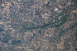
McDonald Lake as seen from the ISS
|
|
| Coordinates | 49°11′38″N 103°14′17″W / 49.194°N 103.238°W |
| Type | reservoir |
| Primary inflows | Souris River, Roughbark River, Jewell River and a 10-kilometre diversion channel connecting Boundary and Rafferty Reservoirs, which allows water to be diverted from Boundary Reservoir into McDonald Lake. |
| River sources | Souris River |
| Primary outflows | Souris River |
| Catchment area | 2,448 km2 (945 sq mi) |
| Managing agency | The Saskatchewan Water Security Agency |
| Max. length | 57 km (35 mi) |
| Max. width | 1.2 kilometres (0.75 mi) |
| Surface area | 48.8 km2 (18.8 sq mi) |
| Average depth | 15 metres (49 ft) |
| Max. depth | 15 metres (49 ft) |
| Water volume | 439,600,000 cubic metres (1.552×10¹⁰ cu ft) |
| Surface elevation | 556 m (1,824 ft) |
McDonald Lake is a large lake in Saskatchewan, Canada. It is also known as Rafferty Reservoir. This lake was not here naturally. It was created by people when the Rafferty Dam was built in 1994. It is an important source of water for the area.
Contents
What is a Reservoir?
A reservoir is like a big, artificial lake. It is built to store water for different uses. People build dams across rivers to create reservoirs. These reservoirs can help with things like:
- Providing drinking water for towns and cities.
- Helping farmers water their crops.
- Controlling floods by holding back extra water.
- Generating electricity using the power of the water.
McDonald Lake is a reservoir that helps manage water in Saskatchewan.
Where is McDonald Lake Located?
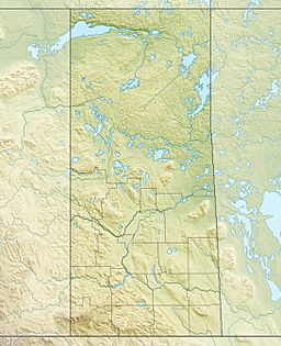
McDonald Lake is found in the southern part of Saskatchewan, Canada. It is located at coordinates 49.194 degrees north and 103.238 degrees west. This area is known for its flat lands and agricultural activities.
How Big is McDonald Lake?
McDonald Lake is quite large!
- It stretches for about 57 kilometers (35 miles) in length.
- Its width is around 1.2 kilometers (0.75 miles).
- The total area of the lake is about 48.8 square kilometers (18.8 square miles).
- The deepest part of the lake is about 15 meters (49 feet).
- It holds a huge amount of water, about 439,600,000 cubic meters. That's a lot of water!
Water Flow in McDonald Lake
Several rivers and channels bring water into McDonald Lake. These are called inflows.
- The main river flowing into it is the Souris River.
- Other rivers like the Roughbark River and Jewell River also add water.
- There is also a special 10-kilometer (6.2-mile) channel. This channel connects McDonald Lake to another reservoir called Boundary Reservoir. It allows water to be moved between the two lakes.
The water then flows out of McDonald Lake through the Souris River. This is called the outflow. The area that collects water for the lake, called the catchment area, is about 2,448 square kilometers (945 square miles).
Why Was McDonald Lake Built?
The Rafferty Dam was built in 1994 to create McDonald Lake. The main reason for building this dam and creating the reservoir was to manage water resources in the region. It helps with flood control and ensures there is enough water for various uses, especially for farming in the dry prairie environment. The Saskatchewan Water Security Agency helps manage the lake and its water.
 | Georgia Louise Harris Brown |
 | Julian Abele |
 | Norma Merrick Sklarek |
 | William Sidney Pittman |


