
Menabe facts for kids
Quick facts for kids
Menabe
|
|
|---|---|
|
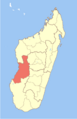
Region
|
|

Location in Madagascar
|
|
| Country | |
| Capital | Morondava |
| Area | |
| • Total | 46,121 km2 (17,807 sq mi) |
| Population
(2018)
|
|
| • Total | 700,577 |
| • Density | 15.18998/km2 (39.3419/sq mi) |
| • Ethnicities | Sakalava |
| Time zone | UTC3 (EAT) |
| HDI (2018) | 0.450 low · 17th of 22 |
Menabe is a region located in the western part of Madagascar. Its capital city is Morondava. The region covers a large area of about 46,121 square kilometers (17,808 sq mi). In 2018, its population was around 700,577 people. Most of the people living here belong to the Sakalava ethnic group.
The name "Menabe" comes from the old Sakalava Kingdom of Menabe, which existed from the 16th to the 18th centuries. The word "Menabe" itself means "big red." This name describes the color of the laterite rock that is common in the landscape of the region.
Contents
History of Menabe
Menabe is the southern part of the land once ruled by the Sakalava people. It is believed that the kingdom was started by a ruler named Adriamandazoala around 1540. The kingdom grew larger and stronger under the famous ruler Andriandahifotsy (who ruled from about 1610 to 1685). Menabe became the most powerful kingdom in Madagascar until the mid-1700s.
Conflicts and Peace Treaties
In the early 1800s, another powerful kingdom, the Merina, led by King Radama I, attacked Menabe three times between 1820 and 1822. To bring peace, Ramitraho, the king of Menabe at that time, offered his daughter Rasalimo to Radama as his wife. However, true peace did not come until Rasalimo offered another peace treaty in 1827. Sadly, King Radama died before the talks could finish.
After Ramitraho's death in 1834, the Merina kingdom took over the southern parts of Menabe. There were many battles, and the Merina finally won in 1846. Queen Ranavalona I of the Merina kingdom then placed soldiers in major Menabe towns and sent farmers to settle the area. Menabe rulers were allowed to keep some power, but they had to follow the Merina governor. The northern part of Menabe mostly stayed independent from Merina rule.
French Colonization
During the Franco-Hova War, when France invaded Madagascar, the kings of Menabe joined forces to fight back. In August 1897, about 100 Menabe chiefs and 10,000 warriors fought against the French troops. King Toera and many of his leaders were killed. However, the Menabe region was not fully controlled by the French until 1900. After this, Menabe became part of the Toliara province under French rule, which ended in 1960. In 2004, Menabe officially became a region of Madagascar.
Geography and Nature
The Menabe region is located between two important rivers: the Mangoky River and the Manambolo River. This area is known for its unique natural beauty.
Amazing Places to Visit
Menabe is home to some incredible natural attractions. The Avenue of the Baobabs is one of the most famous and visited places in the region. It is a dirt road lined with giant, ancient baobab trees that are hundreds of years old.
Protected Natural Areas
Several areas in Menabe are protected to preserve their unique wildlife and plants. These include:
- Part of the Mangoky Ihotry Wetland Complex
- Ambondrobe New Protected Area
- Avenue of the Baobabs New Protected Area
- Menabe Antimena New Protected Area
- Part of the Ambohijanahary Reserve
- Kirindy Mitea National Park
- Andranomena Reserve
Travel and Transport
Menabe is connected to other parts of Madagascar by several national roads. These include:
- Route nationale No.35 to Ivato
- Route nationale No.34 to Antsirabe
- Route nationale No.8 to Bekopaka
Airports in Menabe
The region also has several airports, making it easier to travel to and from different areas. These airports include:
- Ankavandra Airport
- Belo/Tsiribihina Airport
- Malaimbandy Airport
- Mandabe Airport
- Manja Airport
- Miandrivazo Airport
- Morondava Airport
How Menabe is Organized
The Menabe Region is divided into five main areas called districts. These districts are then split into smaller areas called communes. There are 51 communes in total.
- Belo sur Tsiribihina District has 14 communes.
- Mahabo District has 11 communes.
- Manja District has 6 communes.
- Miandrivazo District has 15 communes.
- Morondava District has 5 communes.
Images for kids
-
Location of Menabe in Madagascar
See also
 In Spanish: Región de Menabe para niños
