
Meshoppen, Pennsylvania facts for kids
Quick facts for kids
Borough of Meshoppen
|
|
|---|---|

Meshoppen's Old White Mill
|
|

Location of Meshoppen in Wyoming County, Pennsylvania.
|
|

Borough of Meshoppen
Location in Pennsylvania

Borough of Meshoppen
Location in the United States
|
|
| Country | United States |
| State | Pennsylvania |
| County | Wyoming |
| Founded by | A Sterling |
| Area | |
| • Total | 0.77 sq mi (2.00 km2) |
| • Land | 0.69 sq mi (1.79 km2) |
| • Water | 0.08 sq mi (0.21 km2) |
| Elevation | 623 ft (190 m) |
| Population
(2020)
|
|
| • Total | 326 |
| • Density | 471.78/sq mi (182.27/km2) |
| Time zone | UTC-5 (EST) |
| • Summer (DST) | UTC-4 (EDT) |
| ZIP Code |
18630
|
| Area code(s) | 570 |
| FIPS code | 42-48856 |
Meshoppen is a small town, also called a borough, located in Wyoming County, Pennsylvania, United States. In 2020, about 326 people lived there.
History of Meshoppen
The name "Meshoppen" comes from Meshoppen Creek. This creek has a Native American name that means "glass beads."
A very old building in Meshoppen, called the Old White Mill, is quite famous. It was added to the National Register of Historic Places in 1975 because of its historical importance.
Geography of Meshoppen
Meshoppen is a small area of land. According to the United States Census Bureau, the borough covers about 0.7 square miles (1.79 square kilometers) of land. There is also a small amount of water within its borders.
People of Meshoppen
| Historical population | |||
|---|---|---|---|
| Census | Pop. | %± | |
| 1880 | 554 | — | |
| 1890 | 597 | 7.8% | |
| 1900 | 609 | 2.0% | |
| 1910 | 630 | 3.4% | |
| 1920 | 608 | −3.5% | |
| 1930 | 525 | −13.7% | |
| 1940 | 580 | 10.5% | |
| 1950 | 574 | −1.0% | |
| 1960 | 470 | −18.1% | |
| 1970 | 482 | 2.6% | |
| 1980 | 571 | 18.5% | |
| 1990 | 439 | −23.1% | |
| 2000 | 459 | 4.6% | |
| 2010 | 563 | 22.7% | |
| 2020 | 326 | −42.1% | |
| 2021 (est.) | 327 | −41.9% | |
| Sources: | |||
In 2010, there were 563 people living in Meshoppen. These people lived in 190 different homes. About 128 of these were families.
The population density was about 804 people per square mile. This means that for every square mile, there were about 804 people.
Many different people live in Meshoppen. Most residents are White. There are also people who identify as African American, Native American, and Asian. Some people are from two or more races. About 10% of the population is Hispanic or Latino.
Many homes in Meshoppen have children. In 2010, about 46% of homes had kids under 18. The average age of people living in Meshoppen was 29 years old.
Gallery
-
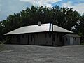
Former Lehigh Valley Railroad, Meshoppen

See also
 In Spanish: Meshoppen (Pensilvania) para niños
