
Meteorological history of Hurricane Patricia facts for kids

Track of Hurricane Patricia
|
|
| Meteorological history | |
|---|---|
| Formed | October 20, 2015 |
| Dissipated | October 24, 2015 |
| Category 5 tropical cyclone | |
| 1-minute sustained (SSHWS/NWS) | |
| Highest winds | 215 mph (345 km/h) |
| Lowest pressure | 872 mbar (hPa); 25.75 inHg (Record low in Western Hemisphere; second-lowest globally) |
| Overall effects | |
| Areas affected |
|
|
Part of the 2015 Pacific hurricane season |
|
Hurricane Patricia was a super powerful storm that formed in October 2015. It became the strongest tropical cyclone ever recorded in the Western Hemisphere. This means it was the most intense storm in places like North and South America. It also had the fastest winds ever measured in a tropical cyclone.
Patricia started as a small weather disturbance near Mexico. It quickly grew into a tropical storm. Then, it became a full-blown hurricane. The storm got incredibly strong very fast. This rapid growth surprised many weather experts. Patricia made landfall in Mexico, but thankfully, it weakened a lot before hitting land.
Contents
How Hurricane Patricia Formed

Hurricane Patricia began as a messy area of weather. This was in the eastern Pacific Ocean in October 2015. Several weather systems came together. They helped create a large area of low pressure. This low-pressure area started to spin.
Showers and thunderstorms grew bigger. The system became more organized. On October 20, it was officially called a tropical depression. This was the first step to becoming a hurricane. It was located south of Mexico.
Patricia's Super Fast Growth
.jpg)
After forming, the storm moved slowly at first. But then, everything changed. On October 21, it became Tropical Storm Patricia. The storm then entered a perfect environment. The ocean water was very warm. There was also very little wind shear. Wind shear can tear a storm apart.
These conditions helped Patricia grow incredibly fast. This is called "explosive intensification." It went from a tropical storm to a Category 5 hurricane in just 24 hours. This was almost a record for how fast a storm can strengthen. A clear "eye" formed in the middle of the storm. This eye is a sign of a very strong hurricane.
Weather experts found it hard to predict. They knew it would get stronger. But they didn't expect it to get so powerful so quickly. This made it one of the hardest storms to forecast.
Patricia's Incredible Strength

On October 23, Patricia reached its strongest point. Its winds were estimated at 215 miles per hour (345 km/h). Its central pressure dropped to 872 millibars. This made Patricia the second most intense tropical cyclone ever seen. Only Typhoon Tip in 1979 was stronger.
Patricia's winds were the highest ever recorded in a tropical cyclone. Special planes called "Hurricane Hunters" flew into the storm. They measured these amazing wind speeds. They also found the lowest pressure ever recorded in the Western Hemisphere. The storm's powerful core was only about 25 miles (40 km) wide.

The storm was so strong that its name, Patricia, was later retired. This means no future hurricane will be named Patricia. This is done for very destructive or record-breaking storms.
Landfall and Weakening

Before hitting land, Patricia started to weaken. This happened very quickly. The hurricane went through something called an "eyewall replacement cycle." This is when a new outer eyewall forms. It causes the inner eyewall to collapse. This process often makes a hurricane weaker.
Patricia made landfall in Mexico on October 23. It hit near Cuixmala, Jalisco. Even though it weakened, it was still very strong. It was the strongest Pacific hurricane ever recorded to hit Mexico. Its winds were about 150 miles per hour (240 km/h) when it hit land.
After hitting the coast, Patricia moved over Mexico's mountains. The mountains quickly broke the storm apart. Within 24 hours, Patricia had weakened a lot. It became a tropical depression. Soon after, it completely disappeared.
Patricia's Records
Hurricane Patricia broke several records. It was the strongest tropical cyclone ever in the Western Hemisphere. It had the highest one-minute sustained winds ever recorded globally. These winds were 215 miles per hour (345 km/h).

It also had the lowest pressure ever measured in the Western Hemisphere. This was 872 millibars. This record was previously held by Hurricane Wilma in 2005. Patricia's rapid growth was also almost a world record. Its winds increased by 120 miles per hour (195 km/h) in just 24 hours.
Even its weakening was record-breaking. It lost strength very fast over the ocean before landfall. Patricia's eye also had one of the highest temperatures ever seen in a hurricane's eye. This shows how incredibly powerful and unusual this storm was.
Images for kids
-
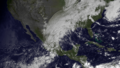
The remnants of Patricia—shortly after dissipation as a tropical cyclone—and a frontal boundary draped across the western Gulf Coast on October 24.

See also
Other record-strength tropical cyclones:
- Hurricane Linda in 1997 – Previous record intensity in eastern Pacific basin.
- Typhoon Megi in 2010 – Had similarly intense sustained winds.
- Typhoon Goni in 2020 – Strongest landfalling tropical cyclone by 1-minute sustained winds.
- Typhoon Nancy in 1961 – Tied with Patricia for highest winds, but considered less reliable.
- Typhoon Tip in 1979 – Most intense tropical cyclone recorded by pressure.
- Hurricane Wilma in 2005 – Previous record low central pressure in the Western Hemisphere.
- Hurricane Allen in 1980 – Previous record high sustained winds in the Western Hemisphere.
- Typhoon Forrest in 1983 – Record-fastest intensification of any tropical cyclone.
