Middle Village, Wisconsin facts for kids
Quick facts for kids
Middle Village, Wisconsin
Nanāweyah omenīkān
|
|
|---|---|

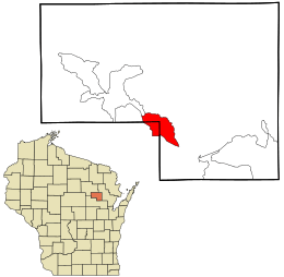
Location in Menominee County and the state of Wisconsin.
|
|
| Country | United States |
| State | Wisconsin |
| Counties | Shawano, Menominee |
| Area | |
| • Total | 6.121 sq mi (15.85 km2) |
| • Land | 6.080 sq mi (15.75 km2) |
| • Water | 0.041 sq mi (0.11 km2) |
| Elevation | 1,020 ft (311 m) |
| Population
(2020)
|
|
| • Total | 290 |
| • Density | 47.7/sq mi (18.4/km2) |
| Time zone | UTC-6 (Central (CST)) |
| • Summer (DST) | UTC-5 (CDT) |
| Area code(s) | 715 & 534 |
| FIPS code | 55-51617 |
| GNIS feature ID | 1852246 |
Middle Village (which in the Menominee language is called Menominee: Nanāweyah omenīkān) is a special type of community. It is known as a census-designated place (CDP). This means it's an area that the government counts for population, but it doesn't have its own official city or town government.
Middle Village is located in the towns of Menominee and Red Springs. It stretches across two counties: Menominee County and Shawano County in the state of Wisconsin. In 2020, about 290 people lived there.
On maps from the Wisconsin Department of Transportation (WisDOT), you might see this community called Nanaweyah Omīnīhekan. The name Nanāweyah from the Menominee language means "middle village."
Where is Middle Village Located?
Middle Village is found in the state of Wisconsin. Its exact location is at 44.933853 degrees north and 88.742805 degrees west.
The area of Middle Village covers about 6.9 square miles (or 17.9 square kilometers). All of this area is land.
Who Lives in Middle Village?
Population in 2020
According to the census taken in 2020, 290 people lived in Middle Village. This means there were about 47.7 people living in each square mile.
There were 83 homes in the area. On average, there were about 13.7 homes per square mile.
Most of the people living in Middle Village are Native American, making up 92.4% of the population. Other groups include:
- 2.4% White
- 1.4% Black or African American
- 0.3% Asian
- 0.3% Pacific Islander
About 3.1% of the people were from two or more races. Also, 3.1% of the population identified as Hispanic or Latino.
See also
 In Spanish: Middle Village (Wisconsin) para niños
 | John T. Biggers |
 | Thomas Blackshear |
 | Mark Bradford |
 | Beverly Buchanan |

