Midlothian, Oklahoma facts for kids
Quick facts for kids
Midlothian, Oklahoma
|
|
|---|---|
| Country | United States |
| State | Oklahoma |
| County | Lincoln |
| Elevation | 853 ft (260 m) |
| Time zone | UTC-6 (Central (CST)) |
| • Summer (DST) | UTC-5 (CDT) |
| GNIS feature ID | 1095372 |
Midlothian is a small, unincorporated community located in Lincoln County, Oklahoma, in the United States. An unincorporated community is a place that doesn't have its own local government, like a mayor or city council. Instead, it's usually governed by the county or state.
Midlothian started to grow when its post office opened in 1902. The town's official plan was set up in 1904. However, the post office closed in 1919. Later, in the 1940s, the local school joined with the Chandler School District.
Why the Name Midlothian?
The first people who settled in this area were pioneers. They decided to name their new home "Midlothian" after a county in Scotland. They thought the green, rolling hills of Oklahoma looked a lot like the landscapes in Midlothian, Scotland.
Where is Midlothian Located?
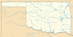
Midlothian is found in a part of Oklahoma that's southeast of a town called Warwick. It's also southwest of another town, Chandler.
This community is about five miles south of Interstate 44, which is a major highway. It sits between U.S. Route 177 to its west and State Highway 18 to its east. You can find it specifically on E 950 Road.
 | Bessie Coleman |
 | Spann Watson |
 | Jill E. Brown |
 | Sherman W. White |


