Milecastle 15 facts for kids
Quick facts for kids Milecastle 15 |
|
|---|---|
| Northumberland, England, UK | |

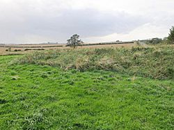
The site of Milecastle 15
|
|
|
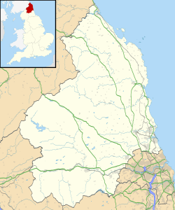
Location in Northumberland
|
|
| Coordinates | 55°00′20″N 1°51′25″W / 55.005644°N 1.856962°W |
Milecastle 15, also known as Whitchester, was a small fort built by the Romans as part of Hadrian's Wall. You can still see its remains today as a raised area with stones that were taken from its walls. It's found about 3 kilometers (2 miles) west of where the B6318 Military Road crosses the A69 road. This site has not yet been dug up by archaeologists.
Contents
Building Milecastle 15
Milecastle 15 was a special type of milecastle called a long-axis milecastle. This means it was longer than it was wide. We don't know what kind of gate it had.
Historians believe that two different Roman legions might have built these long-axis milecastles:
- The Legio VI Victrix, who were based in York.
- The Legio XX Valeria Victrix, who were based in Chester.
These legions were large groups of Roman soldiers. They were responsible for building many parts of Hadrian's Wall.
Discovering Milecastle 15
Archaeologists and investigators have looked at Milecastle 15 over the years. Here's what they found:
- 1958: The milecastle was first spotted in an aerial photo taken by the Royal Air Force (RAF).
- 1966: Experts from English Heritage checked the site. They confirmed it was a long-axis milecastle.
- 1989: Another English Heritage team visited. They noted that the raised platform of the milecastle was still about 1 meter (3 feet) high. They also saw ditches around the edges where stones had been removed.
Turrets Near Milecastle 15
Each milecastle along Hadrian's Wall had two smaller watchtowers, called turrets. These turrets were placed about one-third and two-thirds of a Roman mile to the west. Soldiers from the milecastle would have guarded these turrets. The turrets connected to Milecastle 15 are called Turret 15A and Turret 15B.
Turret 15A
Turret 15A was found in 1931 exactly where it was expected to be. Only one layer of its stone walls remained. In 1966, an English Heritage check found that the modern road now covers this turret.
- Location: 55°00′25″N 1°51′53″W / 55.007001°N 1.864727°W
Turret 15B
Turret 15B was also thought to be found in 1931. It was in the expected spot. The 1931 report said there was little more than its foundations. However, in 1966, English Heritage noted that the modern road also covers this turret. Later, in 1989, another English Heritage investigation questioned if the small amount of foundations found in 1931 was enough proof that the turret was really there.
- Location: 55°00′30″N 1°52′21″W / 55.008241°N 1.872541°W
 | William L. Dawson |
 | W. E. B. Du Bois |
 | Harry Belafonte |


