Milecastle 16 facts for kids
Quick facts for kids Milecastle 16 |
|
|---|---|
| Northumberland, England, UK | |

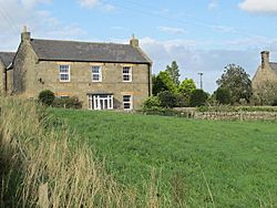
The site of Milecastle 16
|
|
|
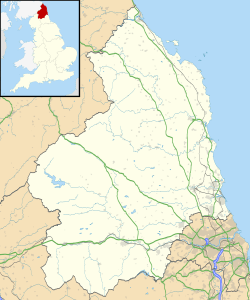
Location in Northumberland
|
|
| Coordinates | 55°00′33″N 1°52′47″W / 55.009200°N 1.879730°W |
Milecastle 16 (Harlow Hill) was a small fort built by the Romans as part of Hadrian's Wall. Hadrian's Wall was a huge stone wall that stretched across northern England. It was built to protect the Roman Empire from tribes to the north. Milecastle 16 was located near Harlow Hill in Northumberland, England. Today, you can't see any parts of this milecastle or its nearby watchtowers on the surface.
Contents
Building Milecastle 16
We don't know many details about how Milecastle 16 was built. You can still see a slight raised area in a field next to the B6318 Military Road. This raised area is about 23 meters (75 feet) long from north to south. There are no other visible parts of the milecastle.
The site is on top of Harlow Hill. This means that when it was built, the Romans had a clear view in all directions. The part of Hadrian's Wall in this area was removed when the Military Road was constructed later.
Discovering Milecastle 16
People have tried to find and study Milecastle 16 over many years:
- 1732: An archaeologist named John Horsley saw the remains of the milecastle's foundations.
- 1920s: Later digs in the 1920s did not manage to find the milecastle.
- 1930: The milecastle's likely position was figured out again.
- 1950s: The milecastle was finally excavated (dug up) by researchers named Hepple and Richmond.
Watchtowers of Milecastle 16
Every milecastle along Hadrian's Wall had two smaller watchtower structures nearby. These towers were placed about one-third and two-thirds of a Roman mile to the west of the milecastle. Soldiers from the milecastle would likely have guarded these towers. The watchtowers linked to Milecastle 16 are known as Turret 16A and Turret 16B.
Turret 16A
Turret 16A was supposedly found by Thomas Hepple in 1930. However, he didn't write about it in his notes from the fieldwork. The likely spot for this turret is now under the B6318 Military Road, which was built in the 1700s. By 1966, there were no visible remains of this turret on the surface.
Location: 55°00′33″N 1°53′15″W / 55.009118°N 1.887548°W
Turret 16B
Turret 16B was also said to have been found by Hepple in 1930. But just like Turret 16A, he didn't write down any details in his notebook if he did find it. The likely spot for this turret is also under the Military Road, close to the Great Northern Reservoir. By 1966, no parts of Turret 16B could be seen on the surface either.
Location: 55°00′32″N 1°53′43″W / 55.008855°N 1.895210°W
 | Tommie Smith |
 | Simone Manuel |
 | Shani Davis |
 | Simone Biles |
 | Alice Coachman |


