Milecastle 21 facts for kids
Quick facts for kids Milecastle 21 |
|
|---|---|
| Northumberland, England, UK | |

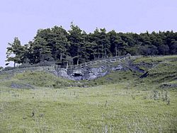
The quarry at Downhill which has obliterated any trace of the milecastle
|
|
|
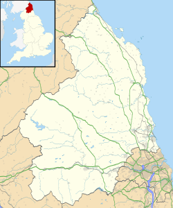
Location in Northumberland
|
|
| Coordinates | 55°00′40″N 1°59′41″W / 55.011201°N 1.994794°W |
Milecastle 21 (Down Hill) was a small fort, like a mini-castle, built by the Romans. It was part of Hadrian's Wall, a huge stone wall that stretched across northern England. The Romans built this wall to protect their land from invaders. Today, we can't see Milecastle 21 because it's completely gone.
Contents
What Was Milecastle 21?
Milecastle 21 (Down Hill) was one of many small forts along Hadrian's Wall. These milecastles were placed about one Roman mile apart. They helped the Roman soldiers guard the wall and control movement. Sadly, we don't know much about how Milecastle 21 was built. This is because no parts of it are left to study.
Why Can't We See It?
The area where Milecastle 21 once stood has changed a lot over time. There was a large quarry nearby, which is a place where stone is dug out of the ground. This quarrying activity likely destroyed all traces of the milecastle. Today, the site is mostly covered by pasture (fields for animals) and partly by a modern road called the Military Road.
Experts from English Heritage have looked for Milecastle 21. In 1966, they noted that nothing was visible. The ground was very disturbed by old quarry tracks. They checked again in 1989 and still found no visible remains. They could only guess where it might have been.
What Are Turrets?
Each milecastle on Hadrian's Wall had two smaller watchtowers called turrets. These turrets were placed about one-third and two-thirds of a Roman mile to the west of the milecastle. Soldiers from the milecastle would have guarded these turrets. The turrets connected to Milecastle 21 are known as Turret 21A and Turret 21B.
Turret 21A: Red House
Turret 21A (Red House) is thought to be about 73 meters (80 yards) east of a Roman fort called Onnum. However, some experts are not entirely sure of its exact spot. Like the milecastle, the remains of Turret 21A are now hidden under the modern road.
55°00′39″N 2°00′11″W / 55.010895°N 2.003081°W
Turret 21B: Fence Burn
Turret 21B (Fence Burn) is also believed to be partly under the Military Road. Its exact location is a bit of a guess. In 1930, people found a small mound, dark soil, and pieces of pottery here. These clues suggest that a Roman structure might have been in this spot.
54°59′37″N 1°44′12″W / 54.993672°N 1.736733°W
 | Delilah Pierce |
 | Gordon Parks |
 | Augusta Savage |
 | Charles Ethan Porter |


