
Milecastle 6 facts for kids
Quick facts for kids Milecastle 6 |
|
|---|---|
| Tyne and Wear, England, UK | |
_-_geograph.org.uk_-_3582849.jpg)
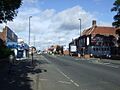
Milecastle 6 probably lies under the A186 road
|
|

Milecastle 6
Location in Tyne and Wear
|
|
| Coordinates | 54°58′29″N 1°39′11″W / 54.974663°N 1.653079°W |
A milecastle was a small fort built by the Romans along Hadrian's Wall. These forts were placed about one Roman mile apart. They helped Roman soldiers guard the wall and control who passed through. Milecastle 6, also known as Benwell Grove, was one of these important forts.
Contents
Building Milecastle 6
The exact spot where Milecastle 6 was built is not known today. We do know that Hadrian's Wall in this area runs under the modern A186 road. This part of Newcastle is now covered with roads and houses. Because of this, no parts of the milecastle can be seen above ground.
Searching for Milecastle 6
People have looked for Milecastle 6 over the years. In 1966, a historian named J Collingwood Bruce suggested where it might be. He thought the site of Milecastle 6 was probably under Benwell Grove road in Newcastle.
Turrets Near Milecastle 6
Every milecastle on Hadrian's Wall had two smaller guard towers called turrets. These turrets were placed about one-third and two-thirds of a Roman mile to the west. Soldiers from the milecastle would have guarded these turrets. The turrets connected to Milecastle 6 are known as Turret 6A and Turret 6B.
Turret 6A Location
Turret 6A has never been found by digging. Its likely position is figured out based on the average distance to Turret 6B. This places Turret 6A about 90 meters (98 yards) east of the Condercum fort. It is thought to be under the houses and roads of Westholme Gardens in Benwell.
Location: 54°58′35″N 1°39′45″W / 54.976487°N 1.662437°W
Turret 6B Discovery
Turret 6B, also called Benwell Hill, was found in 1751. Robert Shafto discovered it while building the Military Road. He said the turret was about 4 meters (4.4 yards) square. It was located about 308 meters (337 yards) west of the Condercum fort. This puts it near the modern road called Two Ball Lonnen. By 1968, all signs of this turret on the surface were gone due to new buildings.
Location: 54°58′42″N 1°40′08″W / 54.978391°N 1.668827°W
Images for kids
-
Milecastle 6 probably lies under the A186 road
See also
 In Spanish: Castillo miliar 6 para niños
