Milefortlet 21 facts for kids
Quick facts for kids Milefortlet 21 |
|
|---|---|

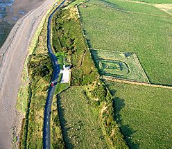
Milefortlet 21, with the post-medieval Allonby Saltpans on the seaward side
|
|
| Type | Milecastle |
| Location | |
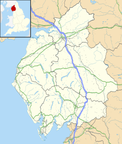
| Coordinates | 54°44′48″N 3°27′01″W / 54.746648°N 3.450398°W |
| County | Cumbria |
| Country | England |
Milefortlet 21 (Swarthy Hill) was a small fort built by the Romans along the coast of Cumbria, England. These coastal forts were built around the same time as Hadrian's Wall, which was a much larger wall across northern England.
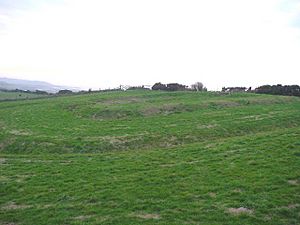
Today, you can see its reconstructed walls, made of earth and grass (called turf ramparts), which are about 1 meter (3 feet) high. There's also a ditch around it, also about 1 meter (3 feet) deep, just like it was originally. This fort is located on a low cliff near the sea, north of a village called Crosscanonby. It's special because it's the only milefortlet that has been fully dug up by archaeologists. You can even visit it!
Contents
Building a Roman Fort
Milefortlet 21 was built with its longer side facing the sea. Its walls were made of turf (layers of earth and grass) and were about 6 meters (20 feet) wide. Inside these turf walls, the fort measured about 14.5 meters (48 feet) by 18 meters (59 feet).
The main gate facing the sea was made of wood and was about 3 meters (10 feet) square. Inside the fort, there was a road. On one side of the road, there were three buildings. They were all similar in size but had different layouts. Two of these buildings shared a wall. The building closest to the sea had a fireplace, and the one in the middle had an oven or furnace. On the other side of the road, there was one large building, about 18 meters (59 feet) by 5 meters (16 feet). This building seemed to be divided into four parts, with fireplaces in the middle sections and ovens in the outer sections.
A ditch surrounded the milefortlet on all sides except the one facing the sea. There was a path or bridge (called a causeway) across the ditch at the entrance.
Digging Up the Past
Archaeologists have learned a lot about Milefortlet 21 by carefully digging it up.
Finding the Fort in 1968
In 1968, special photographs taken from an airplane showed faint outlines of the fort's ditch on the ground. This was about 70 meters (230 feet) northeast of where experts thought it would be.
What Was Found in 1990-1991
Between 1990 and 1991, a full excavation of the fort took place. The archaeologists found many interesting items, including:
- Pieces of pottery, like cooking pots.
- A part of a bead.
- A gaming board (maybe for a Roman game!).
- A knife.
- An unknown tool that might have been an adze (a tool similar to an axe).
All the pottery found was from the time of Emperor Hadrian, which means the fort was likely used for only one period during his rule.
Nearby Watchtowers
Each milefortlet had two smaller watchtowers nearby. These towers were built in a similar way to the turrets (small towers) found along Hadrian's Wall. They were usually located about one-third and two-thirds of a Roman mile away from the milefortlet. Soldiers from the milefortlet would have guarded these towers. The towers linked to Milefortlet 21 are called Tower 21A and Tower 21B.
Tower 21A (Saltpans)
Tower 21A (Saltpans) was located south of the main coastal road (the B5300) and Crosscanonby Road. Nothing of this tower remains today. However, a worker who saw it being taken apart before World War II said it looked similar to another tower, Tower 15A.
Tower 21B (Brownrigg North)
Tower 21B (Brownrigg North) was found on the side of Brown Rigg hill, facing the sea. It consists of buried remains, about two layers of stone high. You can't see anything of it above ground, but its outline shows up in aerial photographs. This tower was first spotted in an RAF aerial photo in 1946. An archaeologist named R.L. Bellhouse investigated it in 1962 and later dug it up in 1966, confirming its size and shape.
Visiting Milefortlet 21
The path to Milefortlet 21 used to start from a small car park, but that entrance closed around 2009 or 2010. Now, you can reach the site by following a clear but unmarked path. This path begins at a field gate just northeast of where the B5300 road meets Crosscanonby Lane. You can park your car a few meters along Crosscanonby Lane.
 | Georgia Louise Harris Brown |
 | Julian Abele |
 | Norma Merrick Sklarek |
 | William Sidney Pittman |


