Millerton, Kansas facts for kids
Quick facts for kids
Millerton, Kansas
|
|
|---|---|

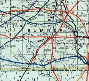
1915 Railroad Map of Sumner County
|
|

|
|
| Country | United States |
| State | Kansas |
| County | Sumner |
| Elevation | 1,345 ft (410 m) |
| Time zone | UTC-6 (CST) |
| • Summer (DST) | UTC-5 (CDT) |
| Area code | 620 |
| FIPS code | 20-46800 |
| GNIS ID | 484509 |
Millerton is a small, quiet place in Sumner County, Kansas, in the United States. It's known as an unincorporated community. This means it doesn't have its own city government or mayor.
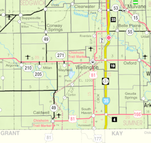
You can find Millerton about 5 miles northeast of Conway Springs. It is located where N Maple Road and W 123rd Avenue N meet, right next to the railroad tracks.
Contents
A Look at Millerton's Past
Millerton has a short but interesting history. For many years, it had its own post office. A post office is where people send and receive mail.
When the Post Office Was Open
The post office in Millerton first opened in 1875. It helped people living in the area send letters and packages. This was very important before emails and text messages existed!
A Different Name for the Post Office
Interestingly, when the post office first started, it wasn't called Millerton. Until 1884, it was known as the "Rolling Green" post office. It changed its name to Millerton later on. The post office eventually closed in 1912.
Learning in Millerton
Even though Millerton is a small community, it is part of a larger school system.
Local School District
Students living in Millerton attend public schools run by the Clearwater USD 264 school district. This district provides education for many communities in the area.
 | Janet Taylor Pickett |
 | Synthia Saint James |
 | Howardena Pindell |
 | Faith Ringgold |


