Mina, South Dakota facts for kids
Quick facts for kids
Mina
|
|
|---|---|
| Country | United States |
| State | South Dakota |
| County | Edmunds |
| Established | 1909 |
| Named for | Mina Erling |
| Area | |
| • Total | 4.71 sq mi (12.21 km2) |
| • Land | 3.78 sq mi (9.80 km2) |
| • Water | 0.93 sq mi (2.41 km2) |
| Elevation | 1,431 ft (436 m) |
| Population
(2020)
|
|
| • Total | 554 |
| • Density | 146.48/sq mi (56.55/km2) |
| Time zone | UTC-6 (Central (CST)) |
| • Summer (DST) | UTC-5 (CDT) |
| FIPS code | 46-42700 |
| GNIS feature ID | 2813018 |
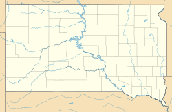
Mina is a small place in Edmunds County, South Dakota, in the United States. It is known as an unincorporated community and a census-designated place (CDP). This means it's a group of homes and businesses that isn't officially a town or city, but the government counts its population. In 2020, about 554 people lived in Mina.
Mina's History
Mina got its start a long time ago. A post office opened there in 1909. It helped people send and receive mail for many years, until 1983. The community was probably named after a girl named Mina Erling. She was the daughter of an important person who worked for the railroad.
The 1999 Plane Accident
In 1999, a sad event happened near Mina. A small plane, called a Learjet, crashed in a field about a mile south of the community. On board were six people, including a famous golf player named Payne Stewart. Everyone on the plane died in the accident. Investigators believe they had already lost oxygen before the plane crashed.
Who Lives in Mina?
The number of people living in Mina is counted every ten years. This count is called the United States Census.
| Historical population | |||
|---|---|---|---|
| Census | Pop. | %± | |
| 2020 | 554 | — | |
| U.S. Decennial Census | |||
 | Stephanie Wilson |
 | Charles Bolden |
 | Ronald McNair |
 | Frederick D. Gregory |


