Mitchell's Fold facts for kids

Mitchell's Fold stone circle
|
|
| Location | Stapeley Hill |
|---|---|
| Coordinates | 52°34′43″N 3°01′34″W / 52.5787°N 3.0261°W |
| Type | Stone circle |
| History | |
| Periods | Bronze Age |
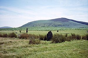
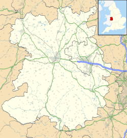
Mitchell's Fold (also known as Medgel's Fold or Madges Pinfold) is an ancient stone circle from the Bronze Age. It is found in southwest Shropshire, England. The circle is located near the small village of White Grit. It sits on dry land at the end of Stapeley Hill, about 330 meters (1,083 feet) above sea level.
This stone circle, along with a standing stone and a cairn (a pile of stones), is a protected Scheduled monument. English Heritage helps look after the circle.
Contents
What is Mitchell's Fold?

We don't know the full history of Mitchell's Fold. The name might come from an old English word, "micel" or "mycel," meaning "big." This would refer to the large size of the stone circle.
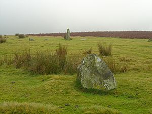
The stones are made of a rock called dolerite. They came from nearby Stapeley Hill. Over time, some stones have gone missing, and others have fallen over. It's important to treat ancient sites with respect. People should avoid damaging them or leaving litter.
How Big is the Stone Circle?
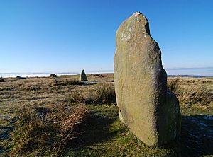
It is believed that there were once about 30 stone pillars. The stones that are still standing today range in height. Some are as short as 25 centimeters (10 inches). The tallest stone is about 1.9 meters (6 feet 3 inches) high.
The stones form an oval shape. It measures about 27 meters (89 feet) from northwest to southeast. It is about 25 meters (82 feet) wide. The tallest stone is at the southeast end. It stands near where the moon rises in the south. This tall stone and another one might have formed an entrance about 1.8 meters (6 feet) wide.
Are There Other Stones?
Some people have suggested there was a stone in the middle of the circle. An old report from the 1700s even claimed there was a stone across two entrance pillars, like at Stonehenge. It also mentioned a stone 80 yards away that was thought to be an altar.
However, experts like Aubrey Burl say that a structure like a trilithon (two upright stones with a third stone across the top) is very rare. It is mostly found only at Stonehenge. So, these claims about Mitchell's Fold are likely just rumors, not facts.
Folklore and Legends

Since we don't know the true history of the site, people have created many stories about it. One popular folk story tells of a giant who had a magical cow. This cow gave endless amounts of milk.
A mean witch, however, tried to milk the cow using a sieve. This drained the cow dry, and it ran away to another part of England. As a punishment, the witch was turned into stone. Other stones were placed around her to stop her from escaping. No one knows what happened to the giant.
King Arthur's Connection
Another local legend connects Mitchell's Fold to the famous King Arthur. Some stories say that this is the very place where King Arthur pulled the magical sword Excalibur from one of the stones in the circle. After doing so, he became the king of Britain.
Ancient Farming Clues
Interestingly, pictures taken from the air show old farming marks. These marks, called ridge-and-furrow ploughmarks, run right through the stone circle. This might make it seem like the circle was built after the Middle Ages. But this is not true. It just means that in the Middle Ages, the whole area was used for farming. The stone circle is much, much older than that.
Other Ancient Sites Nearby
Mitchell's Fold is in an area with many other ancient sites. The only other known stone circle in Shropshire is called the Hoarstones. It is only about 2.4 kilometers (1.5 miles) northeast of Mitchell's Fold.
Just outside Shropshire, less than a kilometer (half a mile) to the east, are the Whetstones. Most of these stones were destroyed in the 1860s. Now, only a pile of broken stones remains. When the last stone was removed in 1870, people found charcoal and bones in its hole.
More Prehistoric Discoveries
The stone circle is about 9.7 kilometers (6 miles) north of Bishop's Castle. It is also about 1.6 kilometers (1 mile) north of Corndon Hill, which is across the Welsh border.
Within a few miles, you can find an ancient factory from the Late Neolithic and Early Bronze Age. This factory, called Cwm-Mawr, made stone axes from a rock called picrite.
To the southeast of Mitchell's Fold, there is a weathered stone block on a small cairn. A path from the Fold crosses Stapeley Common. Along this path, you can find the Cow Stone, which is a single standing stone or Menhir. There is also the Stapeley Hill Ring Cairn.
See also
 In Spanish: Mitchell's Fold para niños
 | Aaron Henry |
 | T. R. M. Howard |
 | Jesse Jackson |


