Mitre Peninsula facts for kids
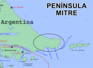
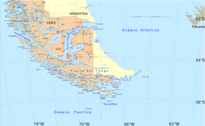
The Mitre Peninsula is a special place at the very southeastern tip of Isla Grande de Tierra del Fuego. It's like the "end of the world" for Argentina! This peninsula is separated from Isla de los Estados by a narrow stretch of water called the Le Maire Strait. To its south, you'll find the Beagle Channel, and to its north, the Argentine Sea. It covers an area of almost 4,000 square kilometers.
Contents
What is the Mitre Peninsula?
The Mitre Peninsula is a unique landform. It is the easternmost part of the main island of Tierra del Fuego. Its easternmost point is Cabo San Diego. This cape is about 29 kilometers northwest of Isla de los Estados. The peninsula is a wild and beautiful area.
How did the Mitre Peninsula get its name?
The peninsula was named by an explorer called Julio Popper. He chose the name to honor Bartolomé Mitre. Bartolomé Mitre was a very important person in Argentina's history. He was a president, a general, and a writer.
Where is the Mitre Peninsula located?
The Mitre Peninsula is part of the Ushuaia municipality. It belongs to the Tierra del Fuego Province (Argentina). This province is in the southern part of Argentina. The area is mostly wild, with very few people living there.
Settlements and Lighthouses
Even though it's a wild place, there are a few small settlements. These are mostly large farms called estancias.
What are the main settlements?
The only settlements on the peninsula are estancias. They include:
- Estancia Policarpo, on the north coast.
- Estancia Bahía Aguirre, on the southwest coast.
- Estancia Bahía Sloggett, a bit further west.
- Estancia Puerto Rancho, near the southernmost point of the island.
Are there any old settlements or lighthouses?
Yes, there was once a settlement called Bahía Thetis. It was located on a bay of the same name. This bay is about five kilometers west of Cabo San Diego.
There are also two important lighthouses:
- The Cabo San Diego Light was built in 1934.
- The Cabo San Pio Light was built in 1919.
Both of these lighthouses are still working today. They help guide ships safely.
Natural Features and History
The Mitre Peninsula has some interesting natural features. It also has a rich history.
What are the highest points?
The highest peak on the peninsula is Cerro Campana. It is part of the Montes Negros mountain range. Cerro Campana stands at 1,026 meters tall. Nearby, to the southwest, is Monte Atocha.
Are there any caves?
In the southern part of the peninsula, you can find some very special caves. These are the southernmost caves in the entire world!
Who lived there before?
Long ago, the area was home to indigenous people. The Haush and Selknam tribes lived on the peninsula. They were the first inhabitants of this land.
Getting to the Peninsula
Reaching the Mitre Peninsula can be an adventure. There are two main roads that approach it.
How do you get to the Mitre Peninsula?
Two roads lead towards the peninsula from the west. However, only one actually enters it:
- Road 24CA comes from the northwest. It runs along the north coast. It goes as far as Estancia Maria Luisa. After that, it becomes a trail that continues to Estancia Policarpo.
- Road 24CJ runs along the south coast. It goes as far as Estancia Harberton.
Both of these roads branch off from National Route 3. This main route runs north-south to the west of the peninsula. Road 24CJ heads towards Ushuaia. Road 24CA goes towards Río Grande.
See also
 In Spanish: Península Mitre para niños


