Isla de los Estados facts for kids

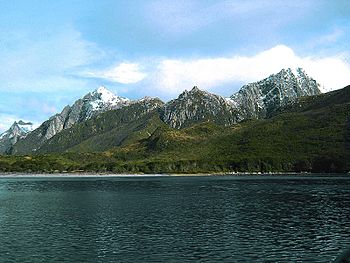
Puerto Cook, north coast
|
|
|
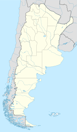
Location in Argentina
|
|
| Geography | |
|---|---|
| Location | Atlantic Ocean |
| Coordinates | 54°47′S 64°15′W / 54.783°S 64.250°W |
| Area | 534 km2 (206 sq mi) |
| Length | 65 km (40.4 mi) |
| Width | 15 km (9.3 mi) |
| Highest elevation | 823 m (2,700 ft) |
| Administration | |
|
Argentina
|
|
| Province | Tierra del Fuego |
Isla de los Estados is an Argentine island. Its name means Staten Island in English, coming from the Dutch Stateneiland. This island is about 29 kilometers (18 miles) off the eastern tip of Tierra del Fuego. The Le Maire Strait separates it from Tierra del Fuego. The island was named after the Netherlands States-General, which was the Dutch parliament.
Isla de los Estados is part of the Tierra del Fuego province in Argentina. It is also part of the department and city of Ushuaia. The island is a special place, declared an "Ecological, Historic, and Tourist Provincial Reserve." This means that only special tours from Ushuaia can visit it.
The only place where people live on the island is the Puerto Parry Naval Station. This station is in a deep, narrow fjord on the northern coast. Since 1978, a small team of four marines has lived there. They work in 45-day shifts. Their job is to watch over the environment, track ships, and help in emergencies.
| Top - 0-9 A B C D E F G H I J K L M N O P Q R S T U V W X Y Z |
Exploring the Island's Past: A History of Isla de los Estados
Before Europeans arrived, the Yamana people visited Isla de los Estados. They were native people who lived on the islands south of Isla Grande de Tierra del Fuego.
First European Discoveries
The first European to see the island was Spanish naval captain Francisco de Hoces. This happened in 1526. His ship, the San Lesmes, got separated in a storm during the Loaísa expedition. The storm pushed the ship south, making him the first European to discover this large island east of Tierra del Fuego. It was later named Isla de los Estados.
Almost 100 years later, Dutch explorers Jacob le Maire and Willem Schouten sailed past the island. This was on December 25, 1615. They named it Staten Landt. Le Maire and Schouten sailed their ship, Eendracht, through a new route south of the Straits of Magellan. This route is now called the Le Maire Strait. Le Maire thought the land mass he saw might be part of a huge 'Southern Continent.'
In 1643, a Dutch expedition led by Hendrik Brouwer sailed south of the island. This proved that Isla de los Estados was not connected to a large southern continent.
Early Settlements and Visitors
For over 200 years, no Europeans settled on the island. In 1862, an Argentine pilot named Luis Piedrabuena set up a shelter. He also built a small place to get oil from seals near Port Cook.
On New Year's Day in 1775, Captain James Cook named a port "Puerto Año Nuevo" (New Years Port). Later, seal hunters tried to set up a factory there. But they left after their ship, the Duke of York, crashed in 1787 while bringing supplies.
The island is also mentioned in Richard Henry Dana Jr.'s book Two Years Before the Mast. He described the island as "bare, broken, and girt with rocks and ice." He also noted "a little stunted vegetation of shrubs" between the rocks.
The Famous Lighthouse
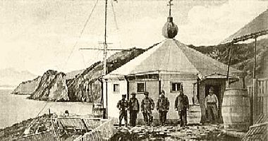
On May 25, 1884, the San Juan del Salvamento Lighthouse opened. Comodoro Augusto Lasserre was in charge of this. The lighthouse worked until September 1900. It is famously known as Faro del fin del mundo (the "Lighthouse at the end of the world"). Many believe it inspired Jules Verne's book The Lighthouse at the End of the World (1905).
A military prison was also on the island from 1896 to 1902. However, strong winds made it unsafe, so it had to be moved to Tierra del Fuego.
Understanding the Island's Geography
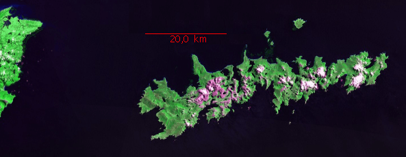
Isla de los Estados is about 65 kilometers (40 miles) long from east to west. It is about 15 kilometers (9 miles) wide. The total area of the island is 534 square kilometers (206 square miles). Many bays cut deep into the island's coast. The highest point on the island is 823 meters (2,700 feet) high. This point is considered the last part of the Andes mountain range. The island gets about 2,000 millimeters (79 inches) of rain each year.
The island is surrounded by smaller islands and rocks. The largest of these is Observatorio island, which is about 6.5 kilometers (4 miles) north. It has an area of 4 square kilometers (1.5 square miles). At the eastern end of Isla de los Estados is Cape St John. This cape is an important landmark for ships. Ships sail around it to avoid the strong currents and tides of the Le Maire Strait to the west.
Climate: Weather on Isla de los Estados
Isla de los Estados has a cold and wet climate. The weather can change very quickly and unexpectedly from day to day. Even with its plants, it's classified as a mild tundra climate. This means it's cold, with the warmest month averaging below 10°C (50°F), and it rains a lot all year.
The island's climate is greatly affected by a low-pressure system near the Antarctic Circle. Strong westerly winds blow across the island all year. This is because it's located between a high-pressure area and this low-pressure system.
Temperatures are low throughout the year, but they don't get extremely cold. In summer, the average temperature is 8.3°C (46.9°F). In winter, the average is 3.3°C (37.9°F). Coastal areas usually stay above 0°C (32°F) in the coldest month.
The island gets a lot of rain, estimated at about 2,000 millimeters (79 inches) per year. Rain falls very often, about 252 days a year. June is the wettest month, and October is the driest. Thunderstorms are very rare. Snow often falls in winter, about 33 days a year. The island is usually very cloudy, with 74% of days being cloudy. Fog is not common, only about 16 days a year. Strong westerly winds are common, bringing frequent storms.
Flora and Fauna: Plants and Animals
Isla de los Estados is covered with thick, low forests. These forests are made up of Nothofagus southern beech trees.
The island's animal life includes many penguins, orcas (killer whales), seals, seagulls, and cormorants. There are also deer and goats, which were brought to the island by humans. Isla de los Estados is home to one of the most southern Atlantic breeding places for the Magellanic penguin. People used the island for harvesting seals as early as the late 1700s.
See also
 In Spanish: Isla de los Estados para niños
- Lists of islands
Books
 | Misty Copeland |
 | Raven Wilkinson |
 | Debra Austin |
 | Aesha Ash |


