Terra Australis facts for kids
Quick facts for kids Terra Australis |
|
|---|---|
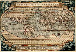
A 1570 map by Abraham Ortelius showing "Terra Australis Nondum Cognita" as a huge continent at the bottom.
|
|
| Type | Hypothetical continent |
| Notable locations | Patalis |
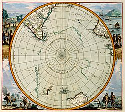
Terra Australis was a huge, imaginary continent that appeared on maps between the 15th and 18th centuries. People believed it existed in the southern part of the world, even though no one had ever explored it.
Since ancient times, people thought there might be a large, unknown land in the south. They called this mysterious continent "Terra Australis," which means "Southern Land" in Latin. Many believed it had to exist to balance out all the land in the northern half of the world.
In the early 1800s, a British explorer named Matthew Flinders went on a big journey. He later wrote a book about his travels called "A Voyage to Terra Australis." Flinders realized that the land he had explored, which we now call Australia, was likely the same place people had been calling Terra Australis for centuries. He thought it was unlikely there was another huge landmass even further south.
It took many more years for people to finally discover the real southern land, which we now know as Antarctica. By that time, the name "Australia" had become popular, and the mysterious Terra Australis was mostly forgotten.
Contents
The Idea of a Southern Land
Aristotle, a famous ancient Greek thinker, wondered if there was a land in the southern part of the world, just like the land near the North Pole. This idea was later picked up by Ptolemy, another famous scholar from the 2nd century AD. He thought the Indian Ocean was surrounded by land to the south. He also believed there should be land in the Southern Hemisphere to balance out the Northern Hemisphere.
The idea of a southern land, often called "Terra Australis," was mentioned on many medieval maps. This happened even though no one had ever seen it. Ptolemy’s maps didn’t actually show this continent, but they suggested that Africa might stretch all the way to the South Pole. They also hinted that the Indian Ocean could be completely surrounded by land.
Many Christian scholars also thought there might be land beyond the southern seas. However, they debated whether anyone could actually live there.
Early Maps and Explorers
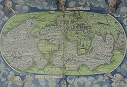
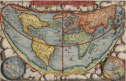
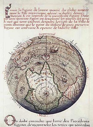
The first globe to show Terra Australis was made by Johannes Schöner in 1523. He described it as a newly discovered place that wasn’t fully explored yet. He wrote that this land was home to friendly people who lived simple lives and respected their elders.
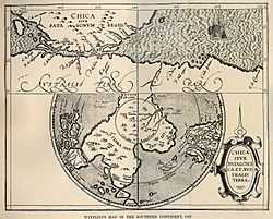
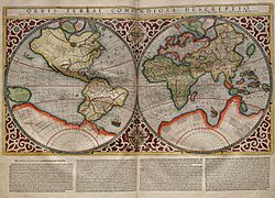
In 1533, Schöner called this continent "Brasiliae Australis" in his writings. He imagined it as a huge, ring-shaped region far to the south. His ideas influenced many other mapmakers. These included Oronce Fine and Gerardus Mercator, who continued to draw maps showing this mysterious southern continent.
Over time, brave explorers like Ferdinand Magellan and Captain James Cook set out to find this mysterious land. They didn’t find Terra Australis exactly as it was imagined. However, their journeys led to the discovery of places like Tierra del Fuego, New Zealand, and Australia.
Over the centuries, the idea of Terra Australis slowly faded away. In 1814, Matthew Flinders published his book A Voyage to Terra Australis. Flinders had decided that the Terra Australis, as imagined by Aristotle and Ptolemy, did not exist. So, he wanted the name to be used for what he saw as the next best thing: "Australia".
He wrote that it was unlikely any other large land would be found further south. He felt the name Terra Australis described the importance of this country and its location. He also noted that it was an old name and didn't favor any specific nation. He thought "Australia" sounded better and was similar to the names of other big parts of the Earth.
His conclusion about there being no other large landmass further south would later be proven wrong. But by that time, the name "Australia" had already become widely used.
Antarctica: The Real Southern Continent
Antarctica was finally sighted in the area where Terra Australis was thought to be in 1820. This discovery helped people understand the true size of the southern land. It also showed that the Southern Hemisphere has much less land than the Northern Hemisphere.
It turned out that Terra Australis actually consisted of two main landmasses: Antarctica and Australia.
See also
 In Spanish: Terra Australis para niños
 | James Van Der Zee |
 | Alma Thomas |
 | Ellis Wilson |
 | Margaret Taylor-Burroughs |


