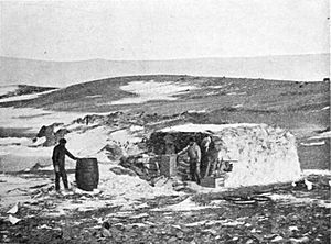
History of Antarctica facts for kids
The history of Antarctica tells the story of how people discovered and explored this amazing continent at the bottom of the world. For a long time, people only imagined a huge southern land called Terra Australis. The word Antarctic means "opposite of the Arctic Circle" and was first used by a geographer named Marinus of Tyre way back in the 2nd century AD.
Sailors in the 1400s and 1500s, like those who sailed around the Cape of Good Hope and Cape Horn, proved that if a southern land existed, it was its own continent. In 1773, James Cook and his crew were the first to cross the Antarctic Circle. Even though he found new islands, he didn't actually see the continent itself. He is believed to have gotten as close as 240 kilometers (150 miles) from the mainland.
On January 27, 1820, a Russian team led by Fabian Gottlieb von Bellingshausen and Mikhail Lazarev discovered an ice shelf that later became known as the Fimbul Ice Shelf. They were the first explorers to officially see and discover the land of Antarctica. Just three days later, on January 30, 1820, a British team led by Edward Bransfield saw Trinity Peninsula. Ten months after that, an American sealer named Nathaniel Palmer also sighted Antarctica on November 17, 1820. The first time someone actually landed on the ice was probably just over a year later, when American Captain John Davis, a sealer, stepped onto the land.
Many expeditions tried to reach the South Pole in the early 1900s, during a time called the "Heroic Age of Antarctic Exploration". It was a very dangerous period, and many people were injured or died. Finally, Norwegian explorer Roald Amundsen reached the Pole on December 14, 1911, winning a dramatic race against the Briton Robert Falcon Scott.
Contents
Early Journeys
Searching for a Southern Land
Ancient thinkers like Aristotle wondered if there was a land at the South Pole, just like there was land at the North Pole.
Some stories from the Māori of New Zealand suggest that a chief named Hui Te Rangiora and his crew might have explored Antarctic waters in the early 600s. Their accounts describe a "frozen ocean." However, some historians believe these stories might have been changed later with information from European explorers.
European exploration of the southern parts of the world really began in 1418, when Prince Henry the Navigator encouraged sailors to explore south of the equator to find a sea route to India. By 1473, sailors knew the equator could be crossed. This made cartographers (mapmakers) believe there must be another continent in the south.
When Bartolomeu Dias sailed around the Cape of Good Hope in 1487, explorers first felt the Antarctic cold. This proved that a large ocean separated Africa from any southern land.
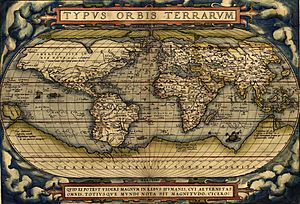
Ferdinand Magellan, who sailed through the Straits of Magellan in 1520, thought the islands of Tierra del Fuego were part of this unknown southern land. Maps like the one by Ortelius showed it as Terra Australis recenter inventa sed nondum plene cognita ("Southern land recently discovered but not yet fully known").
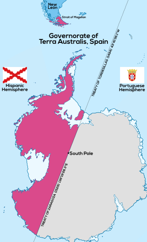
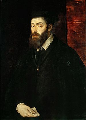
In 1539, the King of Spain, Charles V, created the Governorate of Terra Australis. This land was given to Pedro Sancho de la Hoz, who then transferred it to Pedro de Valdivia in 1540. Later, it became part of Chile.
European mapmakers often drew the coast of Tierra del Fuego connected to New Guinea. They used their imaginations to fill in the huge unknown areas of the southern oceans, sketching a massive continent called Terra Australis Incognita ("Unknown Southern Land"). This search for the great southern land was a main goal for explorers in the 1500s and early 1600s.
In 1599, a Dutch sailor named Dirck Gerritsz Pomp might have seen mountains at 64° South. If true, these would have been the South Shetland Islands, possibly the first European sighting of land near Antarctica. However, other accounts don't mention this, so it's not certain. Some also say the Spaniard Gabriel de Castilla saw "snow-covered mountains" beyond 64° S in 1603, but this is also debated.
In 1615, Schouten and Le Maire discovered Cape Horn, the southern tip of Tierra del Fuego. This proved that Tierra del Fuego was a group of islands and not connected to a larger southern continent.
Finally, in 1642, Tasman showed that even New Holland (Australia) was separated by sea from any continuous southern continent. Sailors often met strong winds and ice when sailing around Cape Horn, but it seems none reached the Antarctic Circle before 1770.
South of the Antarctic Convergence
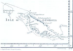
The first discovery of land south of the Antarctic Convergence (where cold Antarctic waters meet warmer northern waters) was made by the English merchant Anthony de la Roché in 1675. He visited South Georgia. Maps soon showed 'Roché Island' in his honor.
James Cook knew about la Roché's discovery when he mapped the island in 1775.
Edmond Halley (famous for Halley's Comet) sailed for magnetic studies in 1700. He met pack ice at 52° S, but this was his farthest south. In 1739, French officer Jean-Baptiste Charles Bouvet de Lozier discovered Bouvet Island at 54°10′ S.
In 1771, Yves Joseph Kerguelen sailed from France looking for a large continent. He found land at 50° S, which he called South France, believing it was the main part of the southern continent. He was sent back to explore more and found it was just a harsh island. It was later named the Kerguelen Islands after him.
The Antarctic Circle
The idea of an undiscovered continent became a big goal for explorers. The Royal Society wanted Alexander Dalrymple to lead an expedition to Tahiti in 1769, but the British Navy gave command to Captain James Cook.
In 1772, Cook sailed with his ships Resolution and Adventure. He searched for Bouvet Island, then sailed far south. On January 17, 1773, his ships crossed the Antarctic Circle for the first time in history! They reached 67° 15' S, where ice stopped them.
Cook then sailed north, but returned south again. He was stopped by ice at 61° 52′ S. He continued eastward, mostly south of 60° S. On March 16, the coming winter forced him north to New Zealand.
In November 1773, Cook left New Zealand and crossed the Antarctic Circle again on December 20. He stayed south of it for three days, reaching 67° 31′ S before turning north.
After a long trip, Cook crossed the Antarctic Circle for a third time on January 30, 1774. He reached 71° 10′ S, the farthest south any explorer had gone in the 1700s. He then sailed east, almost to South America, before returning to Tahiti.
In November 1774, Cook sailed from New Zealand across the South Pacific. He rediscovered Roché Island, renaming it Isle of Georgia, and discovered the South Sandwich Islands. These were the only ice-covered lands he saw.
Cook's voyages proved that there was no large, habitable southern continent. He believed that if land existed farther south, it would be too hard to reach and not useful for trade.
First Sightings and Landings
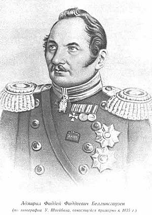
The first land seen south of 60° South latitude was Livingston Island, discovered by the Englishman William Smith on February 19, 1819. He found signs of a Spanish ship, the San Telmo, that had wrecked there. A few months later, Smith returned to explore the other islands of the South Shetland Islands and claimed them for Britain.
The first confirmed sighting of the Antarctic mainland happened on January 27, 1820. This is credited to the Russian expedition led by Fabian Gottlieb von Bellingshausen and Mikhail Lazarev. They discovered an ice shelf at Princess Martha Coast, which became known as the Fimbul Ice Shelf. Bellingshausen and Lazarev were the first explorers to officially discover the land of Antarctica.
Their ships, Vostok and Mirny, got within 32 kilometers (20 miles) of Princess Martha Coast. On January 30, 1820, Irishman Edward Bransfield sighted Trinity Peninsula, the northernmost point of the Antarctic mainland. Bellingshausen's expedition also discovered Peter I Island and Alexander I Island, the first islands found south of the Antarctic Circle.
The first landing on the Antarctic mainland is believed to have been made by the American Captain John Davis, a sealer, on February 7, 1821. However, not all historians agree on this.
In November 1820, Nathaniel Palmer, an American sealer, saw what is now called the Antarctic Peninsula. In 1823, James Weddell, a British sealer, sailed into what is now known as the Weddell Sea. For many years, most expeditions were for commercial reasons, like hunting seals and whales.
Charles Wilkes, leading a United States Navy expedition in 1840, discovered Wilkes Land, a part of the continent around 120 degrees East.
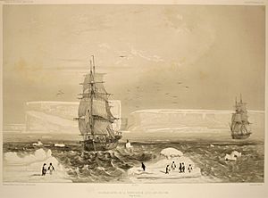
After the North Magnetic Pole was found in 1831, explorers looked for the South Magnetic Pole. James Clark Ross, a British naval officer, found its approximate location but couldn't reach it during his four-year expedition from 1839 to 1843. He commanded the British ships Erebus and Terror. He sailed through thick ice and approached the Ross Ice Shelf, a huge floating ice shelf over 30 meters (100 feet) high. His expedition sailed east along the Antarctic coast, discovering mountains named after his ships: Mount Erebus, an active volcano, and Mount Terror.
The first recorded landing on the mainland of East Antarctica was at Victoria Land by the American sealer Mercator Cooper on January 26, 1853.
These early explorers made amazing contributions but couldn't explore the inside of the continent. After Ross's expedition, there was a quiet period in Antarctic exploration for about 20 years.
The Heroic Age of Antarctic Exploration
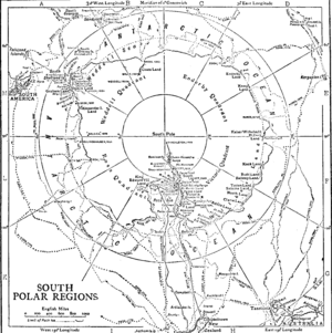
The Heroic Age of Antarctic Exploration began in the late 1800s and ended around 1917. During this time, Antarctica became a major focus for international scientific and geographical exploration. Seventeen big expeditions were launched from ten different countries.
How it Started
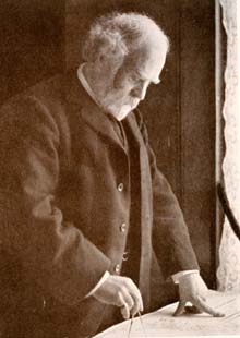
A key event before the Heroic Age was the Dundee Whaling Expedition of 1892-93. Four whaling ships from Dundee, Scotland, sailed south to Antarctica looking for whales. Scientists and an artist joined them. Their reports and exhibitions helped spark public interest in Antarctica again. This expedition also showed the need for a strong research ship, leading to the building of the RRS Discovery.
The main push for the Heroic Age came from a lecture by Dr John Murray in 1893. He urged people to explore Antarctica to answer important geographical questions.
On January 24, 1895, the Norwegian ship Antarctic landed at Cape Adare.
In August 1895, a big meeting in London called for scientific groups worldwide to support Antarctic exploration. They said it would help "almost every branch of science." A Norwegian explorer named Carsten Borchgrevink, who had just returned from Antarctica, spoke at this meeting. He shared plans for a full expedition based at Cape Adare.
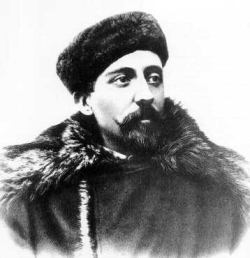
The Heroic Age officially began with an expedition from the Belgian Geographical Society in 1897. Borchgrevink followed a year later with a British expedition. (Some historians consider the Discovery expedition in 1901 as the first true Heroic Age expedition).
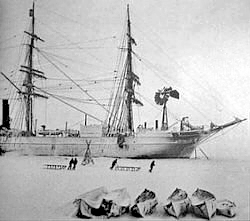
The Belgian Antarctic Expedition was led by Belgian Adrian de Gerlache. In 1898, they became the first people to spend winter in Antarctica when their ship Belgica got stuck in the ice. They were trapped from February 1898 until March 1899.
During this unplanned stay, some men struggled with their mental health due to the dark Antarctic winter and the difficulties. This was the first expedition to spend a winter inside the Antarctic Circle.
Early British Expeditions
The Southern Cross Expedition (1898-1900) was the first to spend winter on the Antarctic mainland at Cape Adare. It was also the first to use dogs and sledges. The team made the first climb onto the Ross Ice Shelf (then called The Great Ice Barrier) and set a new record for the farthest south at 78°30'S. They also figured out the location of the South Magnetic Pole.
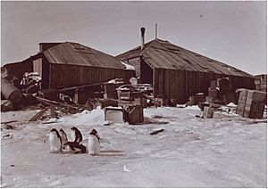
The Discovery'' Expedition (1901-1904) was led by Robert Falcon Scott. This team made the first climb of the Western Mountains in Victoria Land and discovered the polar plateau. Their journey south set a new farthest south record at 82°17'S. Many other places were discovered and mapped. This was the first of several expeditions based in McMurdo Sound.
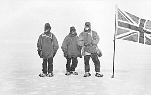
A year later, the Scottish National Antarctic Expedition was led by William Speirs Bruce. They set up 'Ormond House' on Laurie Island in the South Orkney Islands. This became the first permanent base in Antarctica. They explored the Weddell Sea and discovered the coastline of Coats Land.
Ernest Shackleton, who had been on Scott's expedition, led the Nimrod Expedition (1907-1909). Their main goal was to reach the South Pole. Based in McMurdo Sound, they found the Beardmore Glacier route to the Pole and used some motorized transport. Their southern journey reached 88°23'S, a new farthest south record, just 180 kilometers (97 nautical miles) from the Pole, before they had to turn back. Shackleton was the first to reach the polar plateau. Other teams from this expedition were the first to climb Mount Erebus and reach the South Magnetic Pole.
Expeditions from Other Countries
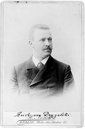
The First German Antarctic Expedition (1901) explored eastern Antarctica. They discovered the coast of Kaiser Wilhelm II Land and Mount Gauss. However, their ship got stuck in ice, stopping further exploration.
The Swedish Antarctic Expedition, working at the same time, explored the east coast of Graham Land. Their ship sank, and they were stranded on Snow Hill Island and Paulet Island in the Weddell Sea. They were rescued by an Argentinian ship.
The French organized their first expedition in 1903, led by Jean-Baptiste Charcot. This expedition mainly mapped islands and the western coasts of Graham Land on the Antarctic peninsula. They explored a section of the coast and named it Loubet Land.
A second French trip (1908-1910) continued this work, exploring the Bellingshausen Sea and discovering islands like Charcot Island.
Race to the South Pole
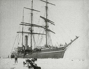
The biggest prize of the Heroic Age was reaching the South Pole. Two expeditions set out in 1910 to achieve this: a team led by Norwegian explorer Roald Amundsen on the ship Fram, and Robert Falcon Scott's British group on the Terra Nova.
Amundsen successfully reached the Pole on December 14, 1911. He used a route from the Bay of Whales to the polar plateau via the Axel Heiberg Glacier.
Scott and his four companions reached the South Pole via the Beardmore route on January 17, 1912, 33 days after Amundsen. Sadly, all five died on their return journey from the Pole, due to starvation and extreme cold. The Amundsen–Scott South Pole Station was later named after these two brave men.
More Expeditions
The Australasian Antarctic Expedition (1911–1914) was led by Sir Douglas Mawson. It focused on the Antarctic coastline between Cape Adare and Mount Gauss, mapping and surveying coastal and inland areas. They discovered Commonwealth Bay, Ninnis Glacier, and Queen Mary Land. They also made important discoveries in geology and biology.
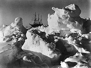
The Imperial Trans-Antarctic Expedition (1914–1917) was led by Ernest Shackleton. He planned to cross the entire continent via the South Pole. However, his ship, the Endurance, got trapped and crushed by pack ice in the Weddell Sea before they could even land. The expedition members survived after a long journey on sledges over the ice, a drift on an ice-floe, and a dangerous voyage in three small boats to Elephant Island. Then, Shackleton and five others crossed the Southern Ocean in a small boat called James Caird and made the first crossing of South Georgia to get help.
Shackleton's last expedition, the Shackleton–Rowett Expedition (1921-1922) on the ship Quest, marked the end of the 'Heroic Age'. After Shackleton's death on January 5, 1922, the Quest finished a shorter program before returning home.
Later Exploration
By Air
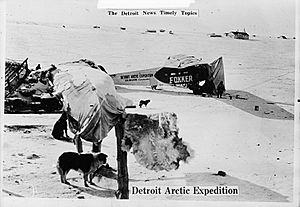
After Shackleton's last trip, there was a break in Antarctic exploration for about seven years. From 1929, airplanes and motorized vehicles were used more and more. This period is sometimes called the 'Mechanical Age'. Hubert Wilkins first visited Antarctica in 1921-1922. From 1927, Wilkins and pilot Carl Ben Eielson began exploring the Arctic by plane.
On April 15, 1928, Wilkins and Eielson made a flight across the Arctic. For this achievement, Wilkins was knighted.
With money from William Randolph Hearst, Wilkins returned to the South Pole and flew over Antarctica in his plane, the San Francisco. He named Hearst Land after his sponsor.
US Navy Rear Admiral Richard Evelyn Byrd led five expeditions to Antarctica in the 1930s, 1940s, and 1950s. He flew over the South Pole with pilot Bernt Balchen on November 28 and 29, 1929. Byrd's explorations focused on science and used aircraft a lot to explore the continent.
Captain Finn Ronne, Byrd's executive officer, returned to Antarctica with his own expedition in 1947–1948. Ronne proved that East and West Antarctica were one single continent, not two separate ones. He explored and mapped large parts of Palmer Land and the Weddell Sea coastline. The Ronne Ice Shelf was named after his wife, Edith Ronne. Ronne traveled 5,800 kilometers (3,600 miles) by ski and dog sled, more than any other explorer.
Overland Crossing
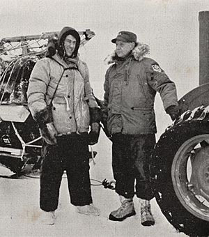
The Commonwealth Trans-Antarctic Expedition (1955–1958) successfully completed the first overland crossing of Antarctica, going right over the South Pole. It was led by British explorer Dr Vivian Fuchs, with New Zealander Sir Edmund Hillary leading the New Zealand support team.
After spending the winter of 1957 at Shackleton Base, Fuchs began his journey in November 1957 with a twelve-man team in six vehicles. They also did scientific research along the way.
Meanwhile, Hillary's team set up Scott Base on the opposite side of the continent. Hillary and his three men used tractors to find a route and set up supply depots (storage points) for Fuchs's team.
Hillary's party reached the South Pole on January 3, 1958. They were only the third team to reach the Pole overland (after Amundsen in 1911 and Scott in 1912). Fuchs's team reached the Pole from the other direction on January 19, 1958, where they met Hillary. Fuchs then continued along Hillary's route and reached Scott Base on March 2, completing the first overland crossing of the continent via the South Pole.
Political History
Claims on Antarctica
Some countries believe the Spanish Empire had early claims on Antarctica. In 1539, the King of Spain, Charles V, gave a governorship to Pedro Sánchez de la Hoz. This included all lands south of the Strait of Magellan, which could mean Antarctica. This claim was later transferred to Pedro de Valdivia in 1540 and then became part of Chile in 1555.
Argentina and Chile say that Spain's claim was recognized by treaties like the Inter caetera bull of 1493 and the Treaty of Tordesillas of 1494. Today, Argentina and Chile each claim a part of Antarctica that is directly south of their own countries.
Modern Spain does not claim any Antarctic territory. They have two summer research stations in the South Shetland Islands.
British Claims
The United Kingdom took control of the Falkland Islands again in 1833. In 1908, the British government claimed more land, including South Georgia, the South Orkneys, the South Shetlands, the South Sandwich Islands, and Graham Land. These areas were managed as part of the Falkland Islands Dependencies. The main reason for this was to control and tax the whaling industry more effectively.
In 1917, the claim was updated to clearly include all territory in the sector stretching to the South Pole, which is now the British Antarctic Territory.
Britain wanted to include the entire continent in the Empire. On July 30, 1923, the British government created the Ross Dependency, which included islands and territories between 160° East and 150° West longitude, south of 60° South latitude. The Governor-General of New Zealand was appointed as the Governor of this territory.
In 1930, the United Kingdom claimed Enderby Land. In 1933, Britain transferred territory south of 60° S and between 160° E and 45° E to Australia, creating the Australian Antarctic Territory.
Other European Claims
Seeing these claims, the French government claimed a strip of the continent in 1924. Their claim to Adélie Land was based on its discovery in 1840 by French explorer Jules Dumont d'Urville, who named it after his wife. Britain eventually recognized this claim, and the border between Adélie Land and Australian Antarctic Territory was set in 1938.
Norwegian whaling companies were also worried about British taxes and wanted their own territory. Lars Christensen, a whale-ship owner, funded expeditions to claim land for Norway. In 1929, an expedition landed on Peter I Island and claimed it for Norway. In 1931, Norway officially declared the island under its sovereignty.
The 1929 expedition also named the continental land mass near the island Queen Maud Land, after the Norwegian queen Maud of Wales. In 1938, Norway and Britain agreed on the western border of Queen Maud Land at 20°W.
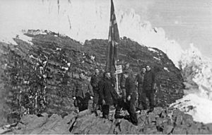
Norway's claim was challenged by Nazi Germany. In 1938, Germany sent the German Antarctic Expedition, led by Alfred Ritscher, to fly over the area. They photographed a large area and dropped darts with swastikas. Germany tried to claim this land as New Swabia, but lost any claim after its defeat in World War II.
On January 14, 1939, Norway officially annexed Queen Maud Land. This was mainly to protect Norway's whaling industry. In 1948, Norway and the United Kingdom agreed on the borders for Queen Maud Land, from 20°W to 45°E.
South American Involvement
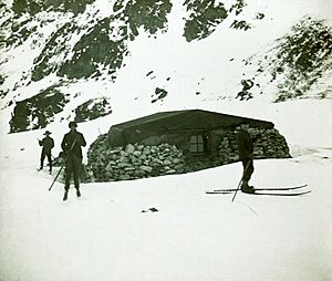
The claims by European powers worried nearby South American countries, Argentina and Chile. During Second World War, Chile's president, Pedro Aguirre Cerda, declared the creation of a Chilean Antarctic Territory in areas already claimed by Britain.
Argentina had been involved in Antarctica even earlier. In 1904, Argentina bought a weather station on Laurie Island that had been set up by the Scottish National Antarctic Expedition. Argentina wanted to continue the scientific work there.
In 1906, Argentina told other countries about its permanent base on South Orkney Islands. However, Britain reminded Argentina that the South Orkneys were British. Argentina tried to claim sovereignty by putting up markers and flags.
Finally, in 1943, Argentina declared the establishment of Argentine Antarctica. This claimed territory overlapped with both British and Chilean claims.
In response, Britain launched Operation Tabarin in 1943 to reassert its claims and set up a permanent British presence in Antarctica. This was also to prevent the area from being used by enemy forces during the war.
In 1943, British personnel removed Argentine flags from Deception Island. British bases were set up at Deception Island and Port Lockroy. Another base was founded at Hope Bay in 1945. Britain also put up signs and issued postage stamps to show its sovereignty.
Operation Tabarin led Chile to organize its First Chilean Antarctic Expedition in 1947–48. The Chilean president Gabriel González Videla personally opened one of its bases.
After the war, the British bases were given to civilian scientists of the British Antarctic Survey.
After the War
Tensions between Britain and the South American countries continued after the war. In 1952, an Argentine group at Hope Bay fired a machine gun over the heads of a British team unloading supplies. Argentina later apologized, saying it was a misunderstanding.
The United States also became interested in Antarctica. The United States Antarctic Service Expedition (1939-1941) set up two bases. After the war, American interest grew with Operation Highjump (1946-1947). This large expedition aimed to set up a research base, train personnel, and gather scientific information.
Towards an International Treaty
To solve the disputes, Britain asked the International Court of Justice in 1955 to decide on the territorial claims. But Argentina and Chile refused.
Talks began in 1948 to create an international agreement for Antarctica, involving the seven countries with claims (Britain, Australia, New Zealand, France, Norway, Chile, and Argentina) and the US. This effort failed when the Soviet Union showed interest and refused to recognize any claims.
A major step towards the Antarctic Treaty System in 1959 was the International Geophysical Year (1957–1958). This was a period of intense international scientific cooperation in Antarctica. Many countries set up research stations. The British established Halley Research Station in 1956. Sir Vivian Fuchs completed the first overland crossing of Antarctica in 1958. Japan built Showa Station.
France contributed with Dumont d'Urville Station. The US built the Amundsen–Scott South Pole Station as the first permanent structure directly over the South Pole in January 1957.
Finally, to prevent military conflict, the United States, United Kingdom, the Soviet Union, and nine other countries signed the Antarctic Treaty in 1959. The treaty started in 1961. It sets aside Antarctica as a place for science and peace. It allows freedom of scientific research and bans military activity on the continent. This treaty was the first arms control agreement during the Cold War.
Recent History
On January 7, 1978, a baby named Emilio Marcos de Palma was born near Hope Bay. He was the first baby born on the continent and the farthest south anyone had ever been born.
On November 28, 1979, an Air New Zealand plane on a sightseeing trip crashed into Mount Erebus, killing all 257 people on board.
In 1991, a new agreement was made among the Antarctic Treaty nations. This led to the Protocol on Environmental Protection to the Antarctic Treaty, also known as the Madrid Protocol. It banned all mineral mining and drilling for 50 years. Antarctica was declared a "natural reserve, devoted to peace and science."
Børge Ousland, a Norwegian explorer, completed the first solo crossing of Antarctica without help on January 18, 1997.
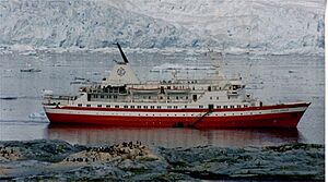
On November 23, 2007, the ship MV Explorer hit an iceberg and sank. All people on board were rescued by nearby ships.
In 2010, the IceCube Neutrino Observatory was finished. In 2013, it detected 28 neutrinos that came from outside our Solar System.
Women in Antarctica
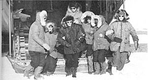
For a long time, women were not allowed to explore Antarctica, even into the 1950s. Some brave women visited the waters before then, but many who wanted to join expeditions were turned away. Early pioneers like Louise Séguin and Ingrid Christensen were among the first women to see Antarctic waters. Christensen was the first woman to step onto the mainland of Antarctica.
The first women to get a lot of attention for their Antarctic journeys were Caroline Mikkelsen, who stepped on an island in 1935, and Jackie Ronne and Jennie Darlington, who were the first women to spend a winter in Antarctica in 1947. The first woman scientist to work in Antarctica was Maria Klenova in 1956. Silvia Morella de Palma was the first woman to give birth in Antarctica, delivering Emilio Palma at the Argentine Esperanza base on January 7, 1978.
Women faced rules and old-fashioned ideas that stopped most of them from visiting Antarctica and doing research until the late 1960s. The United States Congress banned American women from traveling to Antarctica until 1969. People often thought women couldn't handle the extreme cold or difficult situations. The first woman from the British Antarctic Survey to go to Antarctica was Janet Thomson in 1983. She described the ban on women as "rather improper segregation."
However, things changed in the mid-1990s. It became normal for women to be part of Antarctic life. More and more women began working and researching in Antarctica.
See also
 In Spanish: Historia de la Antártida para niños
- Colonization of Antarctica
- Heroic Age of Antarctic Exploration
- History of Livingston Island
- History of South Georgia and the South Sandwich Islands
- List of Antarctic expeditions
- List of Russian explorers
- Research stations in Antarctica
- Timeline of women in Antarctica
- Ui-te-Rangiora, a Polynesian navigator who may have reached or sighted Antarctica
- Women in Antarctica
 | James B. Knighten |
 | Azellia White |
 | Willa Brown |


