Queen Maud Land facts for kids
Quick facts for kids
Queen Maud Land
Dronning Maud Land (Norwegian)
|
|
|---|---|
|
Dependent territory of Norway
|
|
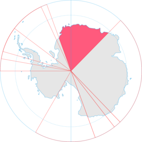
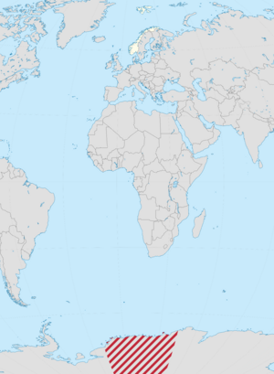
Location of Queen Maud Land (red, in Antarctica)
|
|
| Sovereign state | |
| Annexed by Norway | 14 January 1939 |
| Dependency status | 21 June 1957 |
| Antarctic Treaty | 23 June 1961 |
| Expanded | 12 June 2015 |
| Sector claim | 20°W – 45°E |
| Named for | Maud of Wales |
| Government | Dependency under a constitutional monarchy |
|
• Monarch
|
Harald V |
|
• Administered by
|
Ministry of Justice and Public Security |
| Area | |
|
• Total
|
2,700,000 km2 (1,000,000 sq mi) |
| Elevation | 2,000 m (7,000 ft) |
| Highest elevation | 3,148 m (10,328 ft) |
| ISO 3166 code | AQ |
| Internet TLD | |
Queen Maud Land (Norwegian: Dronning Maud Land) is a huge area in Antarctica. It is claimed by Norway as a dependent territory, which means it's a special area managed by Norway. This land is about 2.7 million square kilometers, which is roughly the size of countries like India or Argentina!
Queen Maud Land is located in East Antarctica. It makes up about one-fifth of the entire continent. The area is named after the Norwegian Queen Maud (1869–1938).
In 1930, a Norwegian explorer named Hjalmar Riiser-Larsen was the first person known to step onto this land. Norway officially claimed the territory on January 14, 1939. Later, on June 23, 1961, Queen Maud Land became part of the Antarctic Treaty System. This treaty makes Antarctica a demilitarised zone, meaning it's used only for peaceful purposes like science.
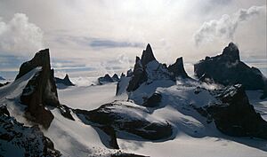
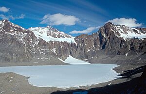
Most of Queen Maud Land is covered by a thick ice sheet. Along the coast, there's a tall wall of ice. Further inland, some mountain ranges poke through the ice. These rocky areas are important for birds to breed. A few small plants also grow there.
The region is divided into five main coastal areas, from west to east:
| No. | Coast | Western border | Eastern border | Width in degrees |
|---|---|---|---|---|
| 1 | Princess Martha Coast | 20° 00′ W | 05° 00′ E | 25° 00′ |
| 2 | Princess Astrid Coast | 05° 00′ E | 20° 00′ E | 15° 00′ |
| 3 | Princess Ragnhild Coast | 20° 00′ E | 34° 00′ E | 14° 00′ |
| 4 | Prince Harald Coast | 34° 00′ E | 40° 00′ E | 06° 00′ |
| 5 | Prince Olav Coast | 40° 00′ E | 44° 38′ E | 04° 38′ |
| Queen Maud Land | 20° 00′ W | 44° 38′ E | 64° 38′ |
The sea next to Queen Maud Land is called the King Haakon VII Sea.
No one lives permanently in Queen Maud Land. However, there are 12 active research stations where scientists work. About 40 scientists live there, but the number changes depending on the season. Some stations are open all year, while others are only for the summer.
Contents
Exploring Queen Maud Land
Queen Maud Land stretches from Coats Land in the west to Enderby Land in the east. It includes the Princess Martha, Princess Astrid, Princess Ragnhild, Prince Harald, and Prince Olav Coasts. The exact northern and southern borders were not clearly set when Norway first claimed the land in 1939. However, in 2015, Norway officially claimed the area between Queen Maud Land and the South Pole.
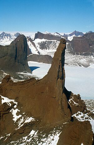
There's very little land without ice along the coast. Most of the coast is a 20 to 30 meter high wall of ice. This makes it hard to land a ship. About 150 to 200 kilometers from the coast, rocky peaks stick out of the ice cap. The ice cap itself is about 2,000 meters high. The highest point is Jøkulkyrkja, which is 3,148 meters tall. Other big mountain ranges include the Heimefront Range and Sør Rondane Mountains.
The rocks in Queen Maud Land are very old. Many are gneiss, formed over a billion years ago. The mountains are mostly made of granite. Scientists believe that if there were no ice, the coast would look like Norway, with deep fjords and islands.
History of Discovery
Early Explorations
Queen Maud Land was first seen on January 27, 1820, by Fabian Gottlieb von Bellingshausen. But it was one of the last parts of Antarctica to be fully explored. This was because explorers needed airplanes and ships to map it properly.
Early Norwegian research in Antarctica was often linked to whaling and sealing trips. Ship owners like Lars Christensen funded these trips. The first Norwegian expeditions happened in the 1890s. They looked for whaling spots but also did scientific research.
Roald Amundsen claimed the Antarctic Plateau for Norway in 1911. He named it the King Haakon VII Plateau after reaching the South Pole. However, the Norwegian government never officially claimed this area.
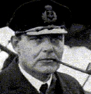
The name Queen Maud Land was first used in January 1930. This was after Hjalmar Riiser-Larsen and Finn Lützow-Holm explored the area during a Norvegia expedition. They named it after the Norwegian Queen Maud. More explorations happened in 1930–31. During this time, many whaling ships, mostly Norwegian, worked off the coast. Riiser-Larsen also discovered several coastal areas from the air, like the Prince Olav Coast.
In 1938, Norway and the United Kingdom agreed on the western border of Queen Maud Land, setting it at 20°W.
Germany also sent an expedition in 1938, led by Alfred Ritscher. They flew over a large part of the area, dropping darts with swastikas. Germany tried to claim this land as New Swabia. But after losing World War II, Germany lost any claim to the land.
On January 14, 1939, Norway officially annexed Queen Maud Land. This means they formally took control of it. The main reasons were Norway's explorations and to protect its whaling industry. Norway also wanted to contribute to polar science.
In 1948, Norway and the United Kingdom agreed to set the borders of Queen Maud Land from 20°W to 45°E.
Recent Developments
|
Maudheim
|
|
|---|---|
|
Antarctic research station
|
|
| Established | 20 February 1950 |
| Closed | 15 January 1952 |
| Government | |
| • Body | NBSAE |
| Active times | All year-round |
|
Norway Station
|
|
|---|---|
|
Antarctic research station
|
|
| Established | 20 January 1957 |
| Closed | 1960 |
| Government | |
| • Body | Sixth Norwegian Antarctic Expedition |
| Active times | All year-round |
|
King Baudouin Station
Base antarctique Roi Baudouin
|
|
|---|---|
|
Antarctic research station
|
|
| Established | February 1958 |
| Closed | 1967 |
| Named for | Baudouin of Belgium |
| Government | |
| • Body | Belgian Antarctic Program |
| Active times | All year-round |
|
Lazarev
Лазарев
|
|
|---|---|
|
Antarctic research station
|
|
| Established | 10 March 1959 |
| Closed | 26 February 1961 |
| Government | |
| • Body | Soviet Antarctic Expedition |
| Active times | All year-round |
The Norwegian–British–Swedish Antarctic Expedition (1949–52) was the first international science trip to Antarctica. They set up a base called Maudheim and mapped much of western Queen Maud Land.
During the International Geophysical Year (1957–1958), several countries built year-round research stations in Queen Maud Land. These included Norway, the Soviet Union, Belgium, and Japan. Norway's Norway Station was later given to South Africa. Russia still operates in the area, moving from Lazarev Station to Novolazarevskaya Station. Japan has been at its Showa Station since 1957.
In 1992, an expedition led by Ivar Tollefsen climbed several mountains, including the tallest, Jøkulkyrkja. Norway built a summer station called Troll in 1989–90. In 2005, Troll was upgraded to a year-round station. This was part of Norway's 100th independence anniversary. Queen Sonja of Norway visited Troll, becoming the first queen to visit Antarctica.
In 2008, Prime Minister Jens Stoltenberg visited Queen Maud Land. He was the first Norwegian prime minister to do so. He named three mountains around the Troll station. He said the visit was to show Norway's claim in Antarctica and to learn about climate research.
In 2015, King Harald V became the first king to visit Antarctica. He also went to Queen Maud Land.
Legal Status
Like all other territorial claims in Antarctica, Norway's claim to Queen Maud Land is part of the Antarctic Treaty System. This treaty says that Antarctica can only be used for peaceful activities. It also ensures that scientists can do their research freely. The treaty bans any nuclear activities.
The treaty does not cancel out territorial claims, but it puts them on hold. This means countries agree not to argue about claims while the treaty is in force. Norway, Australia, France, New Zealand, and the United Kingdom all recognize each other's claims in Antarctica.
Norway's Ministry of Justice and the Police manages Queen Maud Land. Norwegian laws apply to the territory. All land there belongs to the state. It is also forbidden to have nuclear explosions or store nuclear waste.
Since 1995, all Norwegian activities in Antarctica must follow international environmental laws. Norwegians planning activities in Queen Maud Land must report to the Norwegian Polar Institute. The institute can stop any activity that doesn't follow the rules. Visitors must follow laws about protecting nature, managing waste, and preventing pollution.
Animals and Plants
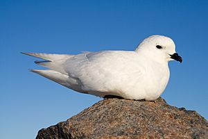
There are three main types of birds around the Troll station: the Antarctic petrel, the snow petrel, and the south polar skua. Antarctic petrels live on sea ice most of the year. During their breeding season (November to February), they move to the mountains.
The Svarthamaren Mountain in Princess Astrid Coast has Antarctica's largest known inland colony of seabirds. Almost a million Antarctic petrels breed there! Many snow petrels and south polar skuas also breed in this area. South polar skuas eat the eggs, young, and adult birds of the petrel species during breeding season.
The emperor penguin also has some breeding spots in Queen Maud Land. All four types of true Antarctic seals live in the King Haakon VII Sea. These are the Weddell seal, leopard seal, crabeater seal, and Ross seal. The Ross seal is found in large numbers in this sea.
Plants are rare in the rocky areas. Only lichen, bryophyte (like mosses), and algae grow there. There are no flowering plants. The Norwegian Polar Institute says that all known plants and animals in Queen Maud Land have healthy populations.
Research Stations
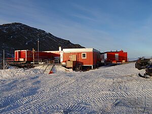
Queen Maud Land has at least 13 research stations. Six of these are open all year. Norway, Germany, and Japan each have one year-round and one seasonal station. These include Norway's Troll and Tor; Germany's Neumayer Station III and Kohnen; and Japan's Showa and Dome Fuji. India, Russia, and South Africa each have one permanent station: Maitri, Novolazarevskaya, and SANAE IV.
Other stations are seasonal, meaning they are only open in summer. These include the Belgian Princess Elisabeth Antarctica base, the Finnish Aboa, the Pakistani Jinnah, and the Swedish Wasa. In summer, about 494 people live at these stations. Far fewer stay during winter.
These stations are connected by the Dronning Maud Land Air Network Project (DROMLAN). This project helps 11 countries share transportation in East Antarctica. Large planes fly between Cape Town, South Africa, and either the Troll Airfield (at Troll station) or the runway at Novolazarevskaya Station. From these main airfields, smaller planes fly to other Antarctic stations.
Norway's Troll station is a major hub for DROMLAN. Scientists at Troll study air and atmosphere, greenhouse gases, bird colonies, and climate. The other Norwegian station, Tor, was built to study birds at the Svarthamaren Mountain breeding colony.
Russia's Novolazarevskaya Station does many types of research. This includes checking the environment, mapping, studying the Earth's magnetic field, and looking at glaciers and earthquakes.
South Africa's SANAE IV station was finished in 1997. Scientists there study biology, geology, and the atmosphere. It has a small hospital and a hangar for two helicopters.
The Swedish Wasa station and the Finnish Aboa station work together as the Nordenskiöld Base. They share research and logistics. They study mapping, glaciers, human biology, and geology.
Germany's Neumayer Station III was built in 2009. It replaced two older stations that got buried by snow. It studies geophysics, weather, and earthquakes. It also measures air chemistry and ozone. Germany's other station, Kohnen, was opened for a big ice-drilling project.
The Maitri station is India's main base. It focuses on geology and studying the supercontinent Gondwana. This was a huge landmass that included India and Antarctica long ago.
The Showa Station is Japan's main research station. It does a wide range of research, including physics, weather, earthquakes, and biology. Japan's other station, Dome Fuji Station, is for a major ice-coring project. It mainly studies climate change.
Belgium's Princess Elisabeth Antarctica base was built to show how to create a zero emission station. An international team of scientists studies climate, glaciers, and tiny living things (microbiology) there.
See also
 In Spanish: Tierra de la Reina Maud para niños
- Queen Maud Mountains
- New Swabia
 | Janet Taylor Pickett |
 | Synthia Saint James |
 | Howardena Pindell |
 | Faith Ringgold |


