
South Shetland Islands facts for kids

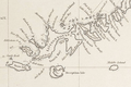
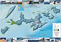
Map of the South Shetland Islands
|
|

Location of the South Shetlands
|
|
| Geography | |
|---|---|
| Location | Antarctica
  |
| Coordinates | 62°0′S 58°0′W / 62.000°S 58.000°W |
| Area | 3,687 km2 (1,424 sq mi) |
| Highest elevation | 2,105 m (6,906 ft) |
| Highest point | Mount Foster |
| Administration | |
| Administered under the Antarctic Treaty System | |
| Demographics | |
| Population | around 500 |
| Ethnic groups | Chileans, others |
The South Shetland Islands are a group of islands in Antarctica. They cover a total area of about 3,687 square kilometers. These islands are located about 120 kilometers north of the Antarctic Peninsula. They are also between 430 and 900 kilometers southwest of the South Orkney Islands.
Under the Antarctic Treaty System of 1959, no country officially owns these islands. They are open for any country that signed the treaty to use for peaceful, non-military activities.
The United Kingdom has claimed the islands since 1908. They are part of the British Antarctic Territory since 1962. However, Chile also claims them since 1940. Argentina has claimed them since 1943.
Many countries have built research stations on the islands. Most of these stations are on King George Island. This is because the Chilean base, Eduardo Frei, has an airfield there. There are currently sixteen research stations across the islands. Chile has the most stations.
Contents
Discovering the South Shetland Islands

The islands were first officially discovered by a British sailor named William Smith in 1819. Some people think that Dutch or Spanish sailors might have seen the islands earlier. There are also ideas that seal hunters from North or South America visited them. However, there is not enough proof for these older claims. Smith's discovery, though, was well recorded. It also had a big impact on history and geography.
Some scientists from Chile once thought that Native Americans had visited the islands. This was because they found stone tools in Admiralty Bay and Discovery Bay. But later, it was found that these tools had been placed there. In 1818, a man named Juan Pedro de Aguirre got permission to set up a sealing base. This base was to be on "uninhabited islands near the South Pole."
Captain William Smith was sailing his ship, the Williams, to Chile in 1819. He went off his usual path south of Cape Horn. On February 19, he saw Williams Point. This is the northeast tip of Livingston Island. This made Livingston Island the first land ever found south of 60° latitude. Smith went back to the South Shetlands. He landed on King George Island on October 16, 1819. He then claimed the islands for Britain.
Around the same time, a Spanish Navy ship called the San Telmo sank in September 1819. It was trying to sail through the Drake Passage. Parts of the ship were found months later by sealers on the north coast of Livingston Island. The crew of the San Telmo is thought to be the first humans to land in Antarctica.
From December 1819 to January 1820, Lieutenant Edward Bransfield explored and mapped the islands. He was on the Williams ship, which the Royal Navy had rented.
The discovery of the islands brought many British and American seal hunters. The first sealing ship there was the Espirito Santo. Its British crew landed on Rugged Island on Christmas Day in 1819. They claimed the islands for King George III. The American ship Hersilia followed. It was the first US sealing ship in the South Shetlands.
The first time people spent a winter in Antarctica was on the South Shetlands. At the end of the 1820–21 summer, eleven British men from the ship Lord Melville got stuck on King George Island. They survived the winter and were rescued the next season.
In January 1821, the Russian Antarctic expedition arrived. It was led by Fabian von Bellingshausen and Mikhail Lazarev. They explored the islands and gave them names. They landed on both King George Island and Elephant Island. Bellingshausen met Nathaniel Palmer, an American ship captain. Palmer told him that many American and British sealing ships were in the area.
The islands were briefly called "New South Britain." But soon, they were named the South Shetland Islands. This name refers to the Shetland Islands in northern Scotland. Both island groups are about the same distance from the equator. However, the South Shetlands are much colder.
People hunted seals and whales on the islands in the 1800s and early 1900s. The sealing period lasted from 1820 to 1908. During this time, 197 ships visited the islands. Twelve of these ships were wrecked. You can still find old iron pots and hut ruins from this time.
From 1908, the islands were managed as part of the Falkland Islands Dependency. But people only started living there all year round in 1944. That is when a scientific research station was built. Today, the islands are a popular place for tourists to visit in the southern summer.
Island Geography

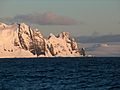
The South Shetland Islands are located at 62°0′S 58°0′W. They are about 940 kilometers south of the Falkland Islands. They are also between 93 kilometers (Deception Island) and 269 kilometers (Clarence Island) northwest of the nearest part of the Antarctic continent, Graham Land.
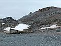
The South Shetlands have 11 main islands and several smaller ones. Their total land area is 3,687 square kilometers. About 80 to 90 percent of the land is always covered in ice. The highest point on the islands is Mount Irving. It is on Clarence Island and is 2,300 meters above sea level.
The South Shetland Islands stretch about 450 kilometers. They go from Smith Island and Low Island in the west to Elephant Island and Clarence Island in the east.
Island Volcanoes
There are several volcanoes on the islands that have been active recently. These volcanoes are linked to the movement of Earth's plates in the Bransfield Rift. Some of the known volcanoes include Sail Rock, Deception Island, and Penguin Island. Most of the rocks and ash from these volcanoes are a type called basalt.
Island Climate
The islands are as far from the equator as the Faroe Islands in the North Atlantic. But because they are so close to Antarctica, their climate is much colder. The sea around the islands is covered by ice from early April to early December. The average temperature each month is below 0°C for eight months of the year.
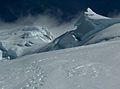
The islands have seen their glaciers shrink in recent years. Even so, more than 80% of the islands are still covered in snow and ice during the summer.
The weather is often cloudy and wet all year. Very strong winds blow from the west in every season. Some of the sunniest weather happens when very cold air comes from the south in late winter and spring. Average summer temperatures are only about 1.5°C. In winter, they are about -5°C. The ocean helps keep summer temperatures low. It also stops winter temperatures from getting as cold as they do further inland to the south.
Flora and Fauna
%E2%80%93Southern_elephant_seal_(Mirounga_leonina)_01.jpg)
Even with the tough conditions, the islands have plants and animals. They are part of the Scotia Sea Islands tundra ecoregion. This area also includes South Georgia and the South Sandwich Islands, the South Orkney Islands, and Bouvet Island. All these islands are in the cold waters south of the Antarctic Convergence. These areas have tundra plants like mosses, lichens, and algae. Many seabirds, penguins, and seals find food in the waters around them.
Main Islands


Here are the main islands and some smaller ones in the South Shetlands, listed from north to south:
- Cornwallis Island (small)
- Elephant Island
- Clarence Island
- Rowett Island (small)
- Gibbs Island (small)
- Eadie Island (small)
- King George Island (the largest island)
- Bridgeman Island (small)
- Penguin Island (small)
- Nelson Island
- Robert Island
- The Watchkeeper (small)
- Table Island (small)
- Aitcho Islands (small)
- Greenwich Island
- Half Moon Island (small)
- Desolation Island (small)
- Livingston Island (second largest)
- Rugged Island (small)
- Snow Island
- Smith Island
- Deception Island
- Low Island
- Seal Islands (small)
Some of these islands also have older Russian names, but these are not used officially anymore.
Research Stations


Many countries have research stations on the islands. Scientists live and work here to study the Antarctic environment. Some stations are open all year, while others are only open in the summer.
 Argentina – Cámara (since 1953, Summer only)
- Argentina – Carlini (since 1953, Year-round)
- Argentina – Base Decepción (since 1948, Summer only)
 Bulgaria – St. Kliment Ohridski (since 1988, Summer only)
 Brazil – Comandante Ferraz Antarctic Station (since 1984, Year-round)
 Chile – Presidente Eduardo Frei Base (since 1969, Year-round)
- Chile – Profesor Julio Escudero Base (since 1994, Year-round)
- Chile – Captain Arturo Prat Base (since 1947, Year-round)
- Chile – Dr. Guillermo Mann Base (since 1991, Summer only)
 China – Chang Cheng / Great Wall (since 1985, Year-round)
 Ecuador – Pedro Vicente Maldonado Base (since 1990, Summer only)
 Spain – Juan Carlos I Antarctic Base (since 1988, Summer only)
- Spain – Gabriel de Castilla Base (since 1989, Summer only)
 South Korea – King Sejong Station (since 1988, Year-round)
 Peru – Machu Picchu Research Station (since 1989, Summer only)
 Poland – Henryk Arctowski Polish Antarctic Station (since 1977, Year-round)
 Russia – Bellingshausen Station (since 1968, Year-round)
 United States – Shirreff Base (since 1996, Summer only)
 Uruguay – Artigas Base (since 1984, Year-round)
Images for kids
-
Fragment of George Powell's 1822 chart of the South Shetland Islands
-
Norwegian whaling boat, Half Moon Island
-
Ongal Peak, Tangra Mountains
-
Renier Point
-
Topographic map of Livingston, Greenwich, Robert, Snow and Smith Islands


See also
 In Spanish: Islas Shetland del Sur para niños
