
Rugged Island (South Shetland Islands) facts for kids

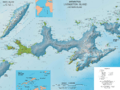
Location of Rugged Island in the South Shetland Islands
|
|
| Geography | |
|---|---|
| Location | Antarctica |
| Coordinates | 62°38′S 61°15′W / 62.633°S 61.250°W |
| Archipelago | South Shetland Islands |
| Area | 10.4 km2 (4.0 sq mi) |
| Length | 3 mi (5 km) |
| Width | 1 mi (2 km) |
| Administration | |
| Administered under the Antarctic Treaty System | |
| Demographics | |
| Population | uninhabited |


Rugged Island is a cool island located near Antarctica. It's also known as Isla Rugosa in Spanish. Sometimes, people used to call it Lloyds Island or Ragged Island.
This island is about 3 miles (5 kilometers) long and 1 mile (1.6 kilometers) wide. It sits to the west of Livingston Island in the South Shetland Islands. Rugged Island covers an area of about 10.4 square kilometers (4 square miles).
The highest point on the island is called San Stefano Peak. It rises 256 meters (840 feet) above the sea. Rugged Island is found at coordinates 62°38′ South and 61°15′ West. Both American and British sealers knew about Rugged Island as early as 1820. Its name has been used around the world for over 100 years.
Contents
Exploring Rugged Island's Past
Rugged Island has an interesting history, especially for those who hunted seals long ago.
First Visitors to the Island
The first recorded visit to Rugged Island happened in 1819. A ship called Espirito Santo arrived. This ship was hired by English merchants from Buenos Aires. Captain Joseph Herring was in charge of the ship.
Christmas Day Landing in 1819
The Espirito Santo reached a bay on the north coast. Today, this bay is known as Hersilia Cove. On Christmas Day in 1819, the English crew landed there. They claimed the islands for King George III.
American Sealers Arrive
On January 23, 1820, another ship joined the Espirito Santo. It was an American ship called the Hersilia. Captain James Sheffield commanded this ship. His first mate was Elof Benson, and the second mate was Nathaniel Palmer. The Hersilia was the first American sealing ship to visit the South Shetland Islands. Captain Herring later wrote about these events. His story was published in the Imperial Magazine in London in July 1820.
Images for kids
-
Topographic map of Livingston Island and Smith Island
See also
 In Spanish: Isla Rugosa para niños
