Momostenango facts for kids
Quick facts for kids
Momostenango
|
|
|---|---|
|
Municipality
|
|

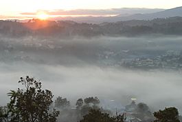
The city in the fog
|
|
| Country | |
| Department | |
| Area | |
| • Total | 330.7 km2 (127.7 sq mi) |
| Population
(June 30, 2022)
|
|
| • Total | 142,191 |
| • Density | 430.0/km2 (1,114/sq mi) |
| Time zone | UTC−06:00 |
| Postal code |
08005
|
| Area code | 0805 |
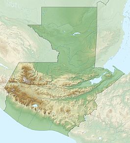
Momostenango is a special municipality located in the Totonicapán department of Guatemala. It's found in the western highlands of Guatemala, a beautiful area known for its mountains.
Contents
Who Lives in Momostenango?
Most people in Momostenango are from the Maya Kʼicheʼ group, an indigenous community. About 70% of the people live in the countryside. Many of them are small farmers. They grow crops like maize (corn), beans, and wheat to feed their families.
The municipality includes the main town of Momostenango, along with 14 villages and 169 smaller communities. These smaller places are called caseríos or parajes.
Momostenango is also famous as the birthplace of Humberto Ak'ab'al (1952-2019). He was a Maya Kʼicheʼ poet who wrote in both the Kʼicheʼ language and Spanish.
What is Momostenango Like?
Momostenango covers an area of about 305 square kilometers (about 118 square miles). It's a very mountainous region. The land goes from about 1,800 meters (5,900 feet) high in the northeast to 3,300 meters (10,800 feet) high in the west. The highest point is called Cerro Tená.
The mountains on the western side of Momostenango are very important. They act like a natural barrier that separates water flowing into different river systems. Most of the 49 streams and rivers in Momostenango flow into the Chixoy River.
Weather and Climate
Like many places in the central highlands of Guatemala, Momostenango has a cool climate. It has a rainy season that starts in mid-May and a dry season that begins in October. Most of the area gets about 1,200 millimeters (47 inches) of rain each year. However, the northern part of the municipality is much drier, getting only 400–800 millimeters (16–31 inches) of rain.
Communities in Momostenango
The Municipality of Momostenango is divided into several main areas.
The Main Town
- Momostenango (This is the main town and where the local government is located.)
- Wards (Barrios): Patizité, Santa Ana, Santa Catarina, Santa Isabel
Villages (Aldeas)
- Chinimabé
- Los Cipreses
- Nicajá
- Patulup
- Pitzal
- Santa Ana
- San Antonio Pasajoc
- San Vicente Buenabaj
- Tierra Blanca
- Tierra Colorada
- Tunayac
- Tzanjon
- Xequemeyá
- Xolajap
See also
 In Spanish: Momostenango para niños
 | William L. Dawson |
 | W. E. B. Du Bois |
 | Harry Belafonte |


