Montrose, Georgia facts for kids
Quick facts for kids
Montrose, Georgia
|
|
|---|---|

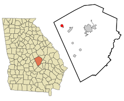
Location in Laurens County and the state of Georgia
|
|
| Country | United States |
| State | Georgia |
| County | Laurens |
| Area | |
| • Total | 1.62 sq mi (4.20 km2) |
| • Land | 1.61 sq mi (4.18 km2) |
| • Water | 0.01 sq mi (0.02 km2) |
| Elevation | 384 ft (117 m) |
| Population
(2020)
|
|
| • Total | 203 |
| • Density | 125.77/sq mi (48.55/km2) |
| Time zone | UTC-5 (Eastern (EST)) |
| • Summer (DST) | UTC-4 (EDT) |
| ZIP code |
31065
|
| Area code(s) | 478 |
| FIPS code | 13-52500 |
| GNIS feature ID | 0318408 |
Montrose is a small town located in Laurens County, Georgia, in the United States. In 2020, about 203 people lived there.
Contents
A Look Back at Montrose's History
Montrose officially became a town in 1929. This happened when the Georgia General Assembly, which is like the state's main law-making group, approved it.
Where is Montrose Located?
Montrose is found at these coordinates: 32°33′30″N 83°9′8″W / 32.55833°N 83.15222°W.
Size and Surroundings
According to the United States Census Bureau, the town covers an area of about 1.6 square miles (4.2 square kilometers). Almost all of this area is land.
Montrose is located along U.S. Highway 80 where it meets State Highway 278. It is also just north of Interstate 16, which is a major highway.
How Many People Live in Montrose?
The number of people living in Montrose has changed over the years. Here's a quick look at the population from different years:
| Historical population | |||
|---|---|---|---|
| Census | Pop. | %± | |
| 1920 | 210 | — | |
| 1930 | 226 | 7.6% | |
| 1940 | 90 | −60.2% | |
| 1950 | 242 | 168.9% | |
| 1960 | 236 | −2.5% | |
| 1970 | 199 | −15.7% | |
| 1980 | 170 | −14.6% | |
| 1990 | 117 | −31.2% | |
| 2000 | 154 | 31.6% | |
| 2010 | 215 | 39.6% | |
| 2020 | 203 | −5.6% | |
| U.S. Decennial Census | |||
In 2000, there were 154 people living in Montrose. By 2020, the population had grown to 203 people.
Famous People From Montrose
Some well-known people have connections to Montrose:
See also
In Spanish: Montrose (Georgia) para niños
 | May Edward Chinn |
 | Rebecca Cole |
 | Alexa Canady |
 | Dorothy Lavinia Brown |

