
Montville, Ohio facts for kids
Quick facts for kids
Montville, Ohio
|
|
|---|---|

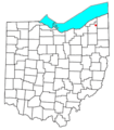
Location of Montville, Ohio
|
|
| Country | United States |
| State | Ohio |
| County | Geauga |
| Township | Montville |
| Elevation | 1,204 ft (367 m) |
| Time zone | UTC-5 (Eastern (EST)) |
| • Summer (DST) | UTC-4 (EDT) |
| ZIP codes |
44064
|
| GNIS feature ID | 1048983 |
Montville is a small, quiet place in Ohio, United States. It's known as an unincorporated community. This means it's a group of homes and businesses that aren't officially a city or town with its own local government. Instead, it's part of a larger area called Montville Township.
Montville is located in Geauga County. It has its own post office, which has been helping people send and receive mail since 1825! The area is also easy to find because it sits right where two important roads meet: U.S. Route 6 and State Route 528.
Contents
What's in a Name?
Montville got its name because of its location. The word "Montville" comes from "mont," which means mountain or hill. This makes sense because the area is known for its "lofty elevation," meaning it's quite high up compared to the land around it.
Where is Montville Located?
Montville is found in the central part of Montville Township. This township is in Geauga County, which is in the northeastern part of the state of Ohio.
Getting Around Montville
If you were to visit Montville, you'd notice two main roads crossing paths right in the community. These are U.S. Route 6 and State Route 528. These roads are important for people living in and traveling through Montville. They connect the community to other towns and cities nearby.
Postal Services in Montville
Even though Montville is an unincorporated community, it has its own post office. This post office uses the ZIP code 44064. Having a local post office means residents can easily send letters and packages, and receive their mail right in their own community. The post office has been serving the area for a very long time, opening its doors way back in 1825.
Images for kids
-
Location of Montville, Ohio
