Morton Street facts for kids
Quick facts for kids |
|
|
Morton Street, Metropolitan Park System of Greater Boston
|
|
 |
|
| Lua error in Module:Location_map at line 420: attempt to index field 'wikibase' (a nil value). | |
| Location | Morton St. between Arborway and Gallivan Boulevard, Boston, Massachusetts |
|---|---|
| Area | 13 acres (5.3 ha) |
| Built | 1930 |
| Built by | City of Boston Dept. of Public Works |
| MPS | Metropolitan Park System of Greater Boston MPS |
| NRHP reference No. | 04001572 |
| Added to NRHP | January 24, 2005 |
Morton Street is an important road in southern Boston, Massachusetts. It stretches from the Arborway in Jamaica Plain all the way to Washington Street in Dorchester. Much of Morton Street is a special kind of road called a parkway. It's part of Massachusetts Route 203. This parkway helps people reach Boston's beautiful Emerald Necklace of parks. Because of its history and design, this part of the road was added to the National Register of Historic Places in 2005.
Contents
Exploring Morton Street's Path
Morton Street begins in Jamaica Plain. Its starting point is near the Forest Hills train station. At first, it's a narrow, one-way street. This section goes northwest.
From Shea Circle to Gallivan Boulevard
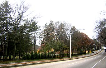
The street soon reaches the James B. Shea Memorial Circle. This circle is where the Arborway ends. From here, Morton Street becomes a wider, four-lane road. It's divided down the middle. This part of the road is signed as Massachusetts Route 203.
As you travel southeast, you'll see interesting sights. On one side is Forest Hills Cemetery. On the other side is Franklin Park. These are big, green spaces. Morton Street also crosses the American Legion Highway.
Morton Street's Urban Sections
After passing Harvard Street, Morton Street changes. It becomes more like a city street. The grassy area in the middle disappears. You'll see many wooden houses close together. There are also shops and businesses, especially at major intersections.
Further along, you'll reach Gallivan Boulevard. This road continues the parkway style. Morton Street then goes for about half a mile more. It ends at Washington Street. This is just north of the Lower Mills Village center. In this final section, the buildings are a bit more spread out.
Morton Street's History
Morton Street was likely built in the 1930s. Either the city or the state built it. For a while, the city of Boston took care of Morton Street. They also maintained the Arborway and Gallivan Boulevard.
Becoming a Park of the MDC System
Later, Boston faced money problems. Because of this, the city gave these roads to the Metropolitan District Commission (MDC). The MDC is now known as the Massachusetts Department of Conservation and Recreation.
Even though the MDC didn't build Morton Street's parkway section, it was designed well. It met the high standards the MDC used for other parkways. This is why the parkway part of Morton Street is special. It's listed on the National Register of Historic Places. This part is between Shea Circle and Gallivan Boulevard.

