Mosby, Montana facts for kids
Quick facts for kids
Mosby, Montana
|
|
|---|---|
| Country | United States |
| State | Montana |
| County | Garfield |
| Elevation | 2,513 ft (766 m) |
| Time zone | UTC-7 (Mountain (MST)) |
| • Summer (DST) | UTC-6 (MDT) |
| ZIP codes |
59058
|
| GNIS feature ID | 774406 |
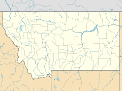
Mosby (also called Half-Breed Crossing) is a very small place in Garfield County, Montana, United States. It's an unincorporated community, which means it's not officially a town with its own local government. Mosby is located along Highway 200, southwest of a place called Sand Springs. It sits about 2,513 feet (766 m) (or 766 meters) above sea level.
Even though Mosby hasn't had a post office since 2015, it still has its own special ZIP code, which is 59058. As of 2015, you can find an RV park there, where a gas station used to be. There is also a church, but no other businesses or services. The Mosby Dome Cat Creek Oil Field, which is a place where oil is found, is also in this area.
Mosby's Past
Mosby was first known as Baldwin. The community got its current name from the first person to settle there, who arrived in 1891.
A post office opened in Mosby on June 29, 1904. It was moved once on February 18, 1983, and then finally closed on July 30, 2015. For many years, from 1950 to 1983, Mosby also had a gas station and a repair shop.
Mosby's Weather
Mosby has a type of weather called a semi-arid climate. This means it's usually quite dry, but not as dry as a desert. On climate maps, this type of weather is often shown as "BSk".
 | Delilah Pierce |
 | Gordon Parks |
 | Augusta Savage |
 | Charles Ethan Porter |


