Mount Carmel, Tennessee facts for kids
Quick facts for kids
Mount Carmel
|
||
|---|---|---|

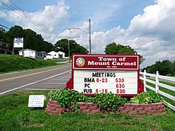
Town (City) of Mount Carmel sign along Main Street
|
||
|
||

Location in Hawkins County, Tennessee
|
||
| Country | United States | |
| State | Tennessee | |
| County | Hawkins | |
| Incorporated | 1961 | |
| Area | ||
| • Total | 6.65 sq mi (17.22 km2) | |
| • Land | 6.64 sq mi (17.21 km2) | |
| • Water | 0.01 sq mi (0.02 km2) | |
| Elevation | 1,365 ft (416 m) | |
| Population
(2020)
|
||
| • Total | 5,473 | |
| • Density | 823.87/sq mi (318.10/km2) | |
| Time zone | UTC-5 (Eastern (EST)) | |
| • Summer (DST) | UTC-4 (EDT) | |
| ZIP code |
37645
|
|
| Area code(s) | 423 | |
| FIPS code | 47-50580 | |
| GNIS feature ID | 1294565 | |
Mount Carmel is a city in Hawkins County, Tennessee, United States. As of the 2020 census, about 5,473 people live here. It is part of the "Tri-Cities" region, which includes nearby cities like Kingsport and Bristol.
Contents
A Look Back: Mount Carmel's History
Mount Carmel is located in Hawkins County. This area was once part of a place called the State of Franklin in the late 1700s. It was like an independent state for four years, led by John Sevier, before it rejoined North Carolina.
Years ago, Mount Carmel got attention from a TV news story. It said the town was only on one side of the main road. Since then, the city has bought land on the other side and built a cemetery there.
Since the 1980s, the community has faced some money problems. This was partly due to changes in its local government. Also, some of its shopping and city services moved to nearby towns like Church Hill and Kingsport.
In 2020, the city started talking about connecting to other cities' sewer systems. This was because Mount Carmel's own sewer plant was no longer working well. People have even suggested that Mount Carmel might join with Kingsport or Church Hill because of these money issues.
Where is Mount Carmel? Geography and Location
Mount Carmel is in the eastern part of Hawkins County. It is next to Kingsport on its east side and Church Hill on its west side.
U.S. Route 11W is the main highway that goes through the town. This road leads east into Kingsport. If you go southwest for about 22 miles, you will reach Rogersville, which is the main town for Hawkins County.
The United States Census Bureau says that Mount Carmel covers about 6.65 square miles (17.22 square kilometers) of land. Only a very small part, about 0.01 square miles (0.02 square kilometers), is water.
Who Lives Here? Demographics
| Historical population | |||
|---|---|---|---|
| Census | Pop. | %± | |
| 1970 | 2,821 | — | |
| 1980 | 3,764 | 33.4% | |
| 1990 | 4,082 | 8.4% | |
| 2000 | 4,795 | 17.5% | |
| 2010 | 5,429 | 13.2% | |
| 2020 | 5,473 | 0.8% | |
| Sources: | |||
Mount Carmel's Population in 2020
The 2020 United States census counted 5,473 people living in Mount Carmel. There were 2,184 households and 1,614 families in the town.
This table shows the different groups of people living in Mount Carmel in 2020:
| Group | Number of People | Percentage of Total |
|---|---|---|
| White (not Hispanic) | 5,181 | 94.66% |
| Black or African American (not Hispanic) | 45 | 0.82% |
| Native American | 10 | 0.18% |
| Asian | 18 | 0.33% |
| Pacific Islander | 1 | 0.02% |
| Other/Mixed | 141 | 2.58% |
| Hispanic or Latino | 77 | 1.41% |
Learning in Mount Carmel: Education
Mount Carmel has one school called Mount Carmel Elementary School. This school teaches children from pre-kindergarten up to 4th grade. It is part of the Hawkins County School District.
Children in fifth and sixth grade go to Church Hill Intermediate School. Students in seventh and eighth grade attend Church Hill Middle School. For high school, students go to Volunteer Comprehensive High School.
Fun and Games: Parks and Recreation
The Parks and Recreation department works together with the cities of Church Hill and Surgoinsville. This is a joint effort by these cities in Hawkins County to provide fun activities and places for everyone.
See also
 In Spanish: Mount Carmel (Tennessee) para niños


