Mount Elephant facts for kids
Quick facts for kids Mount Elephant(Djerrinallum) |
|
|---|---|

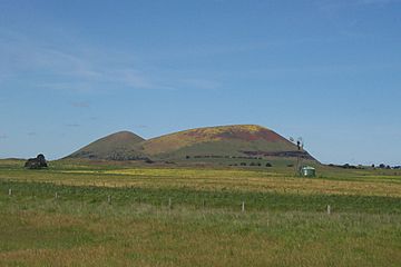
Mount Elephant viewed from Derrinallum township
|
|
| Highest point | |
| Elevation | 380 metres (1,250 ft) AHD |
| Geography | |
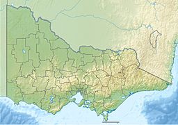
| Location | South West region, Victoria, Australia |
| Geology | |
| Mountain type | conical breached scoria cone |
Mount Elephant is a 380-meter (1,247-foot) high, cone-shaped hill in southwestern Victoria, Australia. It was formed by a sleeping volcano that erupted a long time ago. The mountain is located just 1 kilometer (0.6 miles) from the town of Derrinallum. It's an easy-to-spot landmark and marks the eastern entrance to the Kanawinka Geopark if you're coming from the Hamilton Highway near Derrinallum.
Contents
How Mount Elephant Was Formed
Mount Elephant is a special type of volcano called a scoria cone. Scoria cones are small volcanoes. They usually have steep sides. They form from one big volcanic eruption.
Sometimes, a pool of hot lava forms inside the cone. If this lava breaks through the side of the cone, it creates a "breached scoria cone." Mount Elephant is an example of this.
Scientists believe Mount Elephant first erupted about 184,000 years ago. There are around 200 breached scoria cones in Victoria.
History of Mount Elephant
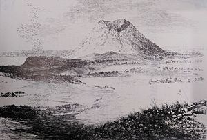
Early European settlers had special names for Mount Elephant. They called it "Swagmans Lighthouse" or the "lighthouse of the western district." This shows how important it was for finding your way.
For many years, rock was taken from Mount Elephant. This rock is called scoria. You can still see where the quarries were at the bottom of the cone.
- The first quarry opened in 1910 and closed in 1913.
- Another quarry operated from the 1950s until the 1990s.
- The last mining stopped recently.
The scoria from Mount Elephant was used to build roads and buildings. Many of these are still in and around Derrinallum.
Mount Elephant was privately owned until the year 2000. Then, the Trust for Nature and the local community bought it. Their goal is to plant trees and plants again. They also want to encourage people to visit the area.
Aboriginal History and Names
The Aboriginal people who lived closest to Mount Elephant were the Djargurd Wurrong language group. The mountain is also near the lands of other groups. These include the Wathawurrung, Gulidjan, and Girai wurrung peoples.
During the 1830s, when Europeans first arrived, Mount Elephant was part of the Teerinyillum Gundidj clan's land. This clan was part of the larger Djargurd Wurrong language group.
The Wathawurrung name for the mountain is Djerrinallum. This name means "nest of sea swallows, terns." Another source said the name meant "a hill of fire." It was also the name of a local clan.
Joel Wright, who translated an old story, said Derrinallum means "home of sea swallows or terns." These birds often visited the nearby marshes. This name comes from the Girai wurrung language.
A photographer named Fred Kruger took a picture of an Aboriginal man called King Tom in 1877. King Tom was from the Derrinallum area. His picture was later put into a book called Album of the Kings & Queens of Victoria.
An artist named Robert Hawker Dowling also painted King Tom in 1856. This painting is called Aborigines in a Bark Hut: King Tom of the Mount Elephant Tribe. It is now in the National Library of Australia.
King Tom lived at Meningoort Station. This station is about 25 kilometers (15.5 miles) southwest of Mount Elephant. It is north of Camperdown. Meningoort Station is still owned by the McArthur family today.
See also
 | Selma Burke |
 | Pauline Powell Burns |
 | Frederick J. Brown |
 | Robert Blackburn |


