Kanawinka Geopark facts for kids
Quick facts for kids Kanawinka GeoparkAustralia |
|
|---|---|
| Established | June 2008 |
| Abolished | 2012 |
| Area | 26,910 km2 (10,390.0 sq mi) |
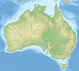
The former Kanawinka Geopark was a special area in Australia. It stretched from the famous Naracoorte Caves National Park in South Australia into Western Victoria. This region was known for its amazing geological features, like a long crack in the Earth's crust called a fault.
Contents
What Was the Kanawinka Geopark?
Kanawinka was officially named Australia's first National Geopark in June 2008. It covered a huge area of about 26,910 square kilometers. This included parts of both South Australia and Victoria. The Geopark was home to about 374 volcanic sites and many other important geological spots. Sadly, it stopped being a Geopark in 2012.
The Meaning Behind the Name
The name "Kanawinka" comes from the language of the Buandik Aboriginal people. They are the traditional owners of this land. In their language, "Kanawinka" means "Land of Tomorrow." This name was chosen to show the connection between ancient culture, European settlement, and the goal of teaching people about the Earth's history through the Geopark.
Where Was the Geopark Located?
The Kanawinka Geopark was part of a large geological area called the Otway Basin. This basin formed about 95 million years ago. This was when Australia began to break away from a giant supercontinent called Gondwana. Over millions of years, layers of sand, mud, and other materials built up in this basin.
The South Australian part of the Geopark was in the Limestone Coast region. It was right next to the Naracoorte Caves National Park, which is a World Heritage area. The Victorian part was in the Western Districts. Both areas are famous for their cheese, wine, and farming.
The eastern edge of the Geopark in Victoria was about an hour's drive from Melbourne. At the border between Victoria and South Australia, it was about four to five hours from Melbourne. In South Australia, it was four to five hours from Adelaide.
Volcanic Activity in the Geopark
Much of the volcanic activity in the Kanawinka Geopark happened between 5 million and 5,000 years ago. This period of volcanic activity is known as the Newer Volcanics Province. You can see many signs of these ancient volcanoes today.
Important Geological Sites
The Geopark included many important geological sites. There were 6 sites considered to be of international importance. Another 14 were nationally important. Many more had state, regional, or local significance.
The landscape changed a lot across the Geopark. You could find flat plains formed by ancient lava flows. There were also limestone caves, and lakes inside old volcano craters. The famous "Terra Rosa" soil of the Coonawarra was also part of this area.
The basalt plains of Western Victoria are among the top 6 in the world for their size and complexity. The Blue Lake at Mount Gambier is especially famous. It's known for its unique color change each year.
Who Managed the Geopark?
The Kanawinka Geopark Board was a group of people from the community. They were the main force behind the Geopark idea. Seven of the nine local government areas helped fund this board. They also had support from tourism groups and geological societies. However, this group has now stopped operating.
 | Jessica Watkins |
 | Robert Henry Lawrence Jr. |
 | Mae Jemison |
 | Sian Proctor |
 | Guion Bluford |


