Mount Harris facts for kids
Quick facts for kids Mount Harris |
|
|---|---|
| Boundary Peak 156 | |
| Highest point | |
| Elevation | 5,289 ft (1,612 m) |
| Geography | |
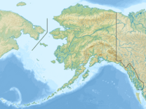
| Location | Stikine Region, British Columbia Glacier Bay National Park and Preserve, Alaska |
Mount Harris, also known as Boundary Peak 156, is a tall mountain located right on the border between Alaska in the United States and British Columbia in Canada. It's part of the Takhinsha Mountains. This mountain is special because it helps mark the boundary between two countries!
Where is Mount Harris Located?
Mount Harris stands in a beautiful, rugged area. It's found in the Stikine Region of British Columbia, Canada. On the American side, it's within the famous Glacier Bay National Park and Preserve in Alaska. Imagine a mountain that belongs to two different countries at the same time!
Why is it Called Mount Harris?
For a while, this mountain was simply known as Boundary Peak 156. This name came from its role in marking the border. But in 1923, it was given a new name: Mount Harris. This was done to honor D. R. Harris. He was a surveyor, which is a person who measures and maps land. Mr. Harris worked on the Canadian side of the important Boundary Survey, helping to figure out exactly where the border between Canada and the United States should be.
What is a Boundary Peak?
A boundary peak is a mountain or a high point that sits directly on the border between two countries or regions. These peaks are often used as natural markers to help define where one territory ends and another begins. Mount Harris is a great example of such a natural border marker.
 | George Robert Carruthers |
 | Patricia Bath |
 | Jan Ernst Matzeliger |
 | Alexander Miles |


