Mount Kuring-gai, New South Wales facts for kids
Quick facts for kids Mount Kuring-gaiSydney, New South Wales |
|||||||||||||||
|---|---|---|---|---|---|---|---|---|---|---|---|---|---|---|---|

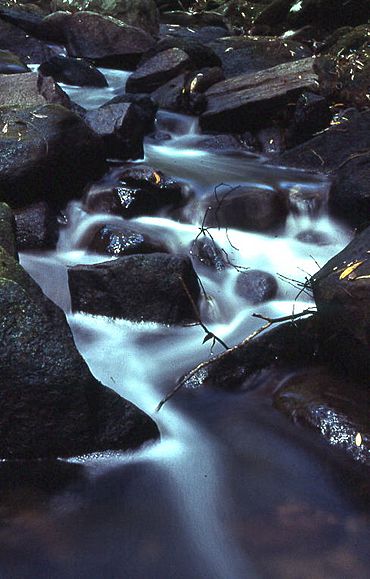
Cascades along Calna Creek
|
|||||||||||||||
| Population | 1,766 (2021 census) | ||||||||||||||
| Postcode(s) | 2080 | ||||||||||||||
| Elevation | 210 m (689 ft) | ||||||||||||||
| Location | 31 km (19 mi) from Sydney CBD | ||||||||||||||
| LGA(s) | Hornsby Shire | ||||||||||||||
| State electorate(s) | Hornsby | ||||||||||||||
| Federal Division(s) | Berowra | ||||||||||||||
|
|||||||||||||||
Mount Kuring-gai is a friendly suburb located in the northern part of Sydney, Australia. It's about 31 kilometers north-west of the main city center. This area is part of the Hornsby Shire local government area. It's known for being surrounded by beautiful bushland and national parks.
Contents
A Look Back: Mount Kuring-gai's History
The name "Kuring-gai" comes from the Guringai Aboriginal people. They were once thought to be the original owners of this land.
The local train station opened on October 5, 1901. It was first called Kuring-gai. The word Mount was added to its name on August 1, 1904. The current station building was built in 1909.
The Kuring-gai Post Office started on January 27, 1908. It also changed its name to Mount Kuring-gai in 1933. Mount Kuring-gai Public School, a local primary school, opened its doors in 1957.
Who Lives in Mount Kuring-gai?
In 2021, about 1,766 people lived in Mount Kuring-gai. Most of the people, about 70.9%, were born in Australia. A large number, 80.6%, spoke only English at home.
When it comes to religion, many people (36.9%) said they had no religion. Other common religions included Catholic (18.0%), Anglican (14.2%), and Hinduism (4.7%).
Getting Around and What's There
Mount Kuring-gai is split into two parts by major transport routes. These include the Pacific Highway, the main railway line, and the Pacific Motorway. The suburb has its own train station, Mount Kuring-gai railway station.
The eastern side of the suburb has a primary school, a community hall, and a sports oval. On the western side, you'll find a shopping center and the train station. A road bridge and a special walking bridge connect the two sides.
In 2010, the old shopping center was replaced. A new Aldi supermarket was built there, along with other shops.
Mount Kuring-gai also has an area with many different businesses. These include a company that makes hot air balloons and electronics firms. There's also a school paint manufacturer, a book publisher, and a bus depot.
Where is Mount Kuring-gai?
Mount Kuring-gai is located about 7 kilometers north of Hornsby. Its neighbors are Berowra to the north and Mount Colah to the south.
The suburb is surrounded by beautiful bushland. Ku-ring-gai Chase National Park is on its eastern side. Berowra Valley Regional Park is on the western side.
You can find several bushwalks starting in the suburb. These include parts of the Great North Walk. There is also a path that leads to Apple Tree Bay. Mount Kuring-gai's height above sea level changes. It ranges from about 57 meters to between 214 and 221 meters.

