Mount Tennent facts for kids
Quick facts for kids Mount Tennent |
|
|---|---|
| Aboriginal: Tharwa | |

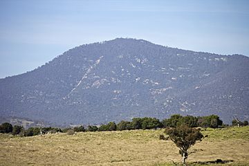
Mount Tennent, viewed from Point Hut Road.
|
|
| Highest point | |
| Elevation | 1,375 m (4,511 ft) |
| Geography | |
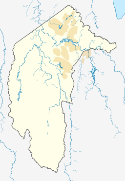
| Location | Australian Capital Territory, Australia |
Mount Tennent is a tall mountain located in the southern part of the Australian Capital Territory (ACT) in Australia. It reaches a height of 1,375 meters (about 4,511 feet). The Gudgenby River flows at the bottom of the mountain.
Contents
About Mount Tennent
Mount Tennent is an important landmark in the ACT. It is known for its natural beauty and the activities you can do there.
Where is Mount Tennent?
Mount Tennent is found in the southern area of the Australian Capital Territory. It is close to the village of Tharwa. The Gudgenby River runs along the base of the mountain.
Why is it Called Mount Tennent?
The mountain is named after a person called John Tennant. He was known to be in the area around 1827. Before this, the mountain was called Mount Currie. This name was given by Allan Cunningham. He named it after Captain Mark Currie, who explored nearby in 1823.
Indigenous Australians have their own name for the mountain. They call it Tharwa. This is also the name of the village at the northern foot of the mountain.
Water for Canberra
In 2004, a company called ACTEW looked into ways to get more water for Canberra and the ACT. One idea was to build a very large reservoir (a big lake for storing water). This would have been done by building a dam on the Gudgenby River, near Mount Tennent.
By 2005, the ACT Government decided not to build the dam at Mount Tennent. Instead, they chose to make the Cotter Dam bigger to help with water supply.
Fun Things to Do
Mount Tennent is home to the main office for Outward Bound Australia. This group uses the mountain for outdoor adventure courses all year. They also help the environment by planting many native trees in the area.
Mount Tennent has many paths for walking and driving. Lots of people enjoy hiking from the bottom of the mountain to the top. It's a popular spot for exercise and enjoying nature.
 | James B. Knighten |
 | Azellia White |
 | Willa Brown |


