
Muñoz Rivera facts for kids
Quick facts for kids
Muñoz Rivera
|
|
|---|---|
|
Barrio
|
|

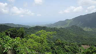
View from Muñoz Rivera
|
|

Location of Muñoz Rivera within the municipality of Patillas shown in red
|
|

Muñoz Rivera
Location in Caribbean
|
|
| Commonwealth | |
| Municipality | |
| Area | |
| • Total | 8.84 sq mi (22.9 km2) |
| • Land | 8.84 sq mi (22.9 km2) |
| • Water | 0 sq mi (0 km2) |
| Elevation | 1,316 ft (401 m) |
| Population
(2010)
|
|
| • Total | 673 |
| • Density | 76.1/sq mi (29.4/km2) |
| Source: 2010 Census | |
| Time zone | UTC−4 (AST) |
Muñoz Rivera is a barrio (which is like a small district or neighborhood) located in the municipality of Patillas, Puerto Rico. In 2010, about 673 people lived there. It is known for its quiet atmosphere and natural beauty.
Contents
Population Changes Over Time
The number of people living in Muñoz Rivera has changed quite a bit over the years. In 1900, there were 1,080 residents. The highest population recorded was 1,311 people in 1950. By 2010, the population was 673.
Understanding Sectors in Muñoz Rivera
In Puerto Rico, barrios are often divided into even smaller areas called sectores. Think of sectores as local neighborhoods or sections within a larger barrio. These sectores can have different names, like urbanización (urbanization) or reparto (development).
Main Sectors of Muñoz Rivera
Here are some of the specific sectores you can find in Muñoz Rivera barrio:
- Carretera 179
- Carretera 184
- Sector El Campamento Real
- Sector Los Tres Chorros
- Sector Miraflores
- Sector Palma Sola
- Sector Real
- Sector Riachuelo
- Sector Río Arriba
- Sector Sonadora
Gallery
-
View facing Patillas Pueblo from PR-184
-
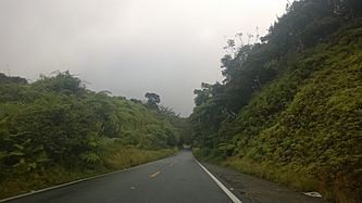
Puerto Rico Highway 184 in Muñoz Rivera


See also
 In Spanish: Muñoz Rivera (Patillas) para niños
- List of communities in Puerto Rico
- List of barrios and sectors of Patillas, Puerto Rico
