Murray, Indiana facts for kids
Quick facts for kids
Murray, Indiana
|
|
|---|---|

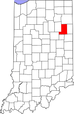
Wells County's location in Indiana
|
|
| Country | United States |
| State | Indiana |
| County | Wells |
| Township | Lancaster |
| Elevation | 807 ft (246 m) |
| Time zone | UTC-5 (Eastern (EST)) |
| • Summer (DST) | UTC-4 (EDT) |
| ZIP code |
46714
|
| Area code(s) | 260 |
| FIPS code | 18-51966 |
| GNIS feature ID | 439894 |
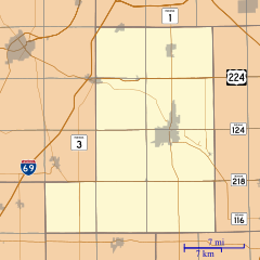
Murray is an unincorporated area located in Wells County, Indiana. It is found near Lancaster Township in the U.S. state of Indiana. Being an "unincorporated area" means it's a community that doesn't have its own separate local government like a city or town.
History of Murray
Murray has a past that includes another name. Long ago, this community was sometimes called New Lancaster.
A post office, which is a place where people send and receive mail, was opened in Murray in 1837. This office served the community for many years before it closed down in 1902.
On February 29, 1996, an unexpected event happened in Murray. A military aircraft accidentally fired its weapons in the area. Fortunately, no one was injured during this incident.
Geography of Murray
Murray is easy to find on a map. It is located right along State Highway 116. This road helps connect Murray to other nearby places.
 | Delilah Pierce |
 | Gordon Parks |
 | Augusta Savage |
 | Charles Ethan Porter |


