Nacuche, Yucatan facts for kids
Quick facts for kids
Nacuche, Yucatan
|
||
|---|---|---|
|
||

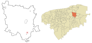
Location of Nacuche, Yucatan
|
||

Nacuche street map
|
||
| Country | Mexico | |
| State | Yucatan | |
| Municipality | Espita Municipality | |
| Elevation | 29 m (95 ft) | |
| Population
(INEGI, 2005)
|
||
| • Total | 1,130 | |
| Time zone | UTC-6 (Central (CST)) | |
| • Summer (DST) | UTC-5 (CDT) | |
| ZIP code |
97736
|
|
| Area code(s) | 986 | |
| INEGI Code | 310320004 | |
Nacuche is a small village found in the Yucatan state of Mexico. It's part of the Espita Municipality and is located on the eastern coast area of Yucatan. The village sits about 29 meters (around 95 feet) above sea level. In 2005, about 1,130 people lived there, according to a count by INEGI, which is Mexico's official statistics agency.
Where is Nacuche?
Nacuche is located at coordinates 20°55′2″N 88°17′45″W. This means it's in the northern part of the Yucatan Peninsula. The village is about 29 meters (95 feet) above the ocean, which is a fairly low elevation.
Nacuche's Weather
Nacuche has a warm and humid climate, which is called a Tropical savanna climate (Aw1). This means it's usually warm all year round, with the average temperature being over 22 °C (72 °F). Even in the coldest month, the temperature stays above 18 °C (64 °F).
Most of the rain in Nacuche falls during the summer. The driest month gets less than 60 millimeters (about 2.4 inches) of rain. Only a small amount of the yearly rain, about 10.2%, happens in the winter.
People of Nacuche
| Historical population | ||
|---|---|---|
| Year | Pop. | ±% |
| 1910 | 52 | — |
| 1921 | 149 | +186.5% |
| 1930 | 231 | +55.0% |
| 1940 | 230 | −0.4% |
| 1950 | 303 | +31.7% |
| 1960 | 290 | −4.3% |
| 1970 | 449 | +54.8% |
| 1980 | 522 | +16.3% |
| 1990 | 747 | +43.1% |
| 1995 | 825 | +10.4% |
| 2000 | 918 | +11.3% |
| 2005 | 1,130 | +23.1% |
| Source: Archivo Histórico de Localidades | ||
In 2005, the INEGI counted 1,130 people living in Nacuche. This made up about 7.83% of all the people living in the Espita Municipality. Out of these residents, 589 were men and 541 were women. At that time, there were 240 homes in the village.
Schools in Nacuche
Nacuche has several schools for different age groups. Here's a quick look at the education system in the village:
| Type of School | Number of Students | Number of Teachers | Number of Schools |
|---|---|---|---|
| Preschool education | 71 | 3 | 1 |
| Primary education | 242 | 9 | 2 |
| Secondary education | 142 | 15 | 1 |
| Total | 455 | 27 | 4 |
| Source: Secretaría de Educación de Yucatán. | |||
As you can see, a total of 455 students attend four different schools in Nacuche, taught by 27 teachers. This shows that education is an important part of the community.
See also

- In Spanish: Nacuché para niños


