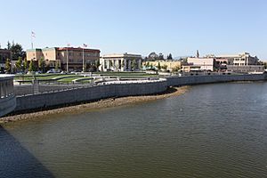
Napa River Flood Project facts for kids
The Napa River-Napa Creek Flood Protection Project is a major effort by the US Army Corps of Engineers. It helps protect the city of Napa, California from floods. This project covers about 6 miles (10 km) of the Napa River and 1 mile (1.6 km) of Napa Creek. Napa Creek is the main stream that flows into the Napa River. This project is special because it uses "living river" ideas to control floods.
Contents
Why the Napa River Floods
The Napa River flows for about 55 miles (89 km) from Mt. St. Helena to San Pablo Bay. It drains a large area of about 426 square miles (1100 km²). The river often floods between November and April each year. Serious floods that harm homes and businesses happen from St. Helena down to the City of Napa. Records show that there have been at least 22 big floods on the Napa River since 1865. Some of the worst recent floods happened in 2005, 1997, 1995, and 1986.
How the Project Was Approved
The US Congress first approved a flood protection project for Napa in 1965. However, they didn't provide any money for it. Local leaders tried to get money from voters twice in the 1970s, but people voted against the tax plans.
A New Plan for Flood Control
After a very bad flood in 1986, people became interested again. They asked the Army Corps of Engineers to restart the project. Nine years later, the Corps presented a plan. But local groups didn't like it. The plan used old ways of flood control, like making the river channel straight and building tall floodwalls. Many people felt this plan would make it harder to enjoy the river. Environmental groups worried it would harm fish like steelhead trout.
The Community Steps In
Local leaders and groups couldn't support the Corps' first design. Instead of letting it fail, a group called the Community Coalition formed. Their goal was to create a better plan that everyone could support.
Working Together for a Solution
The US Army Corps of Engineers and the Napa County Flood Control District wanted to find a good solution. So, many meetings were held over two years. About 25 different groups and 400 people took part. Key groups included Friends of the Napa River and the Sierra Club. After a lot of planning, a new idea was put to a vote in March 1998. This plan asked for a small sales tax to pay for the project. The measure needed two-thirds of the votes to pass. It passed by only 308 votes out of more than 27,000!
What "Living River" Means
The "living river" idea is a new way to control floods. It tries to work with nature, not against it.
Goals of the Living River Design
- Connecting the river: Letting the river spread out into its natural flood plain when it floods.
- Keeping the river natural: Allowing the river to curve and flow as it always has.
- Protecting natural features: Keeping mud flats, shallow areas, and sandbars.
- Supporting wildlife: Creating a continuous path for fish and plants along the riverbanks.
How the Project Works
The Napa River usually flows at about 1,300 cubic feet per second (37 m³/s) through Napa. During a very big flood, like a "100-year flood" (a flood that has a 1% chance of happening in any given year), the flow can increase to 41,000 to 46,000 cubic feet per second (1,161 to 1,303 m³/s). The Napa River-Napa Creek Flood Protection Project uses a mix of old and new methods to stop floods.
Flood Protection Methods
- Restoring wetlands: Old walls (dikes) have been removed, and tidal marshlands have been brought back. This gives floodwaters more space.
- New bridges: Old bridges have been replaced to let water flow more easily.
- Riverbank terraces: The riverbanks have been shaped into steps. This gives more room for large amounts of water.
- Bypass channel: A dry channel was dug to create a shortcut for fast floodwaters.
- New walls: Some new dikes, levees, and floodwalls have been built.
- Bank support: Riverbanks are strengthened in certain areas.
- Water storage: Special basins and pump stations collect runoff water behind the floodwalls.
Work on the Napa Creek part of the project started in November 2010. This area in downtown Napa often floods more than the river itself. This work included replacing bridges and reshaping the creek's banks. Much of this part of the project was finished by 2013. The project also helped fund other river projects further up the valley. The last part of the project, a flood bypass channel, was completed in 2015.
Awards Received
The Napa River-Napa Creek Flood Protection Project has won many awards, including:
- 1998 American Institute of Architects Award
- 1998 American Institute of Landscape Architects Award
- 1998 California League of Cities Helen Putnam Award
- 1999 Outstanding Comprehensive Conservation and Management Plan Implementation Project Award
- 1999 Governor's Environmental and Economic Leadership Award
- 2004 Proclamation of Appreciation from the California Regional Water Quality Control Board
 | Aaron Henry |
 | T. R. M. Howard |
 | Jesse Jackson |


