Napaktulik Lake facts for kids
Quick facts for kids Napaktulik Lake |
|
|---|---|
 |
|
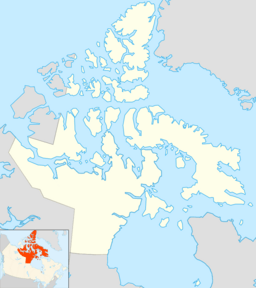
| Location | Kitikmeot Region, Nunavut |
| Coordinates | 66°20′N 113°00′W / 66.333°N 113.000°W |
| Basin countries | Canada |
| Surface area | 1,080 km2 (420 sq mi) |
| Surface elevation | 381 m (1,250 ft) |
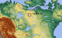
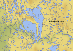
Napaktulik Lake is a large and important lake in Nunavut, Canada. It used to be known as Takiyuak Lake or Takijuq Lake. This lake is special because it is the eighth largest lake in the entire Nunavut territory.
Where is Napaktulik Lake?
Napaktulik Lake is located in the northern part of Canada. It is about 173 km (107 mi) (which is about 107 miles) south of a community called Kugluktuk. Kugluktuk is a hamlet located on the coast of the Arctic Ocean.
Source of the Hood River
One of the most important facts about Napaktulik Lake is that it is the starting point for the Hood River. A river's source is where it begins its journey. The Hood River flows from Napaktulik Lake and eventually makes its way to the Arctic Ocean.
See also
 In Spanish: Lago Napaktulik para niños
Black History Month on Kiddle
Famous African-American Civil Rights Activists:
 | Aaron Henry |
 | T. R. M. Howard |
 | Jesse Jackson |

All content from Kiddle encyclopedia articles (including the article images and facts) can be freely used under Attribution-ShareAlike license, unless stated otherwise. Cite this article:
Napaktulik Lake Facts for Kids. Kiddle Encyclopedia.


