
National Register of Historic Places listings in Aiken County, South Carolina facts for kids

This page is about the special places in Aiken County, South Carolina, that are listed on the National Register of Historic Places. These are important buildings, areas, or sites that tell us about the past.
The National Register of Historic Places is like a special list kept by the United States government. It helps protect places that are important to American history, architecture, archaeology, engineering, or culture. When a place is on this list, it means it's recognized as valuable and worth saving for future generations.
In Aiken County, there are 43 places on this list. One of them is extra special and is called a National Historic Landmark.
Contents
What is the National Register of Historic Places?
The National Register of Historic Places is the official list of the nation's historic places worth saving. It's part of a program to help people understand and protect America's rich history. When a place is added to the Register, it gets special recognition. It also means that certain rules apply to help protect it from being changed or destroyed.
Why are these places important?
Historic places are like time capsules. They help us learn about how people lived long ago, what they built, and what was important to them. They can be old houses, churches, schools, battlefields, or even whole neighborhoods. By preserving these places, we keep our history alive and can visit them to imagine life in the past. They also help us understand how our communities grew and changed over time.
Historic Places in Aiken County
Aiken County has many interesting places on the National Register. These include different types of sites, from old homes to important community areas. They show the diverse history of the county, from its early days to more recent times.
A Special Landmark: Graniteville Historic District
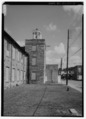
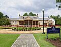
One very important place in Aiken County is the Graniteville Historic District. This area is so special that it's been named a National Historic Landmark. This means it's one of the most important historic places in the entire country!
Graniteville was one of the first planned industrial communities in the South. It was built around a large textile mill in the mid-1800s. The district includes the old mill buildings and the homes where the mill workers lived. It's a great example of how towns were built around factories during that time.
Other Interesting Places
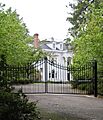
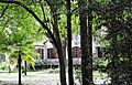
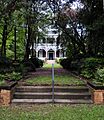
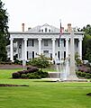
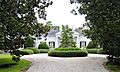
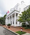
Many other places in Aiken County are also on the National Register. For example, there are several historic districts in Aiken itself, known as the Aiken Winter Colony Historic Districts. These areas have beautiful old homes where wealthy people from the North used to spend their winters.
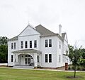
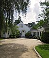
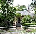
Other listed places include:
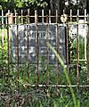
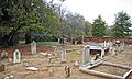
- Aiken Colored Cemetery: An important cemetery that tells the story of the African American community in Aiken.
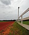
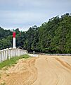
- Aiken Mile Track and Aiken Training Track: These show the county's strong connection to horse racing and equestrian sports.
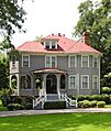
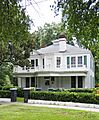
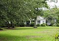
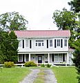
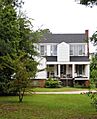
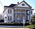
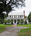
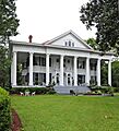
- Old homes: Like the Chancellor James P. Carroll House and the Dawson-Vanderhorst House, which show different styles of architecture from the past.
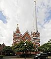
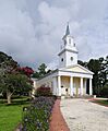
- Churches: Such as St. Mary Help of Christians Church and St. Thaddeus Episcopal Church, which are important parts of the community's history and faith.
- Historic sites: Like Fort Moore-Savano Town Site, which was an important trading post long ago.
- Plantations: Such as Redcliffe Plantation State Historic Site, which offers a look into the past of large agricultural estates.
All these places help us understand the unique story of Aiken County and its people.
Images for kids
-
Aiken Colored Cemetery
-
Aiken Mile Track
-
Aiken Training Track
-
Aiken Winter Colony Historic District I
-
Aiken Winter Colony Historic District II
-
Aiken Winter Colony Historic District III
-
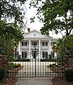
Chancellor James P. Carroll House
-
The Cedars
-
Chinaberry
-
Coker Spring
-
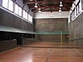
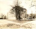
Court Tennis Building
-
Crossways
-
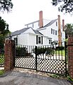
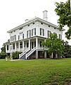
Dawson-Vanderhorst House
-
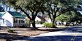
Georgia Avenue-Butler Avenue Historic District
-
Graniteville Historic District
-
Charles Hammond House
-
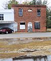
Hickman Mill Historic District
-
Immanuel School
-
Joye Cottage
-
Legare-Morgan House
-
Lookaway Hall
-
Oakland Plantation
-
Phelps House
-
Pickens House
-
Redcliffe
-
Rosemary Hall
-
St. Mary Help of Christians Church
-
St. Thaddeus Episcopal Church
-
Salley Historic District
-
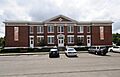
US Court House-Aiken, South Carolina
-
Vaucluse Mill Village Historic District
-
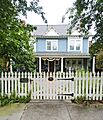
B.C. Wall House
-
Warrenville Elementary School
-
Whitehall
-
Willcox's
-
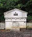
Zubly Cemetery


